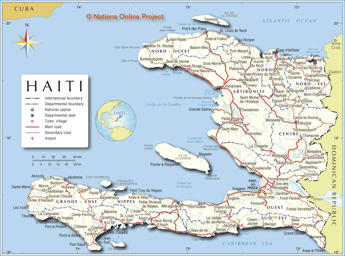
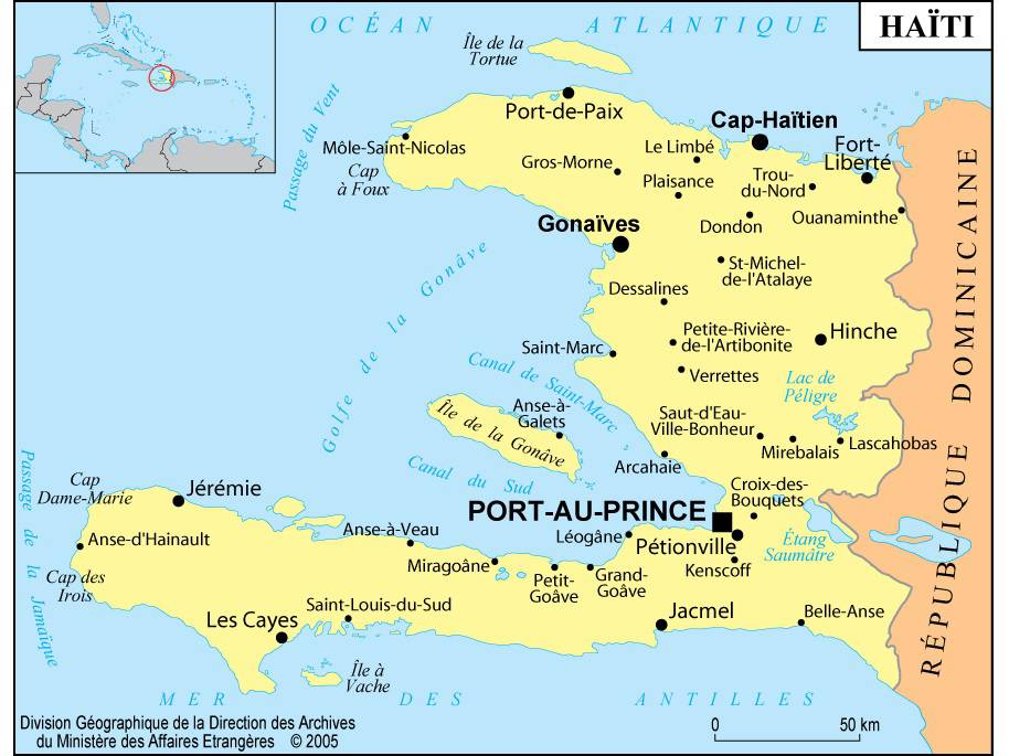
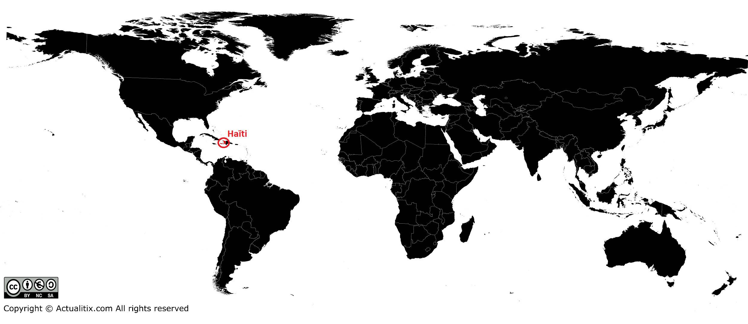
In this article you will find a map of Haiti. The country is located in the Caribbean Sea and covers an area of 27,750 square kilometers. It lies in the western part of the island of Hispaniola (the second largest island in the Caribbean), which it shares with the Dominican Republic.
The two nations, however, have little in common. The problem of overpopulation is particularly acute in this poor state with an often hostile environment. In 1996, the population was estimated at 6.5 million inhabitants. Haiti is one of the oldest republics in the Western Hemisphere, immediately after that of the United States.
Geography with the map of Haiti
Haiti has a much more mountainous landscape than most other Caribbean islands. The main mountain ranges are separated by parallel plains running from east to west. In the north, the Massif du Nord is a direct extension of the Central Cordillera, which forms the backbone of the Dominican Republic.
To the south stretches a long and narrow peninsula formed by the Massif de la Hotte and the Massif de la Selle. The latter contains the highest peak in Haiti: Pic de la Selle (2,680 meters above sea level), which can be seen on the map of Haiti.
Between these two mountainous regions, central Haiti is characterized by alternating plains (the Cul-de-Sac, the Artibonite River Valley, and the Central Plateau) and mountain ranges (the Chaîne des Matheux and the Montagnes Noires). The capital, Port-au-Prince, which can be found on the map of Haiti, is located in the Cul-de-Sac plain. The Northern Plain lies in the northeast near the city of Cap-Haïtien.
Climate in the country
The great variety of climate patterns reflects the complexity of the topography. The part of the territory located between 17° and 20° north latitude has a tropical climate tempered by trade winds, the proximity of the Atlantic Ocean, and the mountains. In most regions, temperatures remain relatively high throughout the year, and seasonal temperature variations are almost insignificant.
The heaviest rainfall is recorded on mountain slopes most exposed to winds coming from the northwest. On the less wind-exposed slopes and in the Cul-de-Sac and Artibonite valleys, rainfall is much lower. The central plains are so arid that irrigation is absolutely essential for agricultural development.
Prolonged droughts in 1965, 1975, 1977, and 1980 significantly reduced coffee and sugar exports and were accompanied by major food shortages. In 1979 and 1980, devastating hurricanes destroyed much of the harvest. Earthquakes are frequent and devastated the capital, Port-au-Prince (see the map of Haiti), twice during the 18th century, as well as the city of Cap-Haïtien in 1842.
Vegetation and wildlife
In the past, Haiti was covered with vast pine forests, but they have almost entirely disappeared. They were cleared to allow the expansion of farmland and have also suffered from numerous fires. Wood remains the most commonly used fuel. Some forests of pine, mahogany, cedar, and rosewood still survive on the highest mountain slopes with a humid climate.
Across the country, there are also many varieties of wild coffee plants, cocoa trees, and coconut palms. Haiti also produces many tropical fruits such as avocados, oranges, citrus fruits, and mangoes.
In regions with a subtropical climate, such as the Artibonite Valley, the savanna is dotted with isolated palm trees. In more arid areas, such as the Cul-de-Sac, vegetation consists almost exclusively of cacti and thorny shrubs. Insects are numerous throughout the territory, but there are no large animals or venomous snakes. The most common species are likely ducks, flamingos, and wild pigeons.
