Discover a map of Finistère. The department of Finistère is located in metropolitan France, in the region of Brittany. The INSEE code of the department is 29.
In this article you will find several maps covering various themes related to the department of Finistère.
Below you will find a map of Finistère. It allows you to discover the department and its main characteristics.
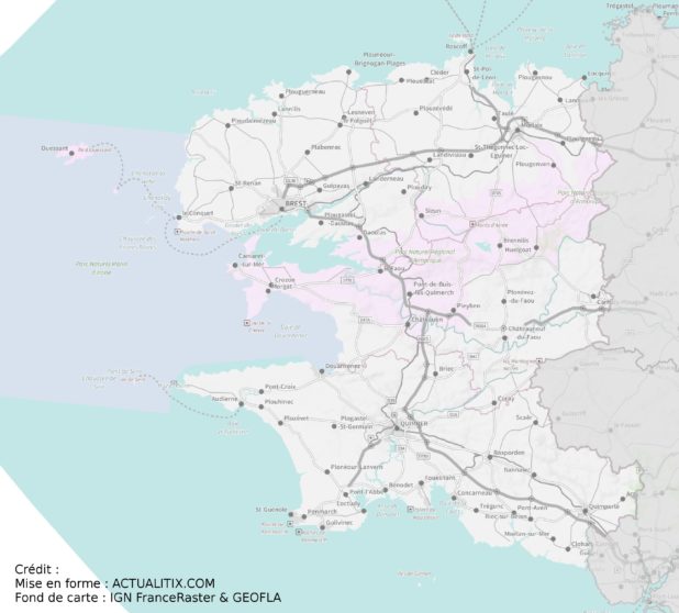
Map of Finistère – Credit Actualitix – Base map: IGN
In this article you will also find maps on various themes such as relief, main cities, municipalities, a blank map, and a political map.
Map of Finistère: geography
The department stretches across the extreme western tip of the Breton peninsula. Finistère has a highly indented coastline. It is bordered by the English Channel to the north, and by the Atlantic Ocean to the west and south. In Finistère, you will find small islands such as Batz, Ouessant, Sein, and the Glénan Islands.
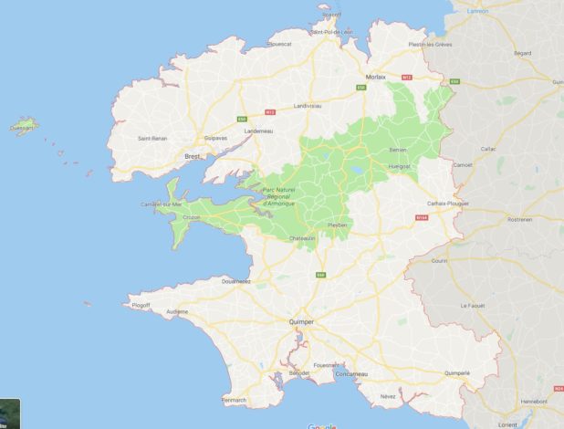
Finistère map – Image from Google Maps
In the north of Finistère lies the Léon plain. In the center are the Monts d’Arrée and the Black Mountains. Finally, in the south, the hills of Cornouaille. These various reliefs form the western part of the famous Armorican Massif. The department’s main rivers are the Elorn, the Aulne, the Odet, and the Aven.
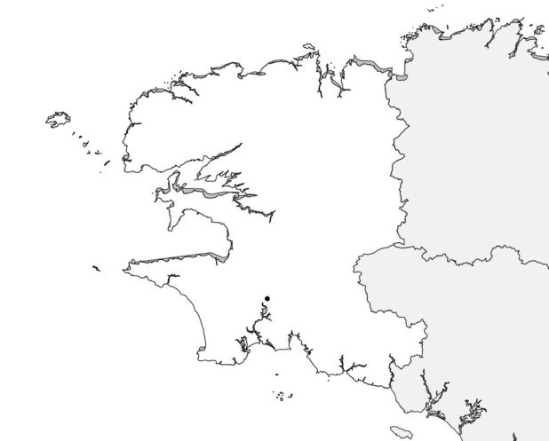
Blank map of Finistère
Climate
The department’s climate has all the characteristics of a temperate oceanic climate. It is influenced by the Gulf Stream and Atlantic weather systems.
Finistère generally experiences mild winters and cool summers. The department has a reputation for rainfall, which is fairly abundant and spread throughout the year, with a peak during the winter months. Precipitation is nevertheless heavier inland and in elevated areas.
For example, the island of Ouessant receives less than 800 mm of rainfall annually, while the peaks of the Monts d’Arrée receive more than 1,500 mm. It should be noted that although the department has a reputation for being cold, frost and snow are rather rare, especially on the islands, due to the coastal influence. Wind is another characteristic feature of this climate.
Learn more
The area of the department is 6,733 km², ranking it 28th among French departments in terms of size.
People living in Finistère are called Finistériens. The department has a population of over 900,000 inhabitants, ranking it 24th in France. The population density is 135 inhabitants per km².

The prefecture of the department is Quimper. The sub-prefectures are the cities of Brest, Morlaix, and Châteaulin. The main cities of the department are:
Brest, Quimper, Concarneau, Morlaix, Douarnenez, Landerneau, Guipavas, Plougastel-Daoulas, Plouzané, Quimperlé, Le Relecq-Kerhuon, Fouesnant, Landivisiau, Pont-l’Abbé, Crozon, Plabennec, Carhaix-Plouguer, Ergué-Gabéric.
The main tourist sites of the department are:
– Pointe du Raz
– Plougrescant and Castel Meur House
– Ploumanac’h and the Pink Granite Coast
– Île de Sein
– Île de Molène
– Île d’Ouessant
– The Fortifications Route
– Menez Dregan Interpretation Center
– Locronan – Monts d’Arrée
– The Glénan Islands
– Notre Dame de Daoulas Abbey
– Quimper, capital of Cornouaille
– Morlaix Bay
– Château de Kériolet
– A day in Pont-Aven
– Château de la Hunaudaye – Erquy
– Industrial tourism in Finistère
