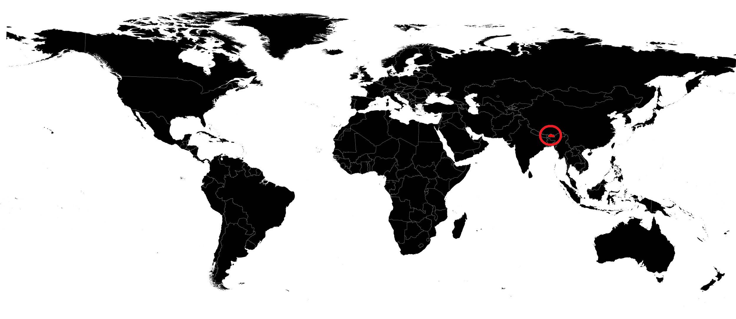
In this article we will discover a map of Bhutan. The Kingdom of Bhutan lies along the high mountain ranges at the eastern end of the Himalayas. Its landlocked position—surrounded by India to the east, south and west, and by Tibet to the north—gives the country its political importance.
Geography with the map of Bhutan
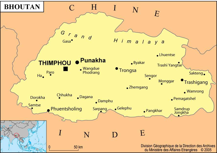
Bhutan can be divided into three regions: the Great Himalaya, the Lesser Himalaya and the Duars plain (see the map of Bhutan). Yaks are taken to graze in the high pastures of the Great Himalaya.
In the Lesser Himalaya, the fertile valleys of central Bhutan, flat and wide, are cultivated and inhabited.
The Duars plain, along Bhutan’s southern border, forms a strip 13 to 16 kilometers wide. With heavy rainfall of about 500 to 760 cm per year, the Duars region is unhealthy, torrid, humid and covered with dense semi-tropical forest.
The northern part of the Duars bordering the mountains is rugged, uneven and sloping. Small villages lie in clearings at the foot of the mountains, but most of the area is covered with dense vegetation and populated by elephants, deer, tigers and other wild animals.
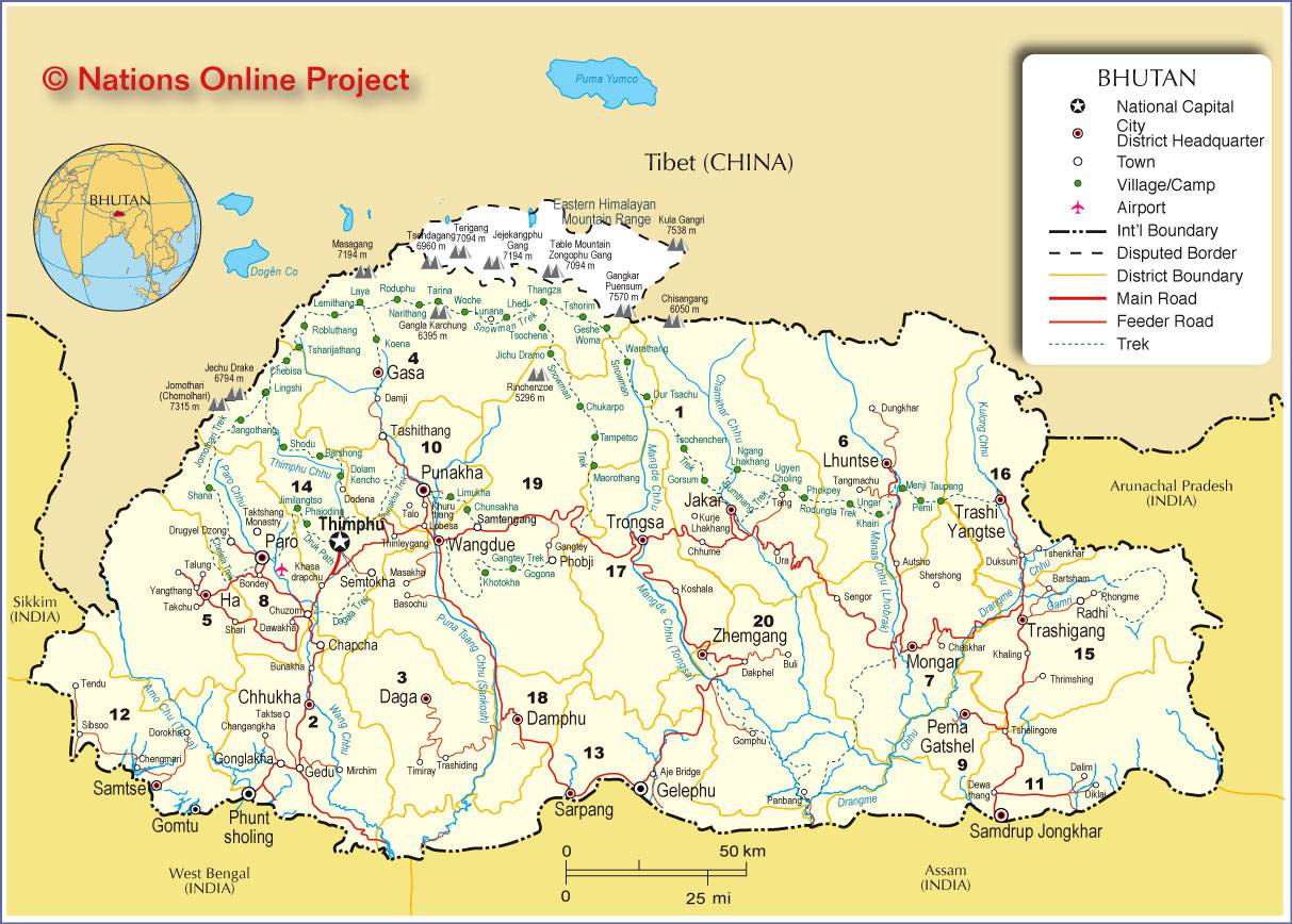
The southern part of the Duars bordering India (see the map of Bhutan) is partly covered with grassy woodlands and bamboo jungles. A wildlife sanctuary has been established in the area, home to many valuable species such as the golden langur, a long-tailed monkey rare in other parts of the world.
Learn more
Most Bhutanese are of Tibetan origin and share that country’s culture and religion. Their language, Dzongkha, is a Tibetan dialect and also the official language of Bhutan. Bhutanese people live mainly in northern and central Bhutan, and their religion is a form of Buddhism. In the south of the kingdom, the population is mainly Nepalese (see the map of Bhutan for proximity), whose religion is Hinduism. Their language is Nepali.

Agriculture is the main occupation. Bhutanese people raise cattle and sheep and grow rice, corn, oranges and potatoes. Four government orchards located in the temperate zone produce apples, pears, peaches, plums, apricots and walnuts. A key strength of Bhutanese agriculture is its highly developed irrigation.
Several industries—carpentry workshops, small distilleries, canning factories—have developed. Silkworm breeding farms in the north of the country produce raw silk for local weaving factories, and some private sawmills operate throughout the country. Other cottage industries produce matches, soap, textiles, carpets and candles.
Although a road network connects different parts of the kingdom, yaks, mules and ponies are still used as transport on rocky mountain paths. Bhutan has several airports, notably in Paro and Yangphulla. Hiking has become one of the most popular activities since the country opened to tourism in 1974.
The telephone network operates between the main cities of the country, but international calls can only be made from Thimphu (you can see it on the map of Bhutan), the capital. Bhutan’s area is 47,000 square kilometers. Its population was estimated at 800,000 inhabitants in 2016.
