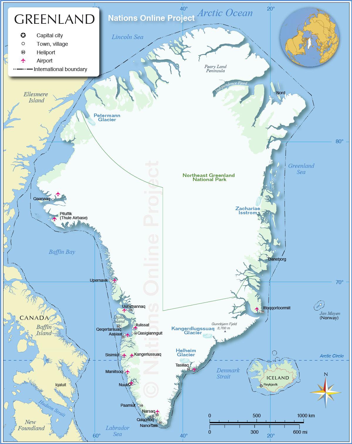
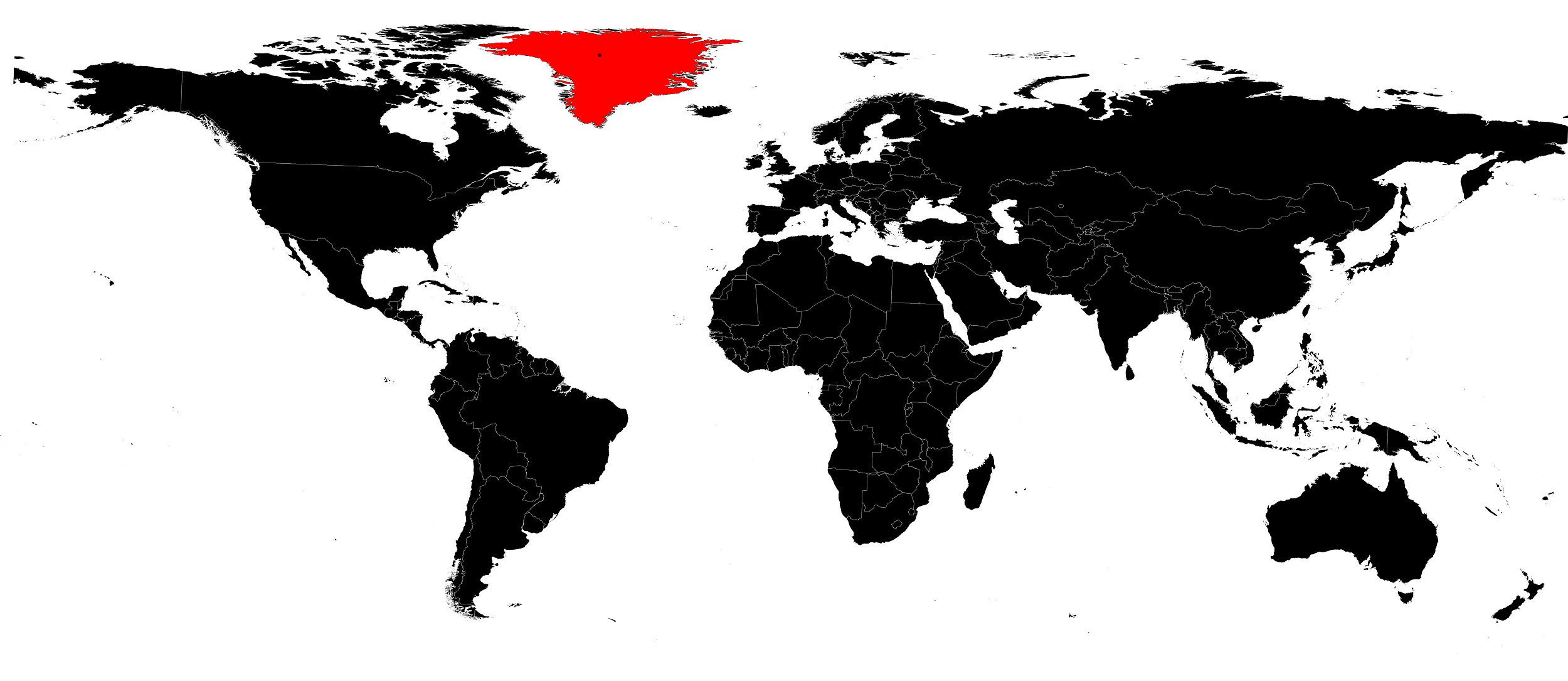
In this article you will find a map of Greenland. The country is the largest island in the world, covering an area of 2,175,600 square kilometers. It measures 2,650 kilometers in length and 1,050 kilometers in width.
The ice sheet covering four-fifths of the territory reaches an average thickness of 1,500 meters. The highest population densities are found along the rocky coastline, particularly in the southwestern coastal regions.
Geography with the map of Greenland
Located northeast of North America, as seen on the map of Greenland, and almost entirely within the Arctic Circle, Greenland has an extremely harsh climate. It is also affected by severe blizzards.
Every year, glaciers from the island of Greenland release millions of tons of ice into the sea. Some of these icebergs drift with ocean currents.
In some regions, soils are relatively fertile and the climate is mild enough to allow tundra vegetation to grow. The people of Greenland, often of Inuit and European origin, live almost entirely from hunting and fishing. Potatoes are by far the most widely grown crop in this harsh environment. Imports mainly include food products, clothing and raw materials.
Sheep farming and fish canning industries are currently expanding. Greenland also exports cryolite (a very rare mineral used in the aluminum extraction process), fish, leather and furs. In recent years, lead, zinc and uranium have expanded its mineral resources.
Despite centuries of Scandinavian influence, Greenlandic people have generally remained faithful to their culture. Stone and earth are the two materials most commonly used in traditional house construction. More modern buildings are most often made of wood.
Some Inuit still live in igloos during winter or when traveling. Almost all towns have their own schools, and education for children is compulsory.

History of the country
The first Inuit peoples settled in Greenland around 3000 BC. In 982 AD, Erik the Red, a Norwegian, landed on the coasts of Greenland and founded a colony. He named these icy and deserted lands the “Green Land” to encourage his compatriots to settle there. His son, Leif Erikson, succeeded him and later discovered North America. In 1261, the colony came under Norwegian authority before being abandoned during the 15th century.
The island of Greenland was later rediscovered by British navigators in the 16th century. In 1721, Hans Egede, a Scandinavian missionary, established a modern colony. When the union between Norway and Denmark ended in 1814, Greenland was not mentioned and therefore remained under Danish authority.
In 1917, Denmark sold the Virgin Islands to the United States in exchange for official recognition of its rights over Greenland. Greenland became an autonomous dependency of Denmark in 1921. However, Norway continued to claim part of the territory and annexed the coastal region north of Scoresby Sound in 1931. In 1933, the International Court of Justice ruled in favor of Denmark.
After the invasion of Denmark by German troops during World War II, the United States ensured the defense of Greenland. In 1951, Denmark and the United States signed a treaty providing for the joint defense of the island. The United States built the Thule Air Base there.
In 1953, Greenland was integrated into the Kingdom of Denmark. It was represented in the Danish parliament by two representatives before becoming a self-governing territory in 1979. Nuuk (you can see it on the map of Greenland) is the capital of Greenland. In 2016, its population was estimated at 56,000 inhabitants.
