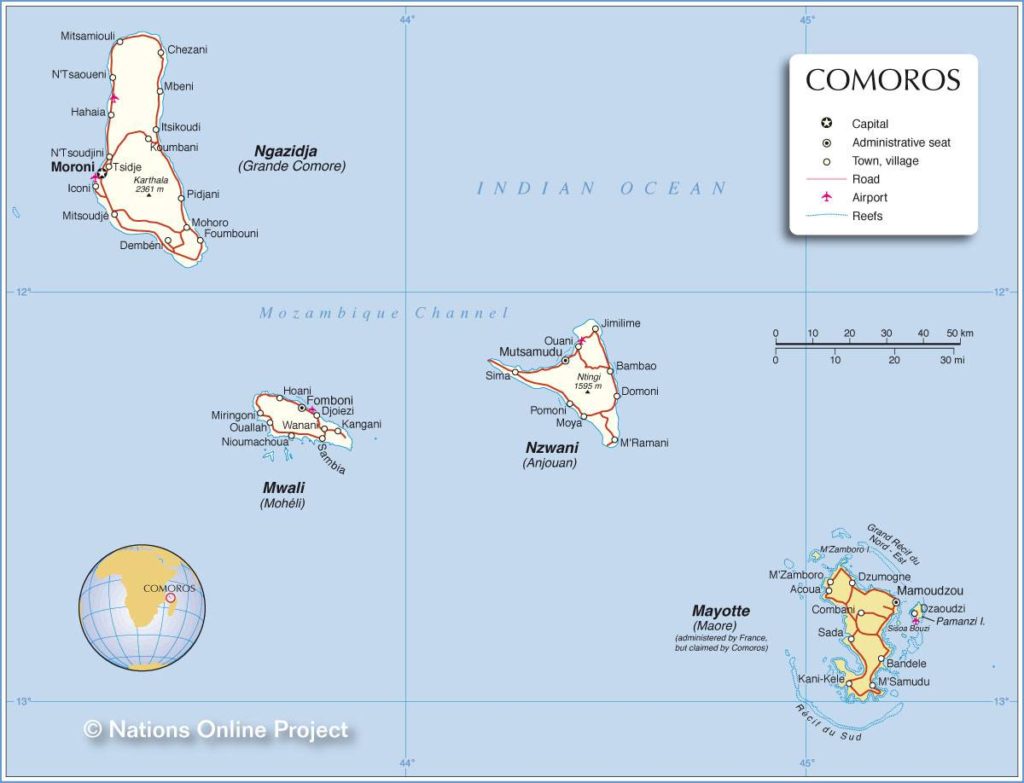
In this article you will find a map of the Comoros. The Federal Islamic Republic of the Comoros is located between the island of Madagascar and the eastern coast of the African continent, at the entrance to the Mozambique Channel.
Geography with the map of the Comoros
This archipelago consists of three large islands and two smaller ones. Excluding the island of Mayotte, its total area is approximately 2,170 square kilometers. The capital, Moroni, is located on the island of Grande Comore and is home to nearly 111,000 inhabitants.
Comoros map – Credit Nation Online
Grande Comore (which can be seen on the map of the Comoros) is the largest island in the archipelago and is home to an active volcano, Mount Karthala, the highest point in the country. The islands of Mohéli and Anjouan are the two other main islands.
The island of Mayotte has a special status. Although it is considered part of the archipelago by the Comorian government, it is in fact a French possession.
The archipelago has a tropical climate characterized by a dry season from May to October and a rainy season from November to April. The hottest temperatures are recorded in November, reaching 28°C. The heaviest rainfall occurs in January.
The archipelago imports more than half of the food products consumed by the population. Comorian farmers raise cattle and sheep. They also grow cassava, sweet potatoes, bananas, rice (on mountain slopes), vanilla, flowers, coconuts, and cloves. The archipelago also has several sawmills and factories specializing in the packaging and processing of vanilla, as well as in soap and oil production. The Comoros also have a few hydroelectric power plants.
The international airport is located on the island of Grande Comore, near Moroni (see the map of the Comoros). The various islands of the archipelago are connected to Madagascar and East Africa by several airlines and ferry companies. Islam is the state religion, and the education system follows both the French and Islamic models.
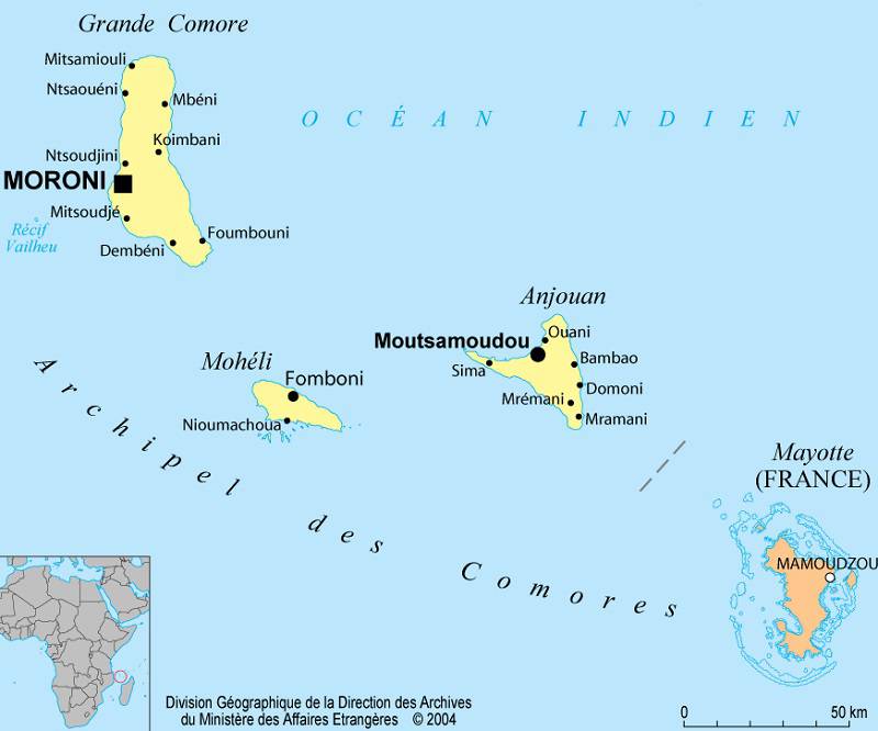
Map of cities in the Comoros
History of the Comoros
France took possession of the island of Mayotte in 1843. The entire archipelago then became a French protectorate in 1886 before becoming part of the French overseas territories in 1947.

In 1974, the islands of Grande Comore, Mohéli, and Anjouan (which can be seen on the map of the Comoros) voted for independence, but the island of Mayotte chose to remain attached to France. The Comorian government is led by a president elected for five years, who then appoints the governors responsible for administering the islands. He also appoints the members of the cabinet. The Federal Assembly consists of 42 members elected by universal suffrage.
Starting in 1984, South Africa supplied Mozambican mercenaries through the Comoros archipelago. During this period, the government was controlled by a Presidential Guard led by the French mercenary Bob Denard.
On November 27, 1989, President Ahmed Abdallah was assassinated, and Said Mohamed Djohar became interim president. His election to the presidency in March 1990 marked the return of democracy. He was re-elected in 1994. Bob Denard attempted another coup in 1995 but eventually surrendered to the authorities. Mohamed Taki Aboukarim won the presidential elections in 1996.
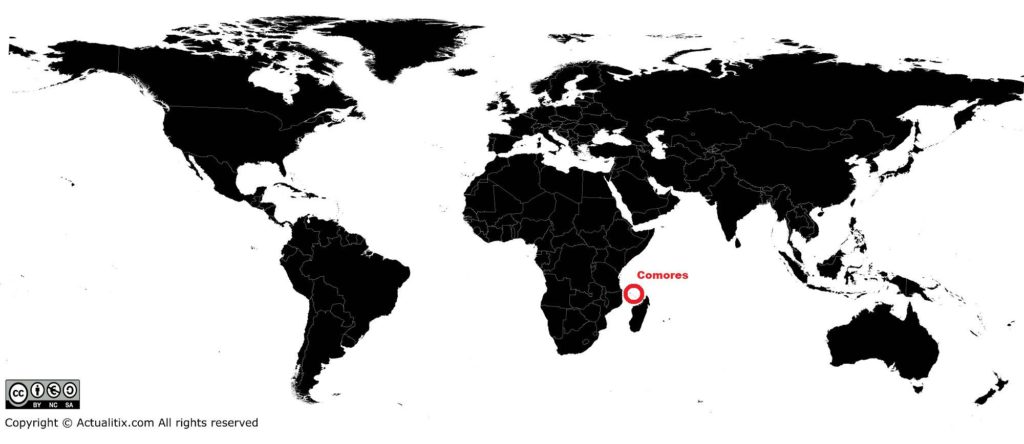
Comoros on a world map – Credit Actualitix
The following October was marked by the adoption of a new constitution inspired by Islamic principles. Among other provisions, it strengthened the powers of the head of state and provided for the formation of a single majority party. In 2016, the population of the archipelago was estimated at 795,000 inhabitants.
