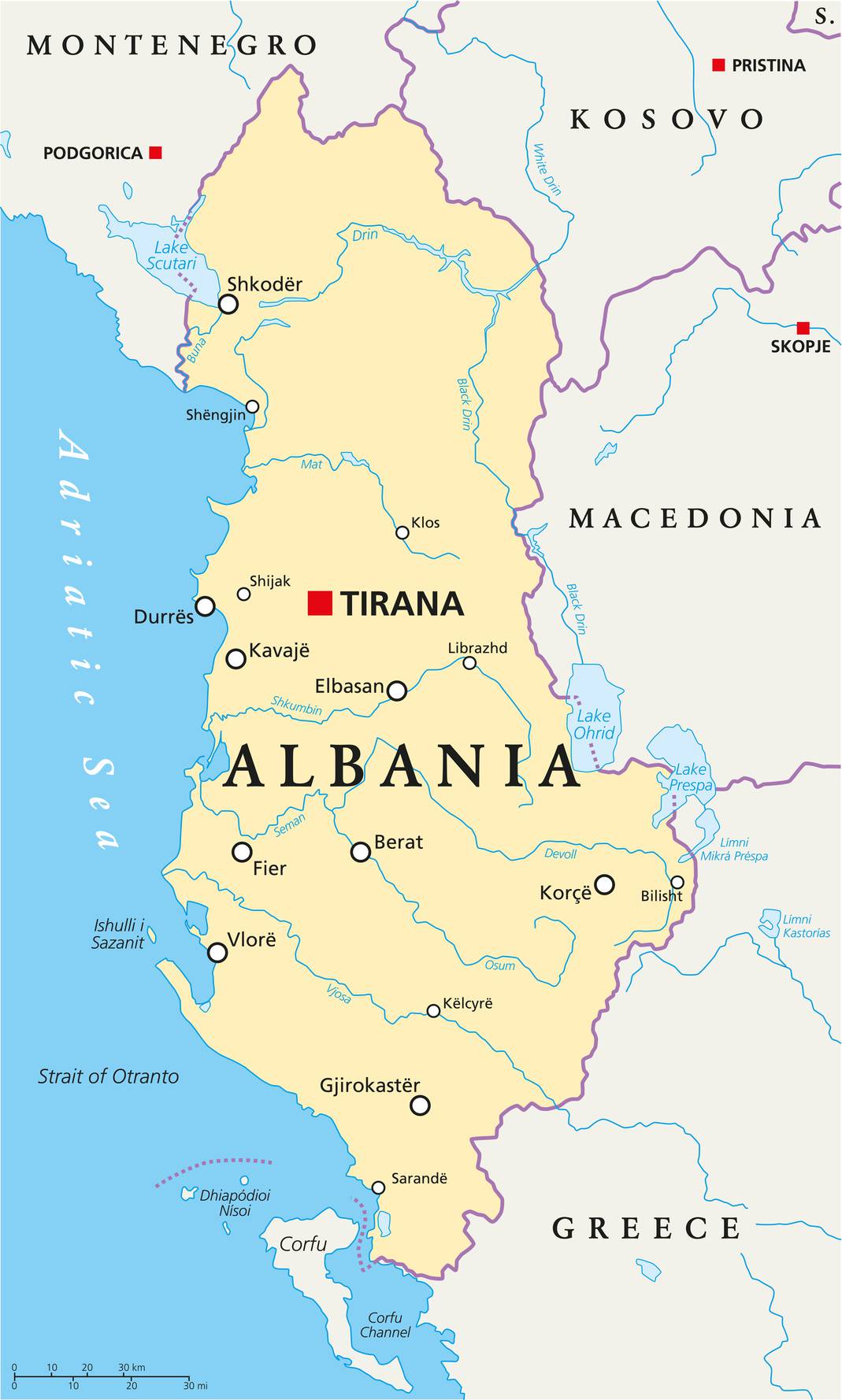
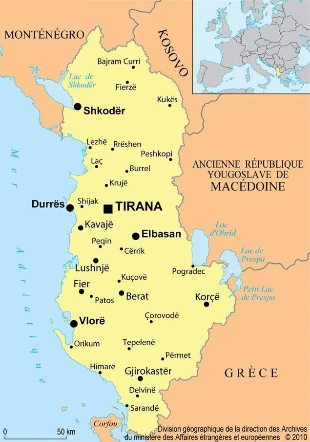
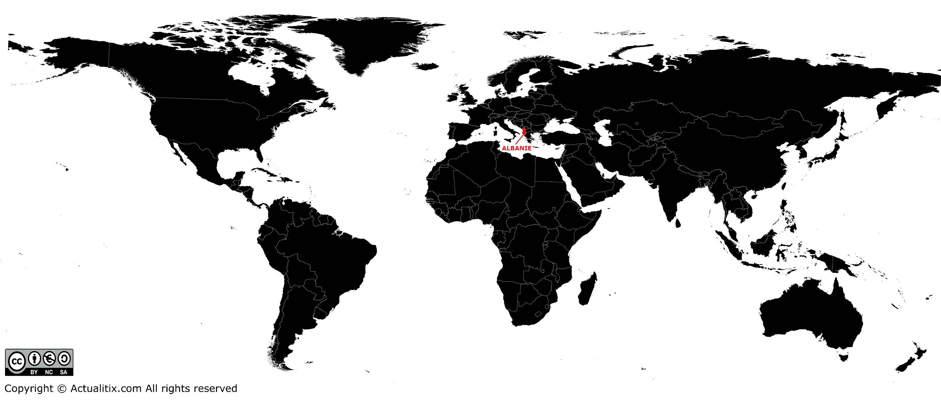
This article presents a map of Albania, which is part of the Balkan Peninsula. It is bordered to the south by Greece, to the north by the Balkan Peninsula, and to the west by the Adriatic Sea.
In 1946 Albania was absorbed into the communist regime. In the years that followed, it became the poorest country in Europe. Like its Eastern European neighbors, it rejected communism in the 1990s, and the party was removed from power in March 1992.
Geography with the map of Albania
With an area of 28,750 square kilometers, Albania is the smallest country on the Balkan Peninsula. Largely mountainous, some peaks rise above 2,500 meters, and the highest is Mount Korab (2,751 meters), which can be seen on the map of Albania. Half of the population lives in the coastal plains, which cover a quarter of the country.
The climate is Mediterranean, with hot, dry summers and mild, wet winters. Rainfall affects river flow, turning them into torrents in winter and causing significant flooding, while in summer they shrink to small streams.
The longest river is the Drin; it rises in Yugoslavia and flows for 280 km through northern Albania. The most important rivers in the south are the Shkumbin, the Mat, and the Vjosa (see the map of Albania).
The soils are generally poor, even in the plains, being infertile and poorly drained. Usable agricultural land is limited, with only 20% of the country’s territory being arable.
Fauna and flora
Albania was once heavily forested, but many forests were cleared to make way for pastures and livestock grazing. However, forests of oak, beech, and pine still remain in the mountains. Reforestation is one of the government’s priorities.
As there were no regulations protecting wildlife in Albania, few wild animals remain, except in remote forests where wolves, wild boars, bears, deer, some chamois, and many wild birds can still be found. A hunting law is currently in the process of being adopted.
Population of the country
The Albanian population belongs to two main ethnic groups: the Ghegs, north of the Shkumbin River, and the Tosks, to the south. Each group speaks its own dialect. In 1972, a unified literary (written) language was created by combining elements of both dialects. Roma, Greeks, and Vlachs (a Romanian-speaking people) also live in Albania, but they represent only 3% of the population.
As the communist regime discouraged religious practices and beliefs, Albania officially became an atheist nation. However, cultural differences of a religious nature still exist among the population. Albanians are Muslim, Catholic, and Orthodox.
The Albanian people have traditionally been divided into clans or tribes, each with its own history. Disputes between certain clans sometimes escalate into real vendettas.
After more than five centuries of Turkish occupation, Albanians—particularly Muslim Albanians—adopted a lifestyle similar to that of Western Asia. This influence can be seen in clothing, architecture, and art. However, by the end of the 20th century, lifestyles were becoming more Westernized.
Two-thirds of the population is rural, while the rest live in a few cities located mainly in the plains. The largest city is the capital, Tirana (see its location on the map of Albania), with more than 557,000 inhabitants. Durrës has a population of 201,000, while Vlora, Shkodra, Korçë, and Elbasan are smaller. Most of these cities are very old and have architectural features reflecting Turkish influence. In the northwest, the landscape then gives way to the Rio Grivalja valley.
You can discover all the available maps for the different countries of the world on this page.
