Discover a map of Denmark. Although it is a small country with relatively limited natural resources, it is nevertheless one of the most prosperous countries in Europe.
Located on the North Sea, it occupies a strategic position on the trade routes of Western Europe. It geographically, culturally and commercially links Scandinavia to the other countries of Central Europe and has one of the highest standards of living in Europe. However, its economy is largely dependent on the prosperity of foreign trade.
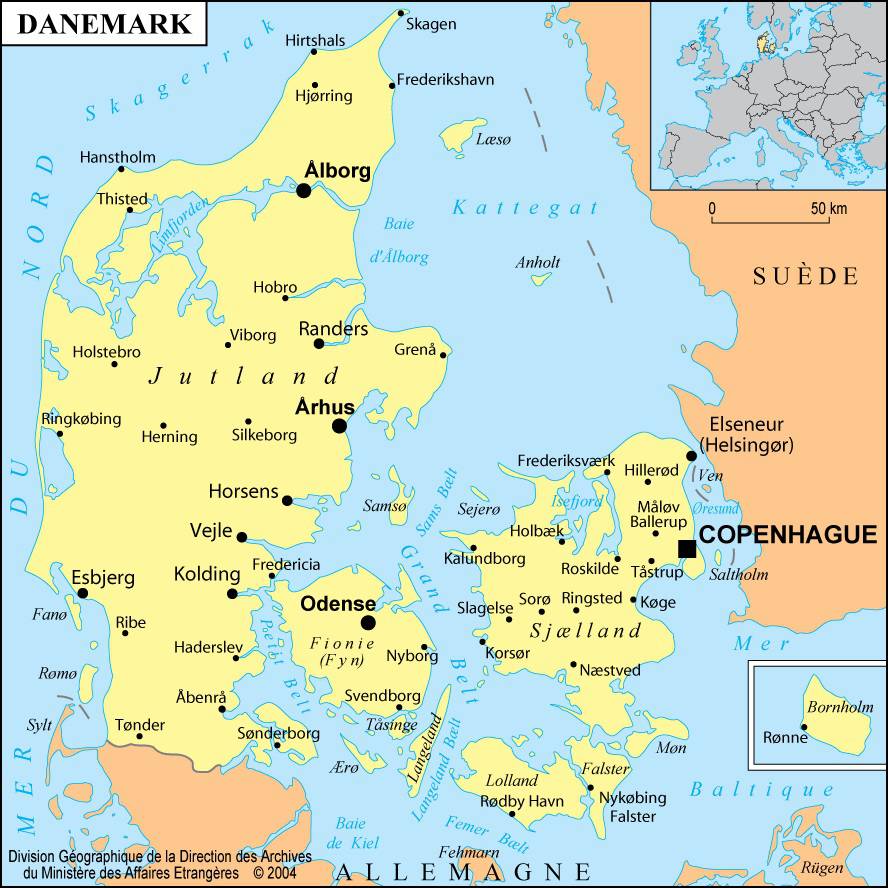
As shown on the map of Denmark, the country stretches across the long Jylland, or Jutland, peninsula and controls 483 islets and reefs scattered at the entrance to the Baltic Sea, not to mention Funen and the island of Zealand, two large islands located off the Danish coast.
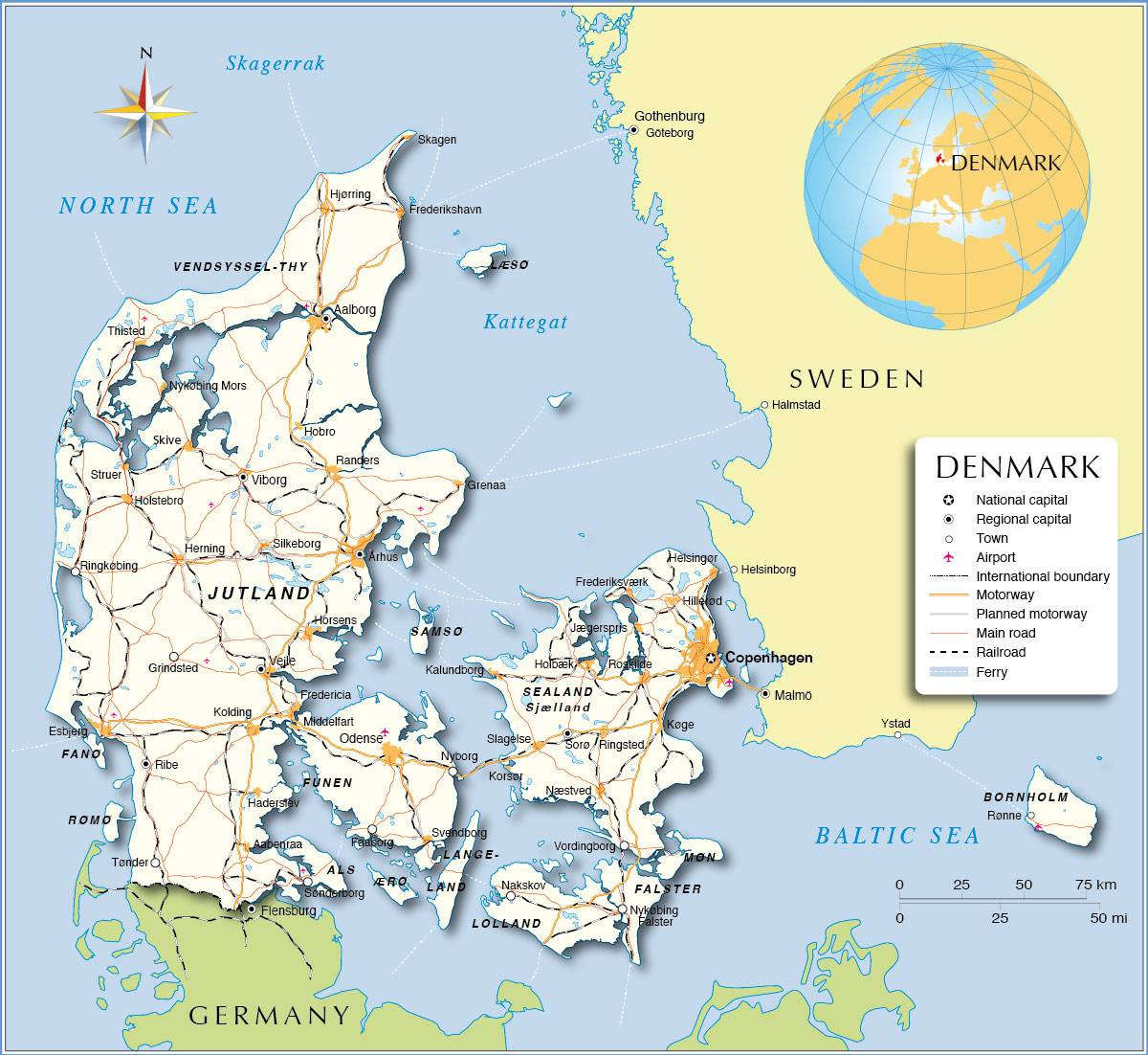
Germany is Denmark’s only land neighbor. A narrow strip of land, 48 kilometers wide, connects Jutland to the great North German Plain just to the south.
The tip of the Danish peninsula lies 113 kilometers from Norway (see the map of Denmark): the Skagerrak Strait separates Danish Jutland from the Norwegian coast. The Kattegat Strait lies between Denmark and Sweden and connects to the Baltic Sea through the Øresund Strait.
More details on the map of Denmark
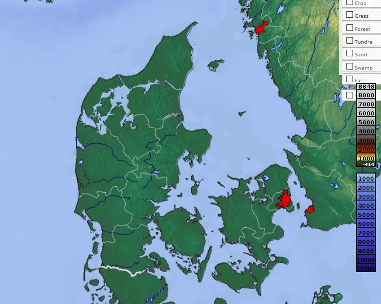
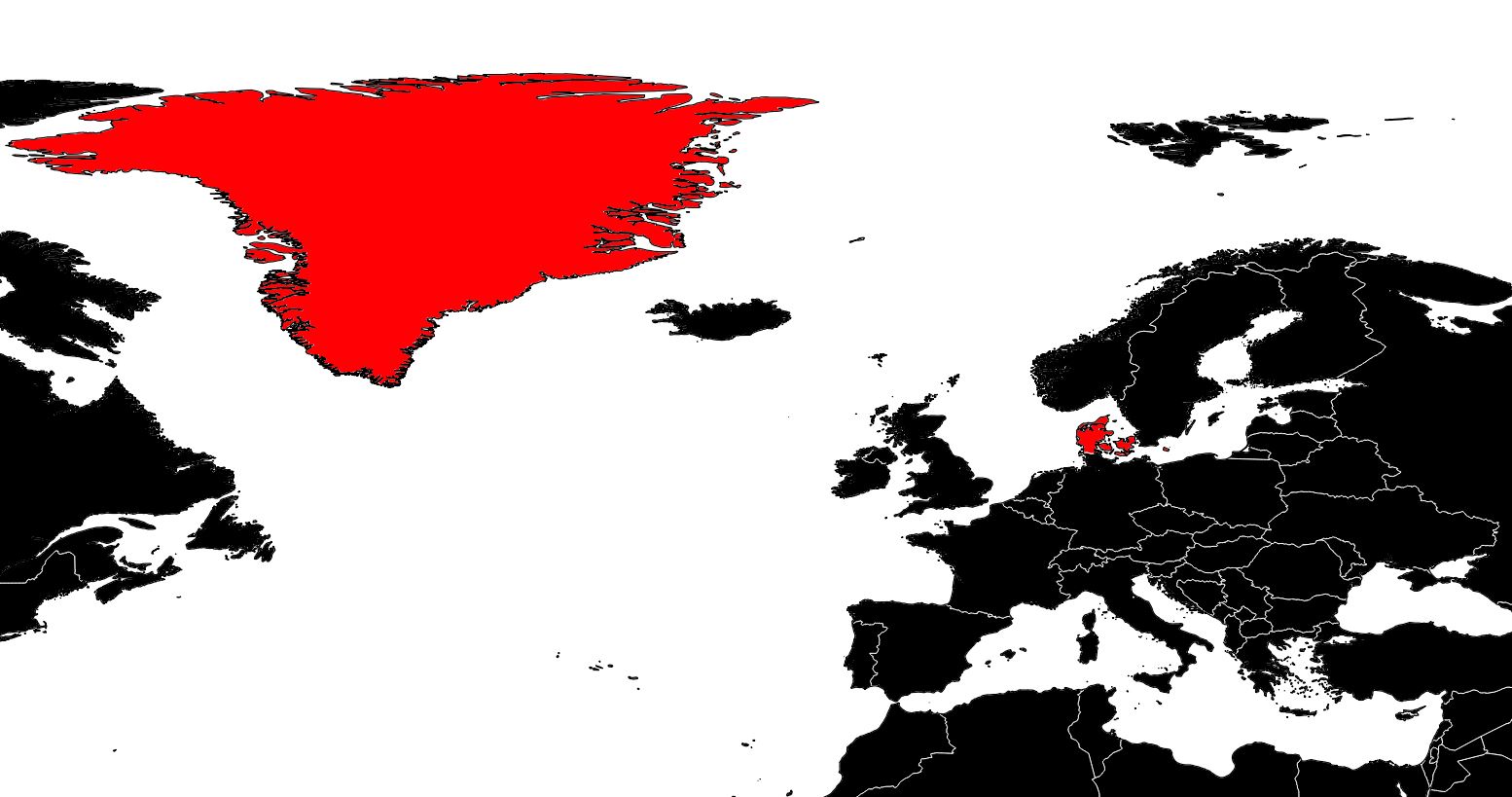
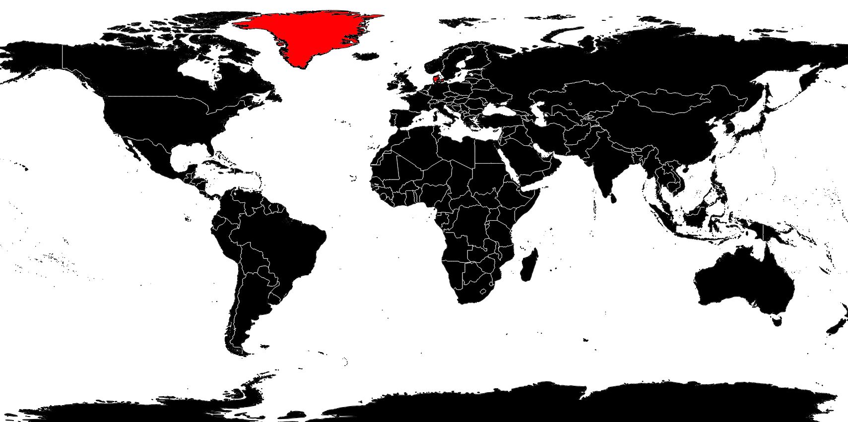
Denmark covers an area of 43,070 square kilometers, excluding its two dependencies: Greenland (the largest island in the world) and the Faroe Islands located in the North Atlantic, between the Shetland Islands and Iceland. You can consult the relief map of Denmark below:
Although Denmark lies between 54° and 58° north latitude, its climate is relatively mild thanks to the proximity of the North Sea and the Baltic Sea. Average temperatures are around 16°C in summer and 0°C in winter. Winter frosts are generally short-lived. Rainfall is abundant, especially between August and October.
The Jutland peninsula occupies approximately two-thirds of the territory. The wide beaches along the North Sea give way to sandy plains alternating with heathland and peat bogs. Swept by winds, the coastline is mainly composed of sand dunes and jagged cliffs.
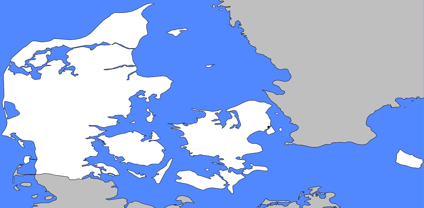
This part of the peninsula was once largely uncultivated. Thanks to the efforts of the Danish Heath Society, it now contains pastures, pine forests, and crops of cereals and sugar beets. The center of the peninsula, where many hills rise, has a more rugged landscape.
Further east, the land becomes very fertile and covered with forests. The coastline of this part of Denmark is indented by numerous shallow fjords whose shores host many small towns and ports.
The port of Frederikshavn, in northern Jutland, is the departure point for ferries to Sweden. The port of Aarhus, on the eastern coast, is home to the country’s second-largest city. Esbjerg, meanwhile, is the only major city on the western coast and handles most Danish exports.
The islands of Denmark
As shown on the map of Denmark, the country has many islands. Danish islands are characterized by very fertile soils and a shared geological history. Their landscapes alternate between beaches and low hills dotted with small lakes. They have a humid climate, are swept by sea winds laden with moisture, and often experience fog forming over the North Sea.
The island of Funen, immediately east of Jutland, is famous for the lushness of its vegetation. Odense, its capital, is the birthplace of the famous writer Hans Christian Andersen.
The large island of Zealand lies further east and hosts the capital, Copenhagen, which is also Denmark’s main port and industrial center. More than a quarter of the population lives in this city.
Although it is not visible on the map of Denmark, the Storstrøm Bridge connects the island of Zealand to the island of Falster. The islands of Lolland and Møn lie nearby. The island of Bornholm, located further east, contains deposits of coal and kaolin (used in porcelain manufacturing). These are the only Danish mineral resources, apart from salt mines opened between 1946 and 1948.
In 2016, Denmark’s population was estimated at 5.7 million inhabitants.
