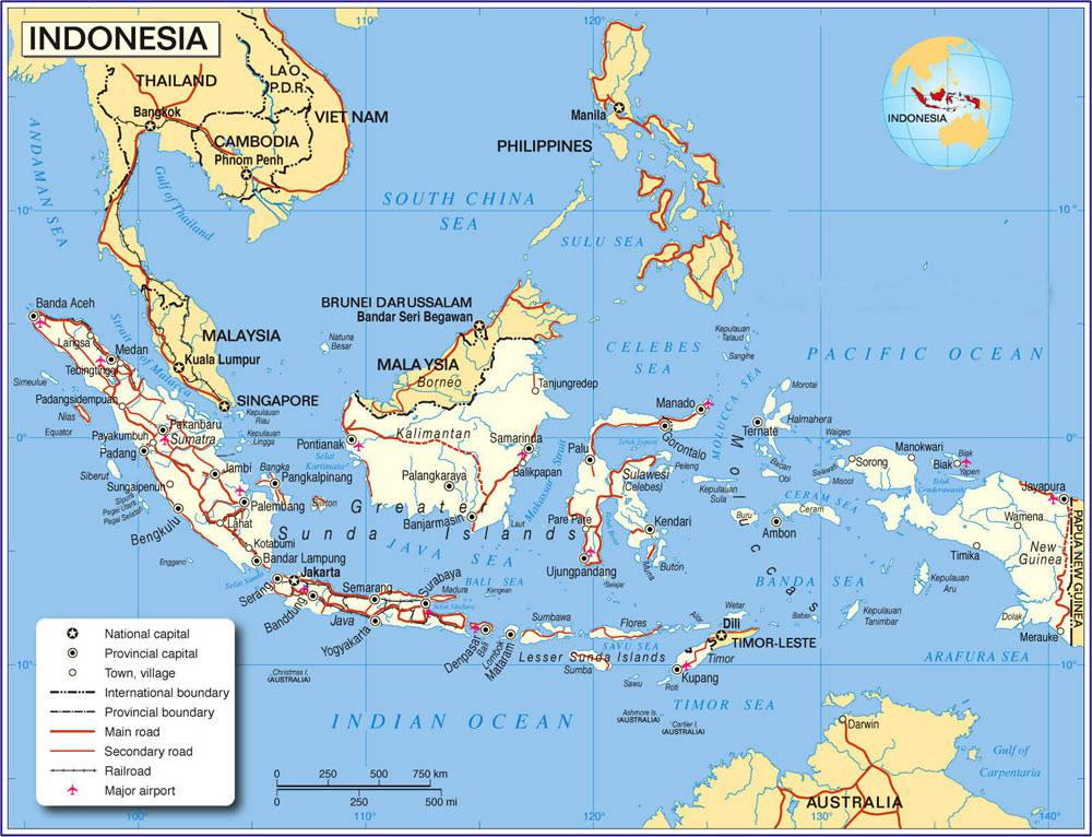
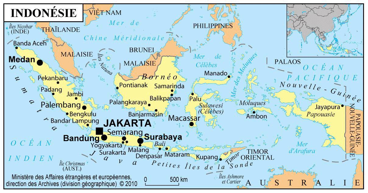
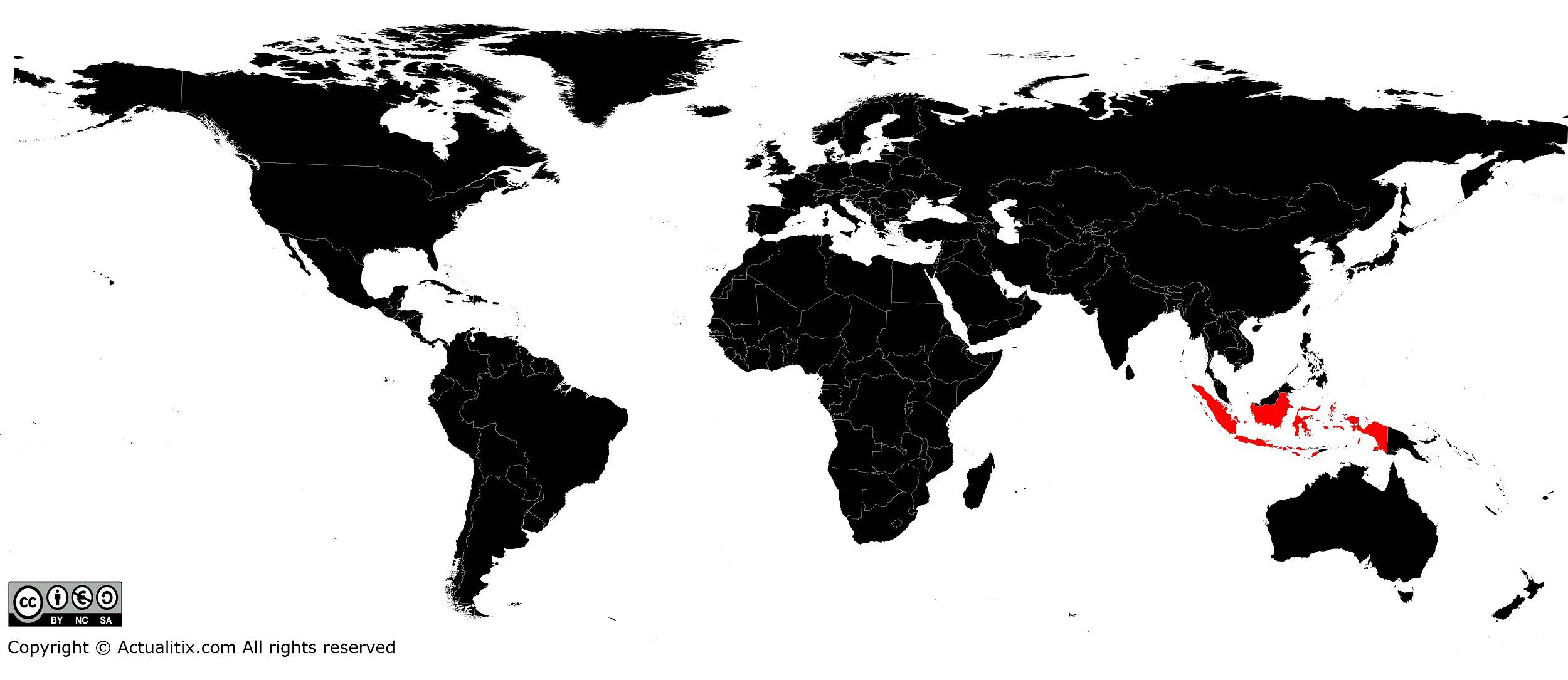
In this article you will find a map of Indonesia. Did you know that the Republic of Indonesia is the largest country in Southeast Asia by both area and population.
The islands of Indonesia
As can be seen on the map of Indonesia, the country consists of 13,677 islands covering 1,919,443 square kilometers and stretching along the equator between the Pacific and Indian Oceans. With a total population of more than 200 million inhabitants, it ranks fifth in the world.
The nation is generally poor; its standard of living is low even though its natural resources are significant. The country has oil deposits underground and offshore as well as natural gas reserves. Tropical timber forests are extensive and minerals such as tin, nickel and copper are found underground. Only 10% of the territory can be cultivated.
The islands of Indonesia, of which 6,044 are inhabited, stretch about 5,300 km from east to west and 2,100 km from north to south. The country’s total area exceeds 7.7 million square kilometers.
Despite the large number of islands, five of them account for 92% of the total area: Sumatra, Java, Sulawesi, two-thirds of Borneo and the western part of New Guinea. Nearly 95% of the population lives on these islands and more than 62% reside on the island of Java.
Throughout its history, Indonesia experienced various dominations. For nearly 350 years, the Netherlands controlled the country. Indonesia declared independence in 1945.
Geography with the map of Indonesia
Most of the country is covered by mountain ranges, as can be seen on the relief map of Indonesia. Lowland areas are rare, with a few exceptions. Most Indonesian mountains are the result of the interaction between two tectonic plates: the Pacific Plate and the Indian Ocean Plate.
Indonesia has more than 60 active volcanoes. They are mainly located west of Sumatra and offshore, in central and southern Java, Bali and Lombok, and in the Lesser Sunda Islands. A smaller volcanic zone exists north of Sulawesi and the Moluccas.

The land on volcanic slopes is relatively fertile. However, frequent eruptions on the islands of Java and Bali cause significant loss of life and temporarily reduce arable land, especially on the upper slopes of volcanoes. Fertile volcanic areas are cultivated intensively despite the danger. Alluvial soils line the coasts of the main islands.
Most of these areas are marshy and difficult to drain, which is why most lowland areas of Sumatra are almost uninhabited. Highlands, such as those covering much of Borneo, are often barren despite sometimes being covered with abundant vegetation.
Nearly two-thirds of Indonesia are covered by tropical rainforest, a small portion of which has never been cut or burned. Mangrove swamps are often found along low-lying coasts, especially along much of eastern Sumatra.
Climate
Because the country lies near the equator, there are no major seasonal changes. Frost occurs only on mountain peaks. Rainfall is abundant and evenly distributed throughout the year. Moving away from the equator, rainfall becomes more seasonal, with heavy rains in summer and almost none in winter.
East of Java and in the Lesser Sunda Islands, the dry season is marked by significant water shortages. The southeast monsoon occurs between May and September. The lowlands are hot and humid throughout the year, while temperatures in the mountains are more moderate and the climate more pleasant.
Fauna
Most animal species in Indonesia are of Asian origin. These include monkeys, orangutans and other primates, tigers, elephants, buffaloes, birds, rhinoceroses native to Java, and giant lizards known as Komodo dragons.
You can discover all available maps for different countries of the world on this page.
