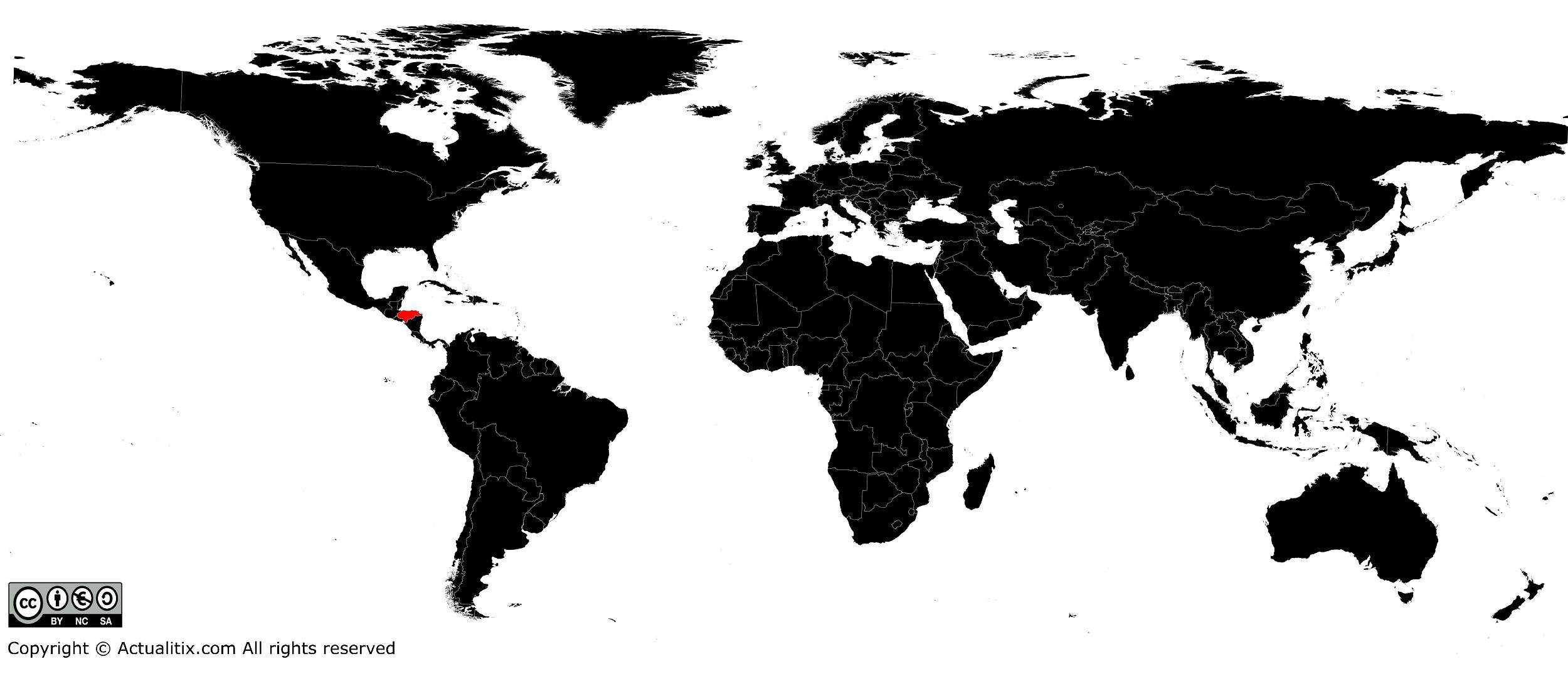
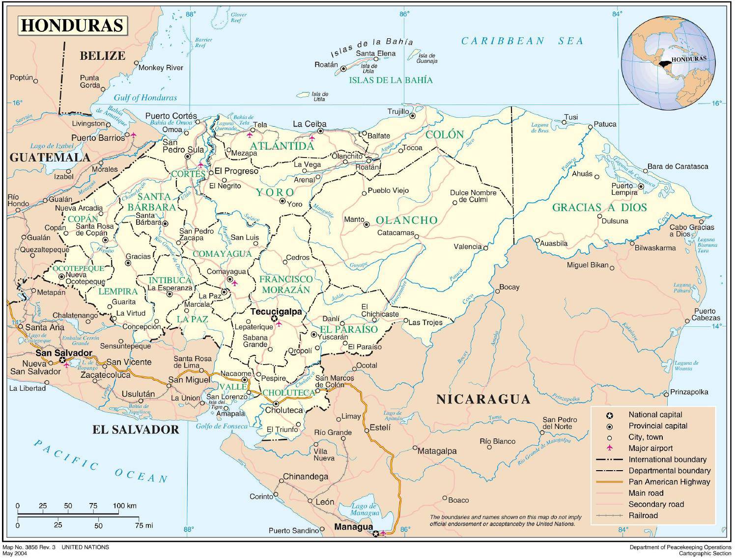
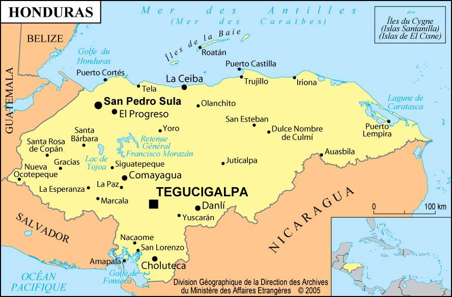
In this article you will find a map of Honduras. The Republic of Honduras is located in Central America and stretches for 282 kilometers between the Caribbean Sea and the Pacific Ocean. It borders Guatemala to the northwest, El Salvador to the southwest and Nicaragua to the southeast.
With an area of 112,000 square kilometers, Honduras is only slightly smaller than Nicaragua.
Geography with the map of Honduras
As can be seen on the map of Honduras, the center and west of the country are occupied by relatively low mountain ranges (up to 2,750 meters) intersected by numerous valleys. Although these mountain systems are often oriented from west to east, some valleys extend from north to south, such as the Comayagua Valley. These fertile regions, largely spared from drought, are now densely populated.
Although the country lies only about 15° or 16° north of the Equator, temperatures are relatively moderate. Near the coastal plains, the climate is tempered by winds blowing from the sea toward the land. In mountainous areas, the higher the altitude, the cooler the temperatures.
As in the rest of Central America, it is not temperatures but rainfall that distinguishes the seasons. The dry season lasts from January to May and the rainy season from June to December. In departments along the Pacific Ocean, droughts are frequent.
The trade winds most often blow from the east or northeast toward the west. The strongest winds accompany hurricanes that form in the Caribbean Sea (whose proximity can be seen on the map of Honduras).
Mainland plains and offshore islands are occasionally devastated by tropical storms. Hurricane Fifi, for example, destroyed most of the banana plantations along the northern coast in 1974. It also caused a violent mudslide that buried the town of Choloma.
Waterways
Almost all major rivers of Honduras flow into the Caribbean Sea. These include the Negro, Platano, Patuca and the Rio Coco, the largest river in Central America, which runs along the border with Nicaragua; they can be seen on the map of Honduras.
Downstream, these rivers are generally navigable. Navigation becomes more difficult upstream because of fast and dangerous currents. Lake Yojoa, famous for its scenic beauty, stretches about 16 kilometers in length.
Regions
Honduras can be divided into three major regions. The largest includes the mountain ranges of the center and west of the country. The inhabitants mainly speak Spanish and have both Spanish and Indigenous origins. The vast region that includes the eastern part of the Mosquito Coast comes next. Nicknamed “La Mosquitia,” it is characterized by alternating savannas, coastal plains and shallow lagoons. Population density is very low (barely 0.8 people per square kilometer). The population consists almost entirely of Indigenous peoples who speak a form of English-based creole.
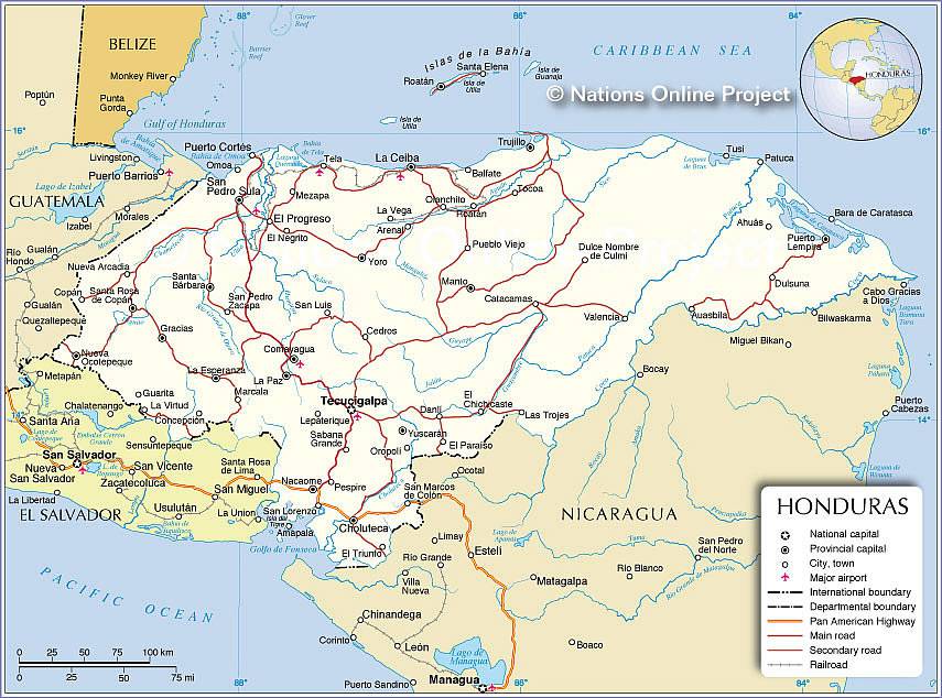
The Costa Norte (or North Coast) also includes the Bay Islands (see the map of Honduras). The population is very diverse and small communities are numerous, including Afro-descendant groups, islanders of English origin settled in the Bay Islands, and Creoles whose ancestors once worked on the coastal banana plantations.

Natural environment
Despite intensive land clearing since the mid-1960s, forests remain vast. In the center of the country and in the mountainous regions of the west, they consist mainly of pine, while in the east and along the northern coast tropical species dominate. Forest management poses many challenges as the government must balance the timber industry with the interests of farmers wishing to expand their land.
Tropical vegetation is lush and wildlife particularly diverse. The entire area near the mouth of the Platano River (which can be seen on the map of Honduras) has been designated a natural reserve by UNESCO.