In this article you will find a map of Ethiopia. The country is located in northeastern Africa. Ethiopia is one of the largest and most populous African countries, but it does not have ethnic, cultural, political, or religious unity.
It is bordered by Djibouti and Eritrea to the north; Somalia to the east; Kenya to the south; and Sudan to the west. You can observe the country’s neighbors on the map of Ethiopia.
The Ethiopian territory is marked by alternating vast plains and high plateaus. The climate is sometimes very dry and sometimes very humid. Despite a few invasions, Ethiopia is one of the rare African countries that was never truly colonized.
Since the Second World War, it has depended in many respects on major world powers. Its foreign trade deficit is largely explained by the internal conflicts that have torn the country apart in recent years.
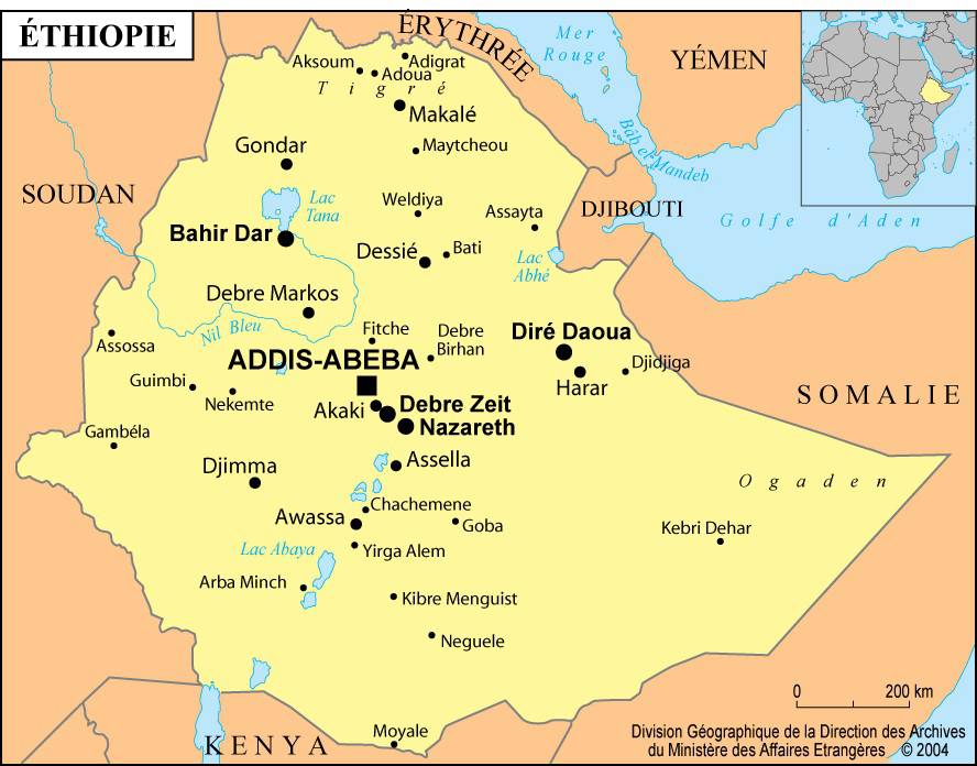
Map of cities in Ethiopia
Geography and climate with the map of Ethiopia
The Ethiopian landscape is dominated by the northernmost part of the East African Rift and by high mountain ranges interspersed with plateaus rising in the center of the country. Their altitude ranges between 2,000 and 4,300 meters (this variation can be seen on the map of Ethiopia). These mountain systems, cut here and there by deep river valleys, overlook arid plains with often stifling climates.
Ethiopia is located in the tropics. The climate varies according to altitude, and the following zones can be distinguished: arid plains located up to 1,500 meters below sea level; densely populated mountainous regions with a much warmer climate (between 1,500 and 2,300 meters); high-altitude areas with a harsher climate (between 2,300 and 3,000 meters); and finally alpine regions (above 3,000 meters). You can observe these differences on the map of Ethiopia, especially on the relief map. Daytime temperatures often exceed 40°C in the plains and drop below 0°C in the mountainous regions.
Rainfall varies from region to region. The abundance of precipitation depends on altitude: high-altitude regions are very humid, while the plains have a much drier climate.
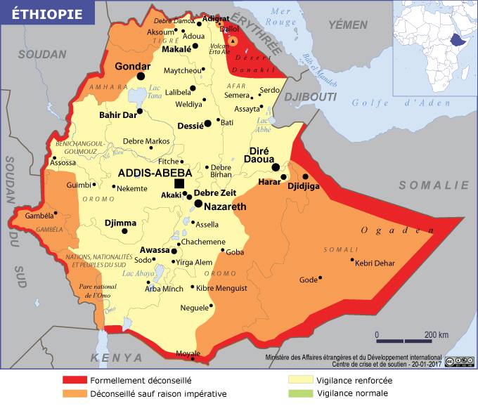
Map of dangerous areas in Ethiopia
Rainfall is relatively regular from the northeast to the southwest of the country. The north and the eastern mountain ranges, however, suffer from frequent periods of drought that ruin crops and cause severe famines.
Environment and natural resources
The most humid regions of Ethiopia were once covered with vast grasslands and immense forests. You can also observe the country’s regions on the map of Ethiopia. After several thousand years of livestock farming and land cultivation, the original vegetation has almost entirely disappeared. It is estimated that 85% of the forests have been cleared, especially in the north of the country. Since the early 1960s, reforestation has been one of the government’s main objectives.
The fertility of the soil is one of Ethiopia’s main assets, but the country has not been able to fully benefit from its agricultural potential. In many regions, soil erosion is severe due to unsuitable farming practices.
Blank map of Ethiopia
Farmers sometimes exhaust the soil by failing to observe fallow periods. As in most other African countries, national agricultural production declined throughout the 20th century. The socio-economic context is not very favorable to the development of modern agriculture: investments are limited, and the agricultural sector must also cope with steadily increasing demand.
Mining exploration is almost nonexistent. However, the country has some deposits of gold, platinum, manganese, salt, oil, and coal.
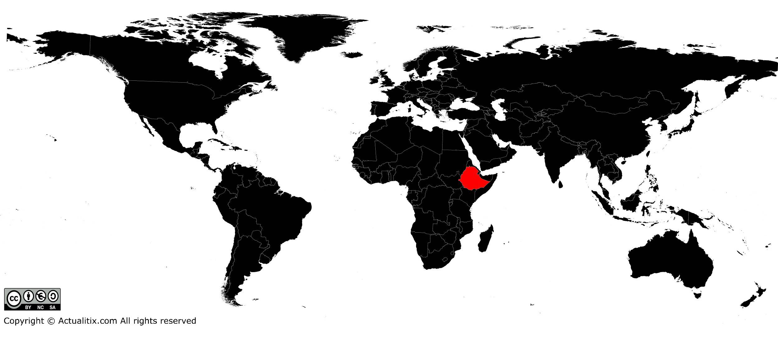
Ethiopia on a world map
