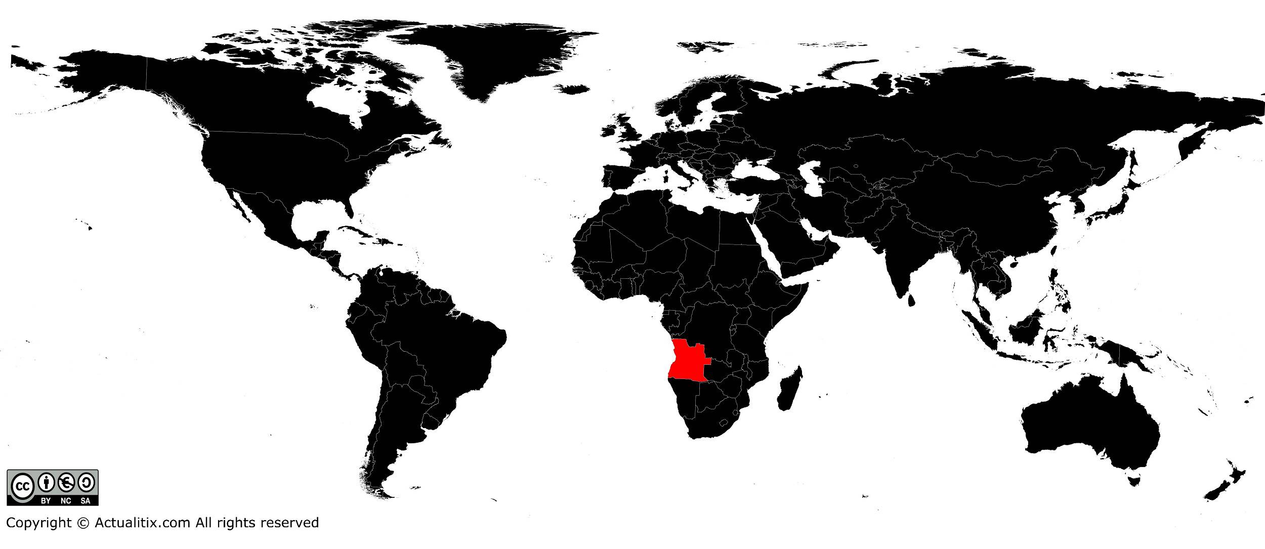
In this article you can discover a map of Angola. After more than 500 years of Portuguese rule, Angola gained its independence in 1975. With an area of 1,246,700 square kilometers, it is the seventh-largest country in Africa.
Its population exceeds 28 million inhabitants. Angola was the largest and richest of the Portuguese colonies.
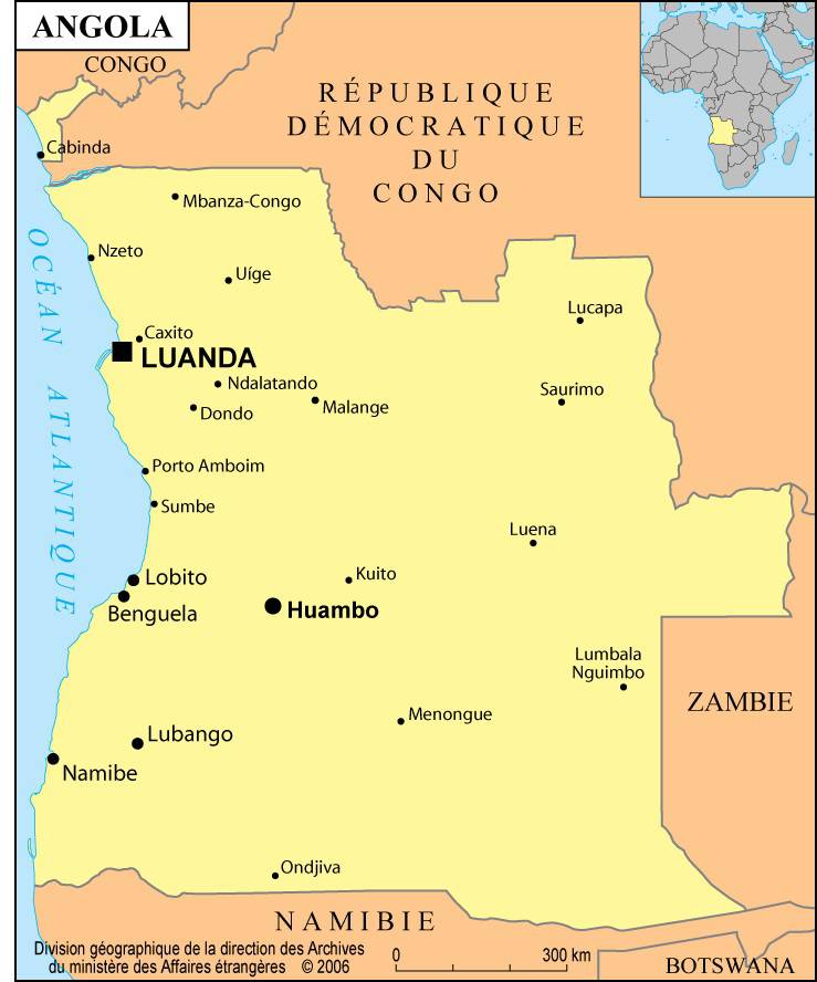
Geography with the map of Angola
As shown on the map of Angola, the country is located on the southwest coast of Africa. It consists of a vast plateau covered with savanna and bushland. The coastal plains widen in the north in the region of the Congo River.
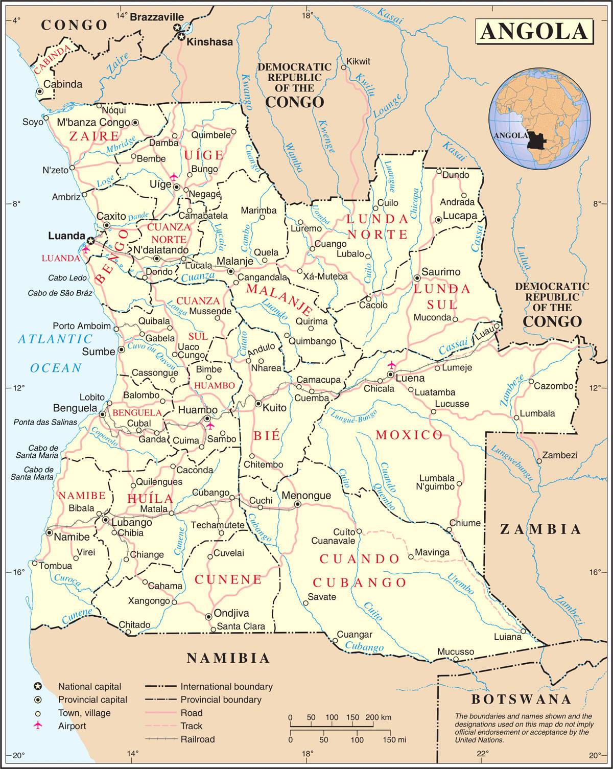
The enclave of Cabinda, located within the Democratic Republic of the Congo (formerly Zaire), belongs to Angola. As can be seen on the map of Angola, the country is bordered by the Democratic Republic of the Congo to the northeast, Zambia to the southeast, and Namibia (formerly South West Africa) to the south. Angola has a tropical climate, with a monsoon season from October to May.
The population is mainly made up of Bantu peoples. A few groups of San (Bushmen) live in the southeast of the country. Angolan farmers grow sugarcane, cotton, beans, rice and maize in the lowlands.
On the central plateau, they produce coffee, sisal and beeswax for export. Livestock is raised in plateau regions beyond the reach of the tsetse fly. Angola extracts diamonds, oil and natural gas.
The Angolan government has developed social services and built schools, hospitals and clinics. It supplies rural areas with drinking water by setting up irrigation systems that provide water to farmers. The road network has been expanded to make the most remote areas of the country accessible.
During the Angolan War of Independence, about 305,000 of the 335,000 Portuguese living in Angola left the country. Many were doctors, chemists or mechanics, and Angola then faced a shortage of skilled workers. In addition, frequent attacks by the South African army and local political difficulties seriously threatened the Angolan economy, and only oil production prevented its collapse.
A bit of history
Before the colonization of Africa by Europeans, several tribes, skilled in ironworking among other crafts, had founded powerful kingdoms in Angola. Their economies were based on agriculture, livestock breeding, hunting, fishing and tool making.
The Angolan coast (very extensive, as shown on the map of Angola) was one of the first areas in Africa to be colonized by Portuguese traders at the end of the 15th century. The capital of Angola, Luanda, was founded in 1576.

Until the end of the 19th century, Portugal controlled only part of the coastal regions and a few inland territories. However, the trade in slaves, textiles and weapons, along with military expansion, enabled the Portuguese to occupy the entire country.
Nearly 7 million people from the Congo-Angola region were sent into slavery, and the region prospered through the slave trade to Brazil, another Portuguese colony. Some Angolan leaders attempted in vain to curb this trade in the 16th century.
You can discover all available maps for different countries of the world on this page.
