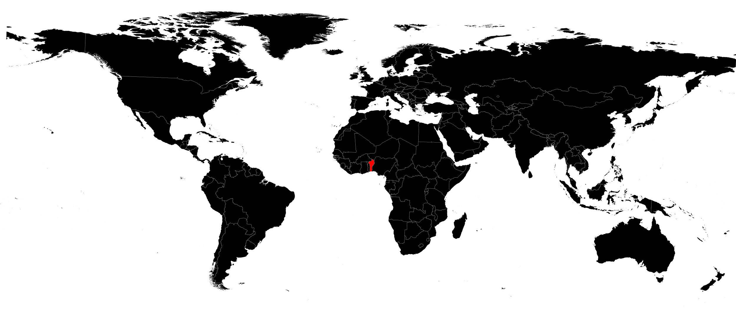
In this article you will find a map of Benin. In one century, the former powerful Kingdom of Dahomey, after being a French colony, became an independent republic, then a Marxist-Leninist state, and finally a free democracy.
Currently the Republic of Benin, it occupies a commercially and politically strategic position in the Gulf of Guinea. Porto-Novo is the official capital, but the port city of Cotonou is the political and economic center of the nation.
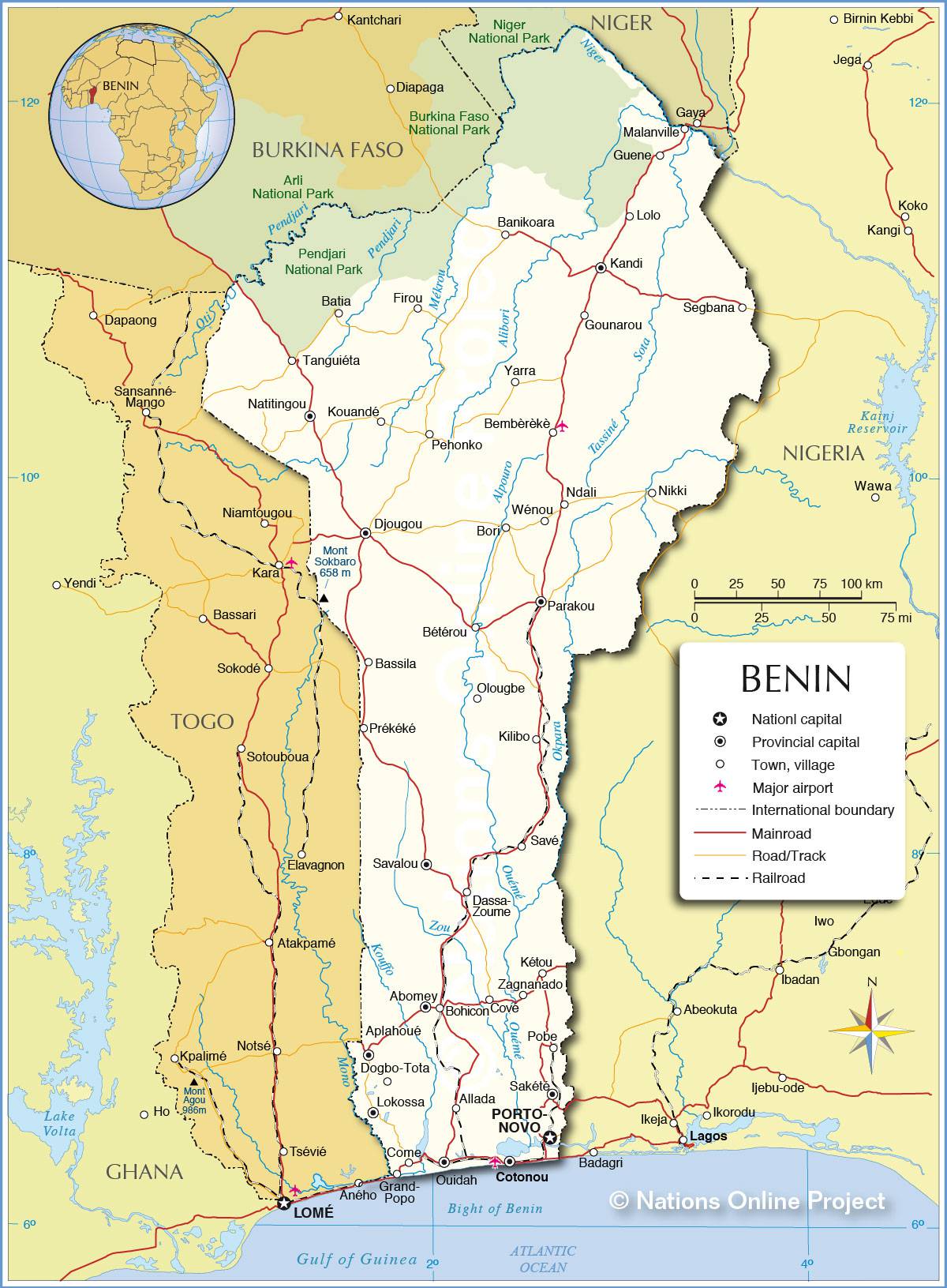
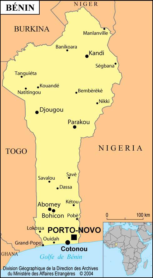
Geography with the map of Benin
The country is made up of 5 distinct regions as shown on the map of Benin. The coastal zone, low, flat and sandy, is bordered by lagoons. The terre de barre, north of the coast, is a fertile clay plateau. To the north and west of the terre de barre lies the Benin plateau whose elevation ranges between 90 and 230 meters.
In the northwest of the country, the Atakora Mountains, whose highest point reaches 640 meters, are an extension of the Togo mountain chain. To the northeast are the plains of the Niger Valley. Temperatures in the south of the country range from 22° to 34°C and average around 27°C in the drier north.
Population of Benin
Benin is a country covering an area of 112,620 square kilometers. You can look at the map of Benin to discover its shape. It is one of the African countries with a very high population density, with about 109 people per square kilometer.
More than 40 ethnic groups live there, but the Fon, Bariba, Yoruba and Somba make up the majority of the population. Most of the population follows traditional religious beliefs; 25% of the population is Christian and 15% is Muslim. French is the official language, but people speak Fon, Adja, Bariba, Yoruba, Fulani and other languages in daily life and in primary schools.
Economy of the country
It is not necessarily visible on the map of Benin, but Benin’s economy relies almost entirely on small family farms that produce only slightly more than necessary. Families grow corn, yams, cassava, rice, fruit, sorghum and beans. Palm oil products have long been the main exports.
The country also exports cotton, coffee and cocoa beans. Livestock is raised for milk and meat, and fishing represents a large share of domestic trade. The coastal oil field produces about twice the country’s needs.
History and government
Between the 12th and 19th centuries, five kingdoms—Allada, Abomey, Ouidah, Nikki and Porto-Novo—were located in what is now Benin. The people who lived in Abomey called their nation Dahomey. At the beginning of the 17th century, Dahomey was attacked by the Kingdom of Allada and strengthened its defenses. The 9-meter-high walls that protected the palace of King Houegbadja, the first monarch of Dahomey, still exist.
Dahomey gradually consolidated its power and conquered neighboring states. The Kingdom of Dahomey, one of the best organized states in West Africa, was divided into six provinces, each governed by a governor. Its army included a corps of women. The kingdom eventually expanded toward the coast, where European slave traders were located. The demand for slaves led to wars in the region as kingdoms made money by selling prisoners.
French colony
Dahomey signed a trade treaty with France in 1851, but French interests in the area went beyond simple commercial ties. When the neighboring kingdom of Porto-Novo requested protection against rival powers, the French readily helped. France also conquered vast territories in the north of the country, aware that control of Dahomey and neighboring kingdoms would link the inland regions to the sea.
Dahomey became a French colony in 1902, but the African population put up strong resistance. Resistance continued during the First and Second World Wars when West Africans were conscripted to fight for France, most against their will. Meanwhile, France grouped all its West African colonies into a vast administrative unit called French West Africa.
In 1958, Dahomey became an autonomous republic within the French Community. It gained independence on August 1, 1960, but kept colonial borders that divided the country into different ethnic groups. This division separated communities that had long lived together, and the government struggled to build a sense of national unity. It therefore became weak and unstable.
A group of armed officers led by Mathieu Kérékou seized power in 1972 and claimed that the corrupt government failed to meet the needs of the people. President Kérékou introduced a policy of “Marxist-Leninist scientific socialism” in 1974. A year later, he changed the country’s name to the People’s Republic of Benin and took control of the largest foreign companies. The population was estimated at 10.87 million inhabitants in 2016.
