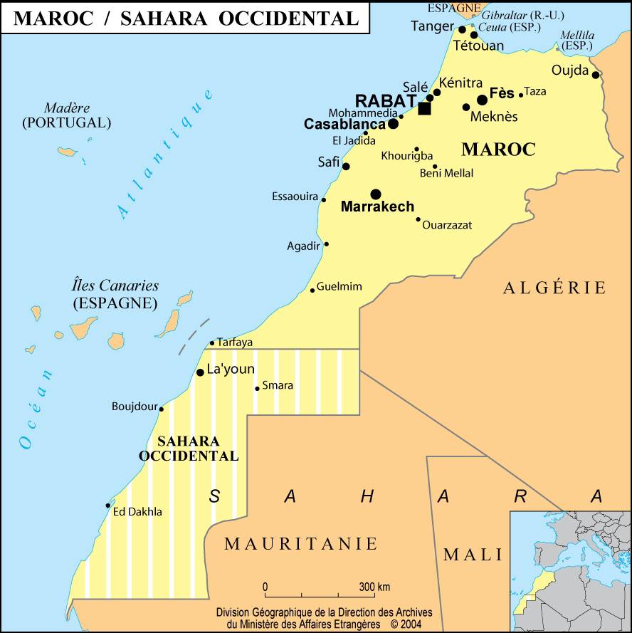
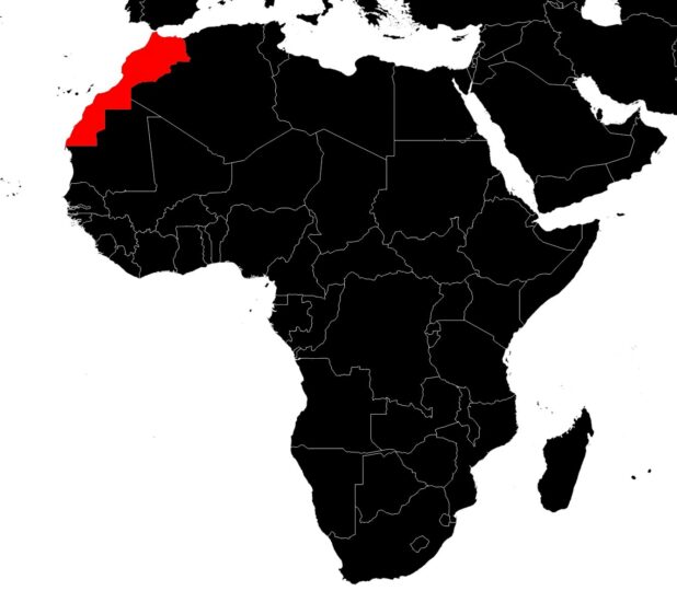
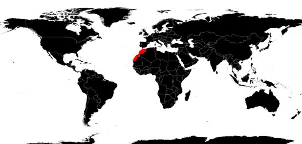
Discover the map of Morocco. The Kingdom of Morocco is located at the far west of North Africa. Formerly known by Arabs as Maghreb Al-Aqsa, or the “Far West”, Morocco was the center of Berber Islamic kingdoms.
Table of contents

It once included most of Spain and North Africa. In 1912, France established a protectorate there, then granted Morocco its independence in 1956. The country has a coastline 1,835 kilometers (1,140 miles) long on the Atlantic Ocean and the Mediterranean Sea. The Strait of Gibraltar separates Morocco from Spain. Algeria shares its border to the east.
As you can see on the map of Morocco, to the south of the country lies the area known as Western Sahara. This is a territory occupied by Moroccans but one that has been the subject of conflicts: Morocco claims this area, while Western Sahara’s leaders consider themselves independent.
Map of Morocco: the relief
Morocco covers an area of 446,550 square kilometers. You can see on the map of Morocco (the relief map) that the landscape is dominated by the rugged features of the Atlas mountain range. Earthquakes are frequent and are responsible for significant damage.
The Rif (part of the Atlas mountains running along the Mediterranean) rises abruptly up to 2,200 meters in altitude. The Middle Atlas, whose peaks reach 3,190 meters, separates the country’s main river system. The Moulouya River flows northward into the Mediterranean.
The Sebou River and the Oum Er-Rbia River flow west and south into the Atlantic Ocean. The High Atlas, for its part, develops from the Atlantic coast near Agadir and, to the northeast, reaches the Algerian border and the Saharan Atlas. These mountains reach an altitude of 4,000 meters and their summits are snow-covered in winter. Jebel Toubkal, the highest peak in North Africa, rises to 4,165 meters.
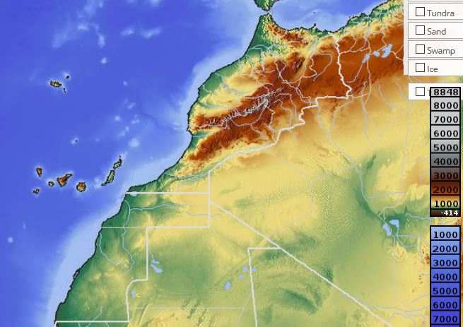
The lowlands descend from the mountain foothills to the Atlantic coastline. In the north, you encounter the Gharb Plain and the great Sebou River valley. Further south, you can discover the Meseta and Tadla plains. If you look at the map of Morocco, you’ll realize that the Sahara begins just south of the High Atlas. To the southwest, the Anti-Atlas mountains separate the Draa River valley, which flows into the Atlantic. The Sous River flows toward the Sahara.
Northern Morocco has a Mediterranean climate. Average annual rainfall in the Rif and the Middle Atlas reaches 75 cm. Rain falls mainly during the mild winter months. Summers are hot and dry. In Fez, the average annual temperature is 17°C and rainfall amounts to 54 cm/year. The further you go toward the southern lowlands, the more rainfall decreases as temperatures rise. In Casablanca, rainfall is 47 cm/year, and 23 cm/year in Marrakech, where the average annual temperature is 19°C. During the summer months, hot, dry winds from the Sahara blow over the southern plains. The Canary Current along the coast brings cooler air.
The Atlas mountains are covered with conifer forests. Due to significant deforestation, the lower slopes and lowlands are covered with scrub and grasslands. On the southeastern slopes of the Atlas and on the lowlands reaching the Sahara, you find steppe vegetation and species that withstand drought. Intermittent streams descend from the Atlas and disappear into the Sahara. You also find oases with palm trees and date palms in the gorges of the Anti-Atlas and along the edge of the desert. Everywhere else, there is no vegetation.
The population of Morocco
A related aspect of the map of Morocco is its population: the majority of the country’s 29 million inhabitants live in rural areas. People are mainly concentrated in the Sebou River valley and on the Atlantic coastal plains. The annual population growth rate is 3.3%. Arabic is the official language. French, often taught as a second language, is frequently used in business and within government.
One third of the population speaks Berber dialects. The population lives mainly in the towns and villages of the Atlas and the Saharan lands. People who speak Arabic tend to live in the cities and large towns of the lowlands and agricultural regions. Adult illiteracy is estimated at 72%. Primary and secondary school are nevertheless compulsory. The University of al-Quaraouiyine, founded in 859, is located in Fez. Muhammad V University, founded in 1957, is in Rabat.
