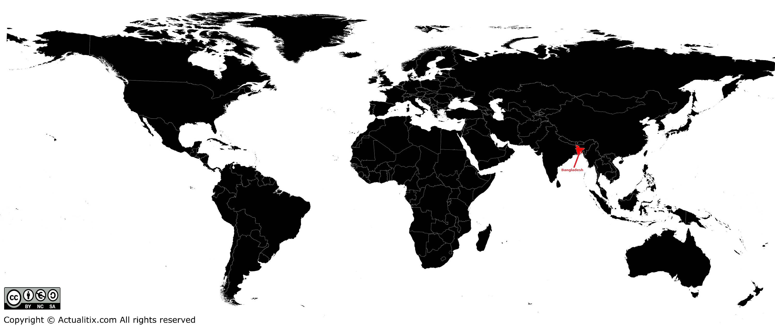
In this article you will find a map of Bangladesh. Located in South Asia, Bangladesh is the country with one of the highest population densities in the world.
It is also one of the poorest countries in the world. More than 128 million people live on an area of 147,570 square kilometers, which represents about 755 inhabitants per square kilometer. Most of the population survives through agriculture.
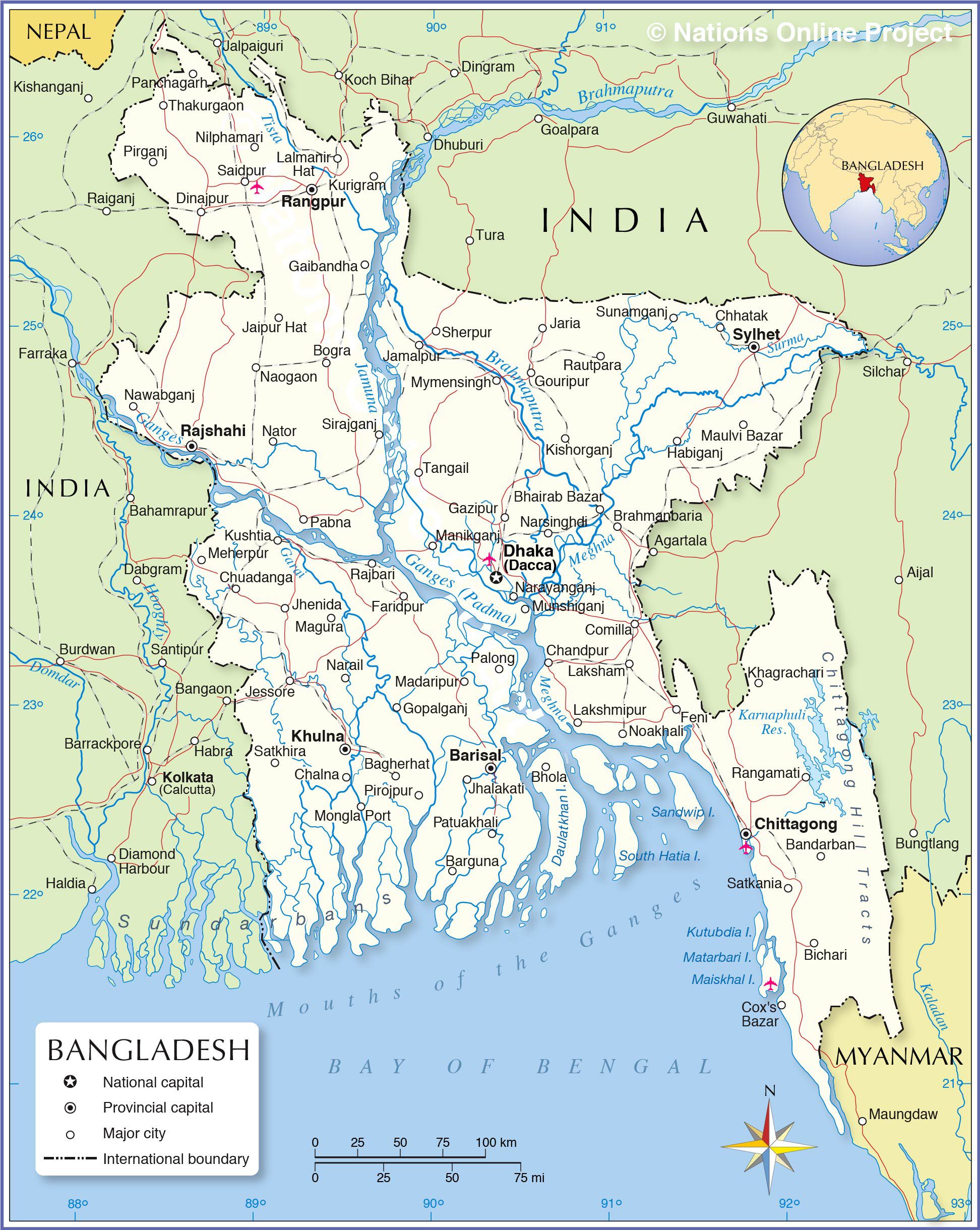
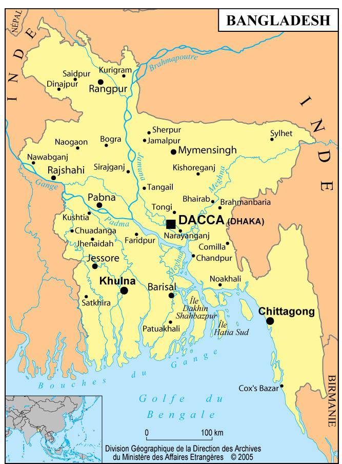
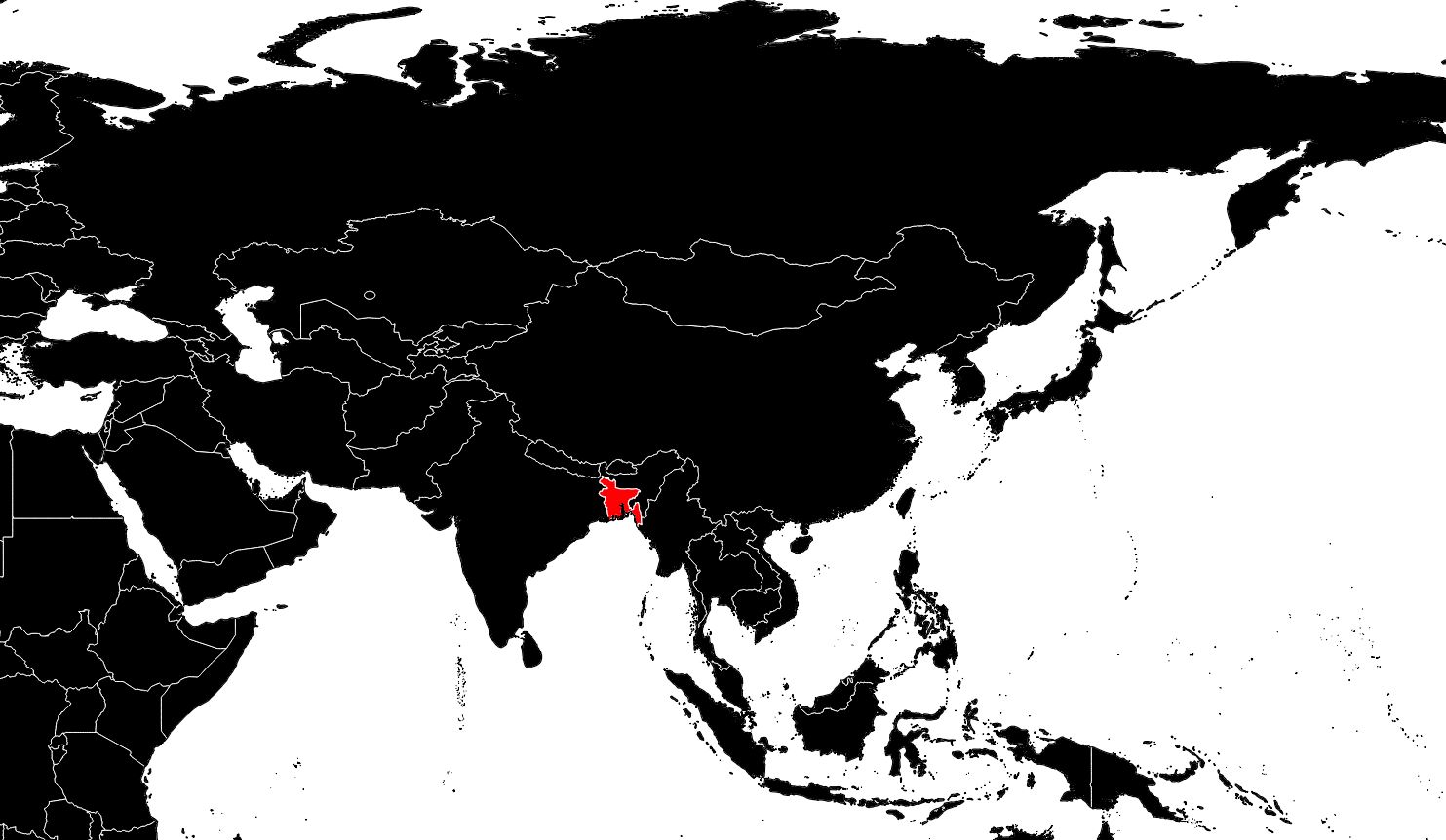
As shown on the map of Bangladesh, the country is bordered by India to the west, north, and northeast, by Myanmar to the southeast, and by the Bay of Bengal to the south. Bengalis mainly speak Bangla, or Bengali. They share a specific culture with their neighbors in West Bengal, a state of India. Bangladesh and West Bengal once formed the province of Bengal under British India.
Geography with the map of Bangladesh
The country has no significant relief, as can be seen on the map of Bangladesh. It is divided into five distinct physical regions: the Ganges Delta in the southwest, the paradelta in the northwest, the east-central plains, the Sylhet Hills in the northeast, and the Chittagong region in the southeast.
The Ganges Delta is the most recently formed geological region. Mangrove forests abound in the lower part of the delta, which is flooded by tides. The soil consists of recent alluvium. The paradelta is a plain located 30 to 90 meters above sea level. Its soils vary and are composed of sandy clay, silt, and older alluvial deposits. This region lies between the Ganges and the Brahmaputra.
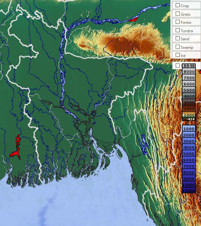
The east-central plains, crossed by the Meghna River, are flood-prone. Rivers such as the Brahmaputra once changed their course there. The Madhupur jungle, in the center of the plain, was once a hunting ground for tigers. The Meghna depression in the northeast, part of which lies only three meters above sea level, turns into a vast lake of 7,250 square kilometers during the rainy season.

The Sylhet Hills are an extension of the foothills of the Meghalaya Plateau in India. The highest point, Harargaj, reaches only 336 meters (it is difficult to distinguish on the map of Bangladesh). The Chittagong region consists of coastal plains and islands. It also includes the Matamori Delta, part of the Karnaphuli Valley to the west, as well as mountain ranges and eastern valleys.
The country’s rivers
Bangladesh’s extensive river network is fundamental to the country’s life and economy. The rivers flow into the Bay of Bengal. Nearly three-quarters of the water discharged into the bay comes from rainfall between June and September.
The main river of Bangladesh, the Ganges (easily identifiable on the map of Bangladesh), known locally as the Padma, is sacred to Hindus. It rises in the Himalayas and flows mainly through India. Forming a natural border between India and Bangladesh to the west, it then turns southeast into the Meghna’s course. The Meghna divides to form a delta near the Bay of Bengal.
The Brahmaputra and the Tista join the Ganges near the center of the country. The Brahmaputra rises in the Kailas ranges of the Himalayas in Tibet and enters Bangladesh from the north; it is about 2,900 kilometers long (see the map of Bangladesh). The Tista changed its course in 1787, after which the two rivers joined and now follow the Brahmaputra’s course. The Tista also rises in the Himalayas and enters Bangladesh from the north.
The Meghna and its tributary, the Surma, flow together for 210 kilometers before joining the Ganges southeast of Dhaka. During the rainy season, water from these rivers fills the Meghna depression, creating a vast body of water. The Lower Meghna forms when it is joined by the Ganges, and they then empty into the Bay of Bengal. The Ganges, Asia’s most important river, is the third longest river in the world after the Amazon and the Congo.
The Karnaphuli, the Sangu, and the Matamori, in the Chittagong region, are fast-flowing rivers prone to frequent flooding. The port of Chittagong is located at the mouth of the Karnaphuli.
Climate of the country
Bangladesh lives according to the rhythm of the monsoons (this is not very visible on the map of Bangladesh), with hot, rainy summers and mild, dry winters. Moist winds from the south and southwest, carrying humidity from the Indian Ocean and the Bay of Bengal, dominate from April to October. During this period, 95% of the annual rainfall occurs (about 203 centimeters per year). Average temperatures are around 20°C in January and 30°C in April.
Bengalis divide the year into six seasons: Grissho (summer), Barsha (rainy season), Sarat (autumn), Hemanto (mild season), Sheet (winter), and Basanta (spring). However, for practical reasons, three seasons are distinguished: summer, the rainy season, and winter. Rain begins in April, the hottest month.
Farmers then start plowing their fields. The monsoon rains arrive, and temperatures drop below 25°C. Heavy rainfall continues for two or three months and then gradually decreases until November. Every two or three years, Bangladesh experiences devastating floods.
You can discover all the available maps for the different countries of the world on this page.
