World Map Overview. For a long time, humans have organized themselves into societies in order to live, cooperate, and develop. As a result, the notion of the tribe (or clan) has tended to fade (especially in Western countries). Today, the nation-state is the main way the world recognizes human groupings and political borders.
Table of contents
- World map by countries
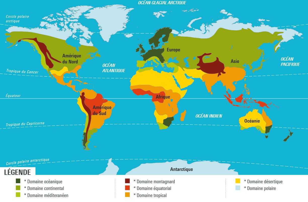
- World climate map
- Continents
- Europe map
- Asia map
- Africa map
- South America map
- North & Central America map
- Oceania map
- Middle East map
- Political systems map
- Time zones map
- Religions map
- Languages map
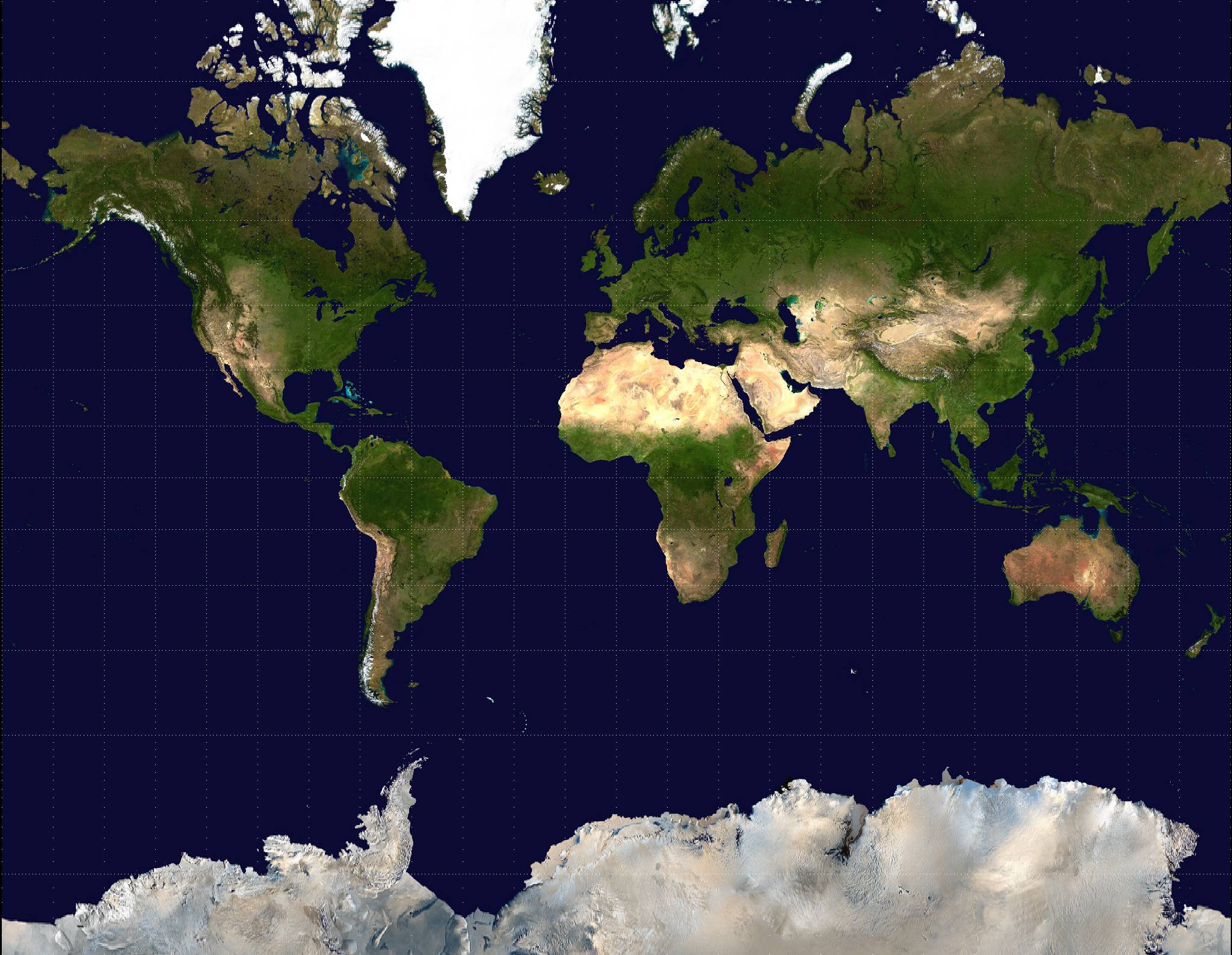
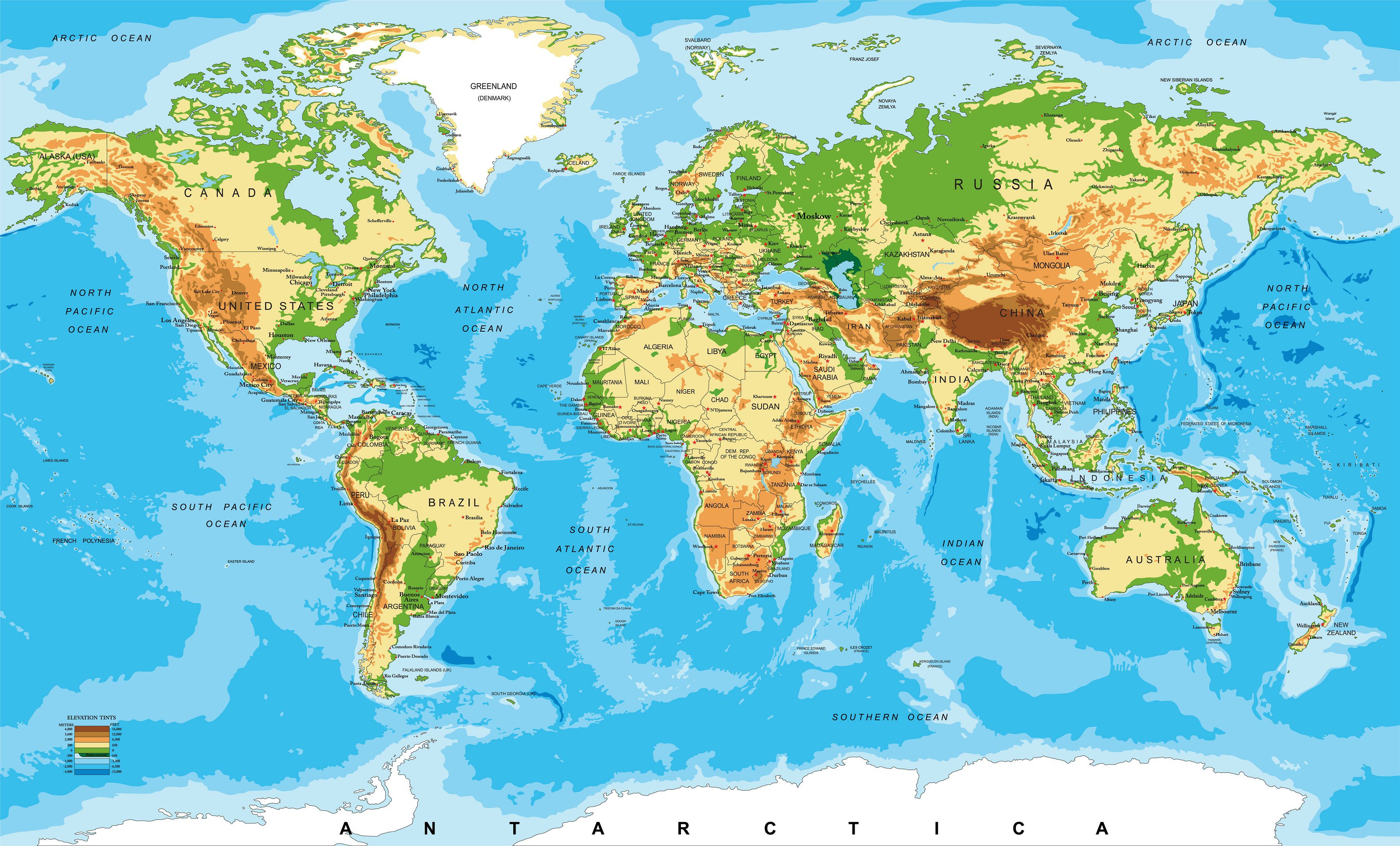
- World relief map
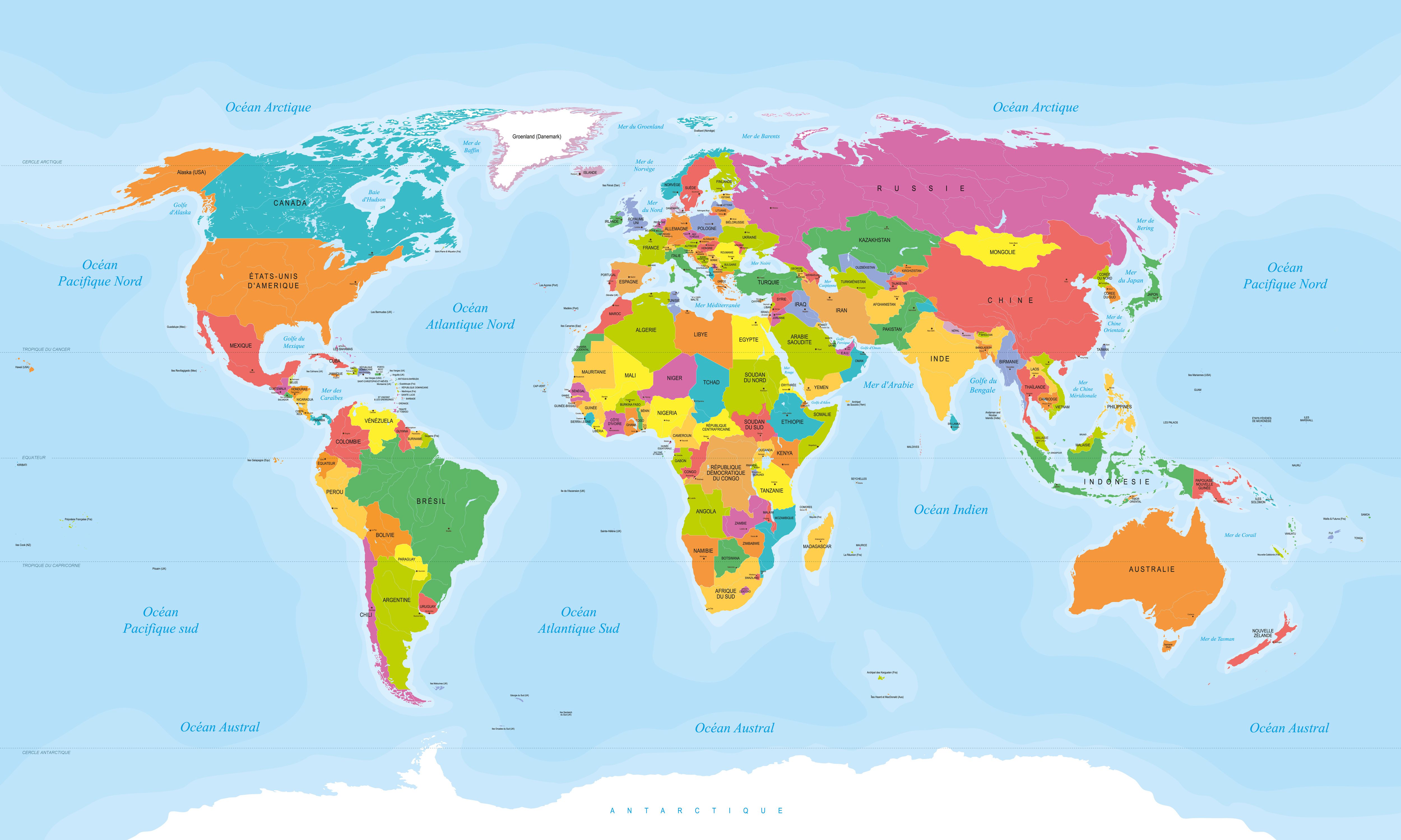
- Political world map
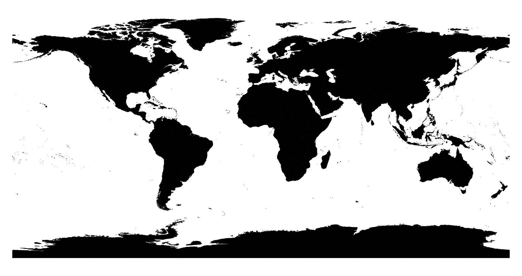
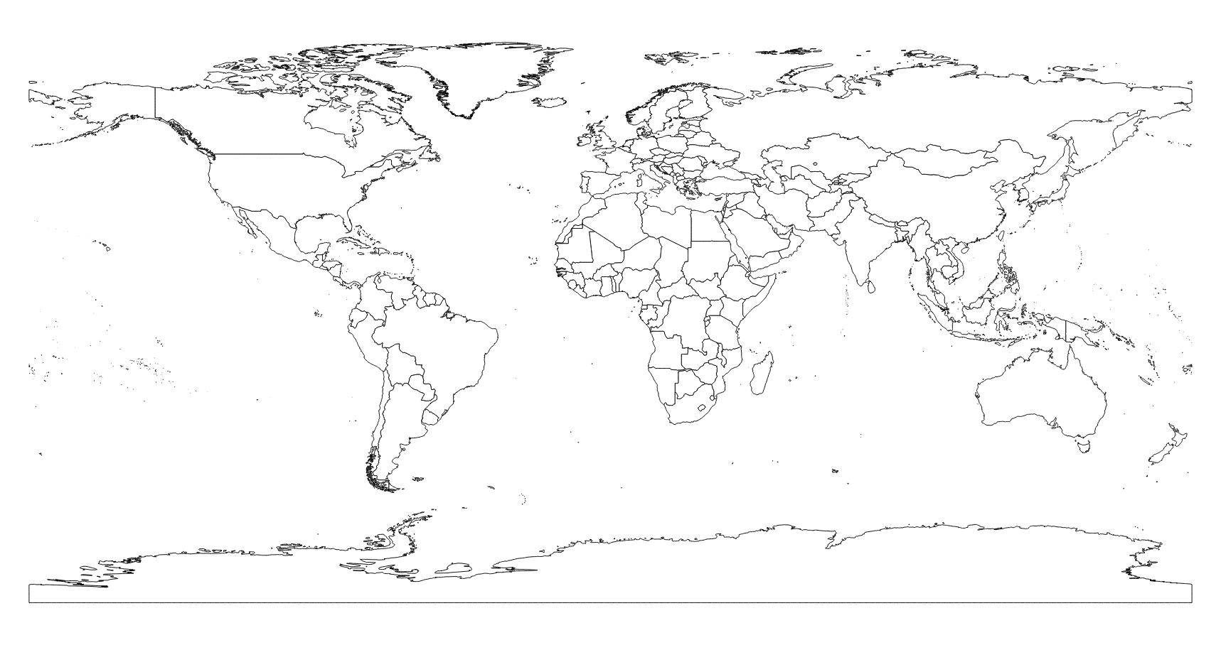
- Blank world map
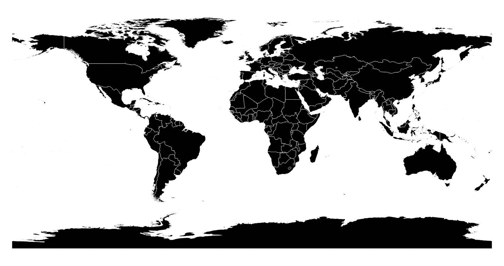
- Black and white world map
- Geography at a glance
- Political & administrative divisions
- Major tourist highlights
- Climate: best times to visit
- Population: key figures
- Extra facts about Earth
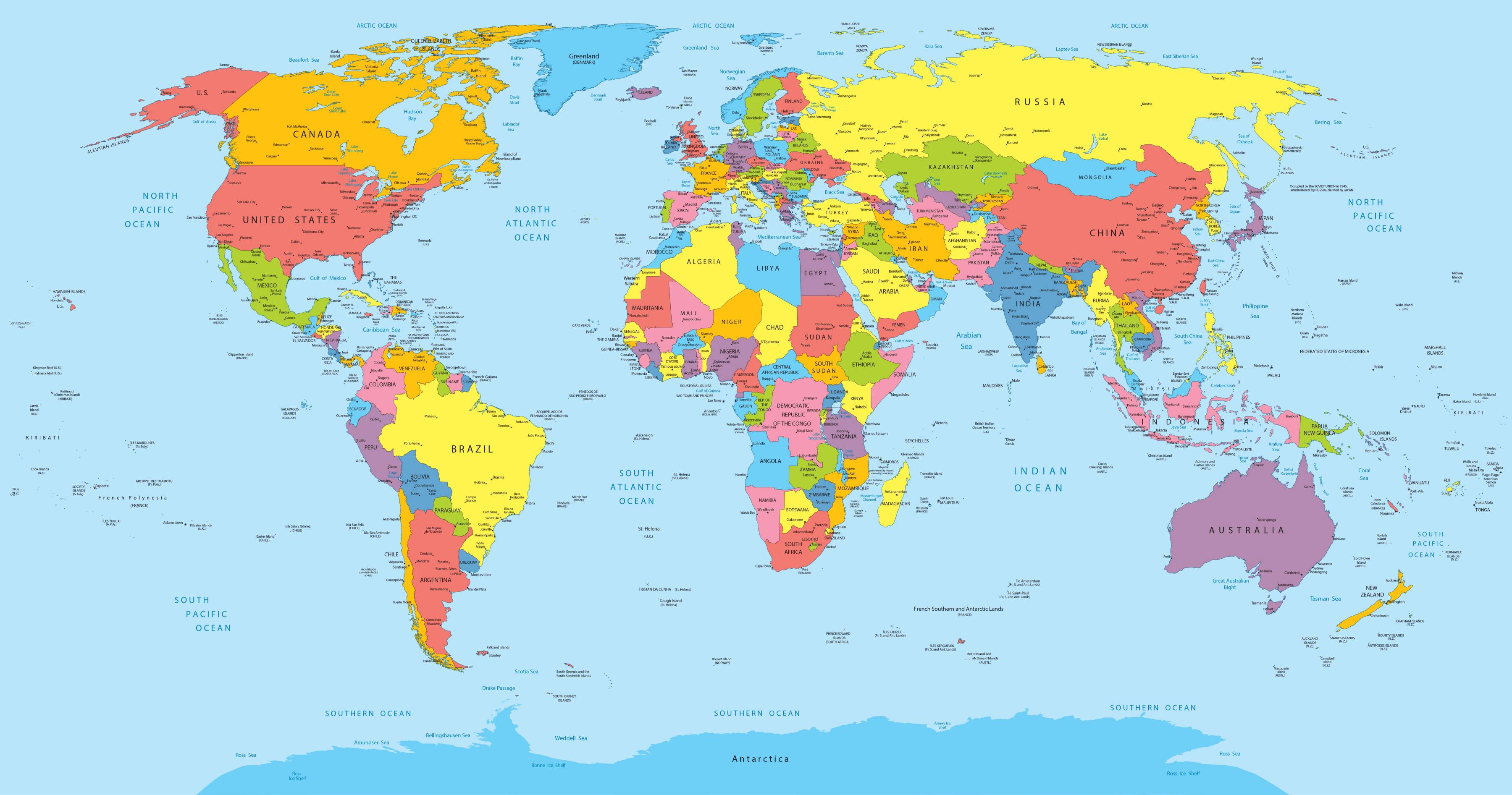
At the time these lines were written, and as you can see on the world map, the planet is commonly described as being divided into 195 states. Among them, 193 are members of the UN (United Nations). The least populated state (after the Vatican, which is not a UN member) is often cited as Tuvalu, a Polynesian archipelago made up of 9 coral atolls in the South Pacific. At the other end of the scale, the most populous country is China, with more than a billion inhabitants.
Continent maps
Below you’ll find a map showing the world’s continents. The Americas are often split into two: North (and Central) America and South America.
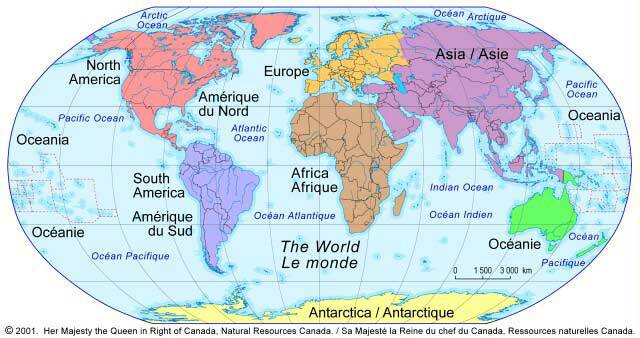
World continents map
You can access articles featuring maps of the different continents via the links and images below:
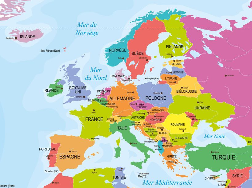
Discover a map of Europe. This continent—one of the smallest on Earth—brings together nearly 40 independent states along with several monarchies, principalities, and historic duchies. Traditionally, it also includes the most populated regions of western Russia, as well as the European part of Turkey.
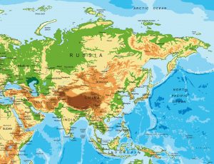
Discover a map of Asia. A land of extremes and contrasts, Asia is the largest and most populous continent on the planet. It is home to the world’s highest mountains, some of its longest rivers, the highest plateaus, vast deserts, and immense plains.
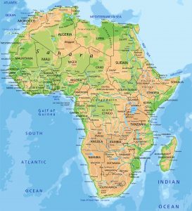
Discover a map of Africa. The African continent and its islands include more than 50 independent states. Together, they represent more than a third of the United Nations’ member countries.
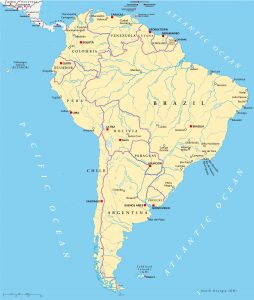
By clicking on the map you can discover a map of South America (a full article featuring several maps). Triangular in shape, South America is bordered to the east by the Atlantic Ocean, to the west by the Pacific Ocean, and to the north by the Caribbean Sea.
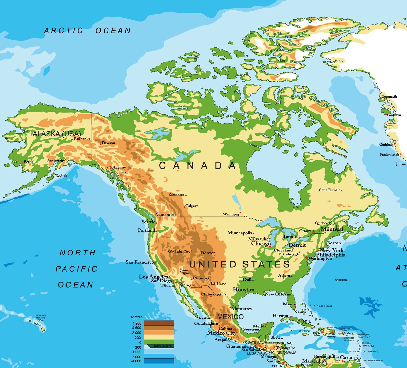
By clicking on the map of North America and Central America, you’ll access the dedicated article (with several maps). The third-largest continent by area, North America stretches from Alaska and Greenland down to the Panama–Colombia border (where South America begins).
Canada, the United States, Mexico, the republics of Central America, the Bahamas, as well as the Greater and Lesser Antilles also belong to the North American region.
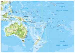
You can discover a map of Oceania by clicking the image above. Oceania is often used to describe an ensemble formed by tens of thousands of islands spread across a vast area of the Pacific Ocean, from Belau to Easter Island (about 12,500 km) and from Midway to New Zealand (about 7,500 km).
Around three thousand of these islands are significant enough to have a name. The term Oceania can sometimes include Australia, New Zealand, and New Guinea (a group also called Australasia). To learn more, see the dedicated article.
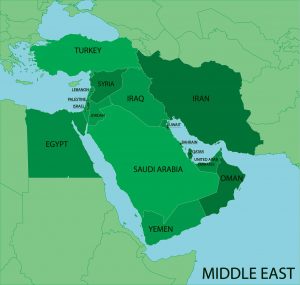
This section gives you access to a map of the Middle East (Near East). The Middle East is defined in a fairly flexible way. Several criteria are used, such as geography, culture, and politics.
It is generally considered a group of countries located between the eastern Mediterranean and the north-western Indian Ocean. The Middle East covers an area of roughly 5,000,000 km².
[/one_half]
Political systems
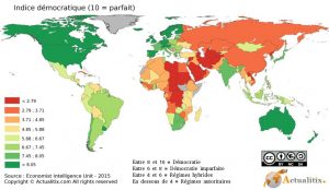
Discover a map of political systems around the world.
Throughout history, societies have often highlighted pyramid-style political organization, built around one (or several) leaders who steer the group—sometimes at the expense of more collegial forms of governance.
Time zones
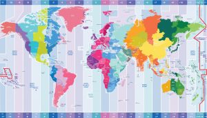
Find information and a time zones map for the world.
Because our planet rotates, time differs depending on your location on the globe (except if you are on the same meridian).
In 1884, the Earth was divided into multiple time zones (24 in total)…
Religions
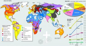
Discover religions around the world through maps. The origin of the word religion is not fully established.
For some Christian authors, the word (Latin) comes from the verbs ligare and religare, which gave rise to the idea of “to bind” and “to reconnect.” The concept is that religion creates a link with a divinity.
Languages
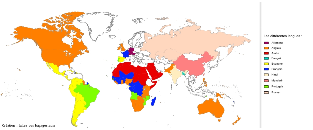
You can discover an article about languages spoken by country.
You will also find a world languages map by country with a table.
Other information on the world map

[/one_half_last]
The world—or rather the Earth in this case—is not only the largest rocky planet in the Solar System, nicknamed the “blue planet,” where life appeared around 3.8 billion years ago. Earth is also humanity’s home. Today, billions of people live across the globe, and that number continues to grow. But did you know that only a small portion of land is densely inhabited, and that a large majority of the population lives in the Northern Hemisphere? Discover the world map below:
Geography at a glance
- Oceans: Pacific, Atlantic, Indian, Arctic (and the Southern Ocean, depending on classification).
- Major mountain ranges: Himalayas, Andes, Rockies, Alps.
- Longest rivers (often cited): the Amazon and the Nile.
- Major deserts: Sahara, Arabian Desert, Gobi, Australian deserts.
Political & administrative divisions
On a world map, the main political units are countries (sovereign states). Within countries, maps can also show administrative divisions such as regions, provinces, states, departments, and major cities—useful for understanding how territories are organized and governed.
Major tourist highlights
World maps are also great for locating iconic destinations. Here are a few examples by region:
- Europe: Paris, Rome, Barcelona, the Alps.
- Asia: the Great Wall, Kyoto, Angkor, the Himalayas.
- Africa: the Pyramids of Giza, the Serengeti, Cape Town.
- Americas: Machu Picchu, the Grand Canyon, New York, Patagonia.
- Oceania: the Great Barrier Reef, New Zealand’s fjords, Sydney.
Climate: best times to visit
- Tropical climates: best in the dry season; rainy seasons can bring heavy downpours and humidity.
- Temperate climates: spring and autumn are often the most pleasant; winters can be cold and summers hot depending on the latitude.
- Continental climates: cold winters and hot summers; ideal travel windows are usually late spring and early autumn.
- Polar and high-mountain climates: very cold for long periods; short summers can offer better access for trekking and sightseeing.
Population: key figures
Population is unevenly distributed across the planet: large urban hubs concentrate millions of inhabitants, while vast areas (deserts, mountains, dense forests, polar regions) remain sparsely populated. World maps can help visualize population density, major metropolitan areas, and demographic contrasts between regions.
Additional facts about the world map
- Age: 4.55 billion years
- Distance to the Sun: 150 million km
- It is the third planet in the Solar System
- Mass: 5,972 billion billion tonnes
- Average density: 5.52
- Average diameter: 12,740 km
- Equatorial circumference: 40,075 km
- Earth’s surface area: 510 million km²
- Total land area: 133 million km²
- Ocean area: 363 million km² (70% of Earth’s surface)
Smallest countries :
- Vatican City (Stato della Città del Vaticano): 44 ha. Mineral plate: SCV
- Monaco: 195 ha, a large part reclaimed from the sea
- Nauru (Oceania): 21 km²
Largest countries :
- Russia: 17,075,400 km² (width: 10,000 km, height: 3,500 km), about 30 times France
- Canada, China, United States: close to 10 million km² each
Least populated countries :
- Tuvalu (Oceania): 12,000 inhabitants. Former Ellice Islands (9 Pacific atolls, 8 inhabited)
- Nauru (Oceania): 9,300 inhabitants
Most populated countries :
- China: 1.33 billion inhabitants (about 20 times France)
- India: 1.18 billion inhabitants
- United States: 308 million inhabitants
Lowest population densities :
- Mongolia: 1.7 inhabitants/km²
- Mauritania: 1.95 inhabitants/km²
- Namibia: 2.2 inhabitants/km²
Highest population densities :
- Monaco: 16,400 inhabitants/km²
- Singapore: 6,750 inhabitants/km²
- Japan ranks only 17th with 337 inhabitants/km²
Lowest GDP per capita :
- Mozambique: $80 per inhabitant
- Ethiopia: $100 per inhabitant
- Sixteen African countries occupy 17 of the top positions for the lowest GNP
Highest GDP per capita :
- Luxembourg: $78,409 per inhabitant
- Qatar: $78,260 per inhabitant
- The United States is 6th ($45,934 per inhabitant), France is 22nd ($33,434 per inhabitant)
Longest rivers in the world :
- The Amazon: 7,025 km long, drains an area of 6 million km², crosses Peru and Brazil, receives more than 500 tributaries (including 20 rivers over 1,500 km). Discharge at the mouth: 190,000 m³ per second. Flows into the Atlantic Ocean.
- The Nile: 6,700 km
Highest mountains :
- Everest (China): 8,846 m
- K2 (China, Pakistan): 8,611 m
Largest islands :
- Australia: 7,686,850 km² (14 times France)
- Greenland (Denmark): 2,186,000 km²
Largest natural lakes :
- Caspian Sea (ex-USSR): 371,000 km², tectonic lake, 980 m deep
- Lake Superior (Canada): 83,300 km², glacial lake, 307 m deep
Largest artificial lake :
- Owen Falls (Uganda): 68,100 km², raised level of Lake Victoria (Africa)
Deepest lake :
- Lake Baikal (southern Siberia): 1,741 m deep
Largest urban area :
- Mexico City: around 20 million inhabitants
Life expectancy
- Highest in the most industrialized countries (over 75 years in Japan, over 73 years in France)
- Lowest in sub-Saharan Africa, with less than 50 years in most countries—and even under 35 years in Angola, Zambia, Zimbabwe, or Sierra Leone