Discover a map of Africa. The African continent and its islands include more than 50 independent states. Together, they represent more than a quarter of the members of the United Nations.
Article Summary
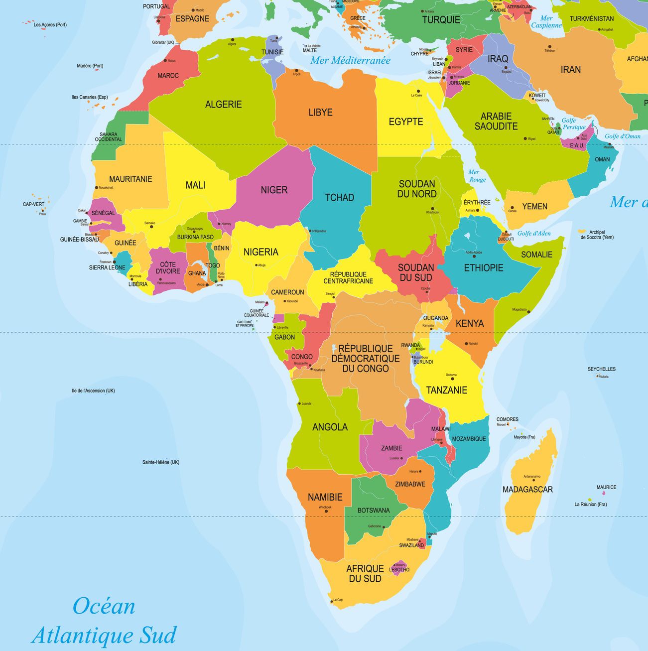
Geography on the Map of Africa
The African continent lies on the Equator and stretches from 35° north latitude to nearly 35° south latitude. It is the second largest continent in the world after Asia and covers an area three times larger than that of the United States. In 2016, its population was estimated at 1.2 billion inhabitants. About one third of Africa’s total surface area is cultivated. You can find a map of Africa below.
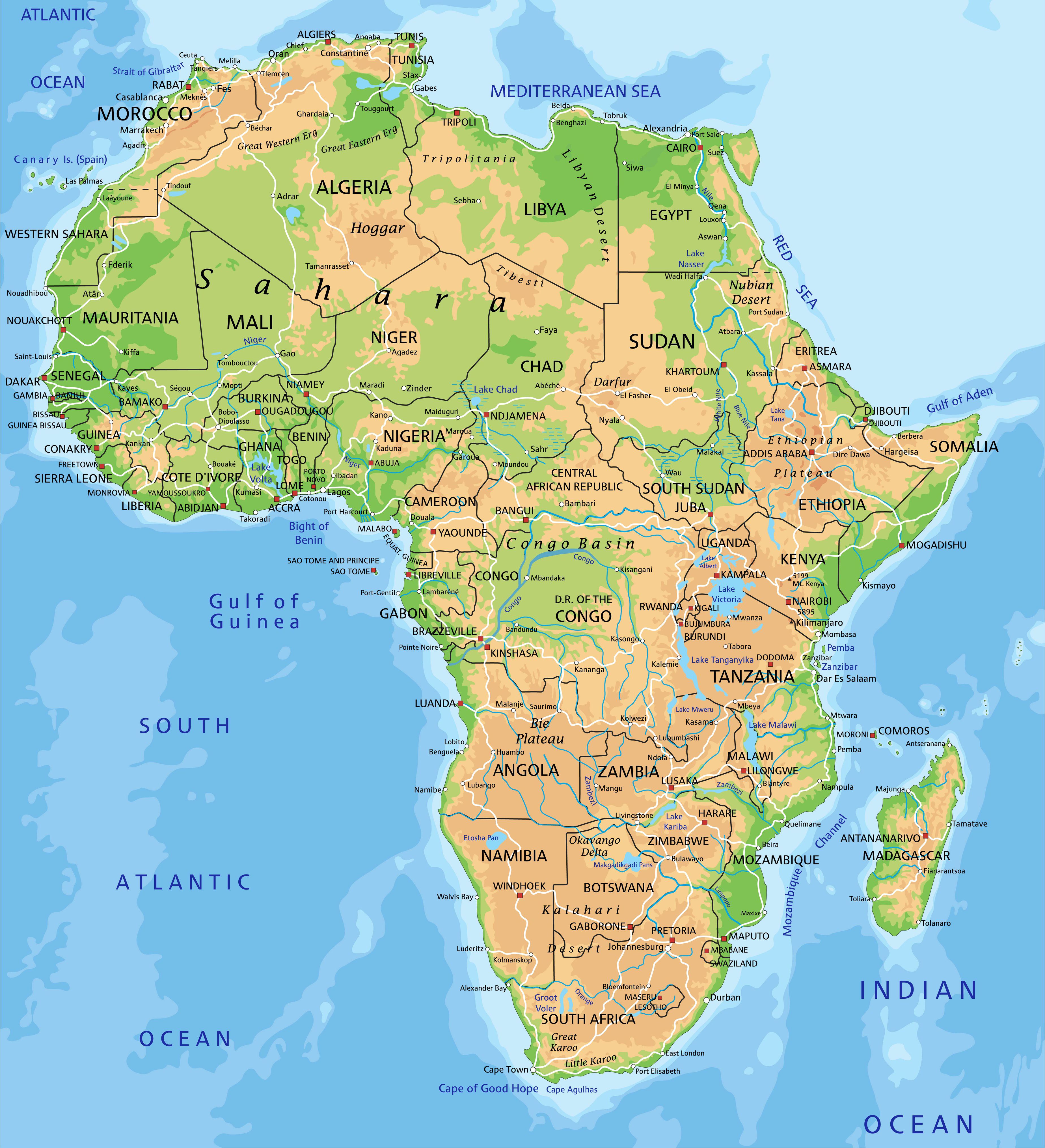
Geologically, Africa is one of the oldest continents. It was the heart of Gondwana, a hypothetical continent that brought together all the present-day continents of the southern hemisphere. As Africa has undergone erosion for hundreds of millions of years, most of its mountain ranges have been worn down. Further below, you will find a map of Africa showing the relief, but the map below first allows you to identify the countries that make up the continent.
Today, the continent is essentially a vast undulating plateau ranging from 150 to 1,400 meters above sea level. However, several mountain ranges remain: the Atlas in the northwest, the Hoggar and Tibesti ranges in the Sahara, and the East African mountains stretching from Ethiopia to Tanzania. The map of Africa below allows you to observe the continent’s relief.
Africa’s highest peak is Mount Kilimanjaro (5,895 m) in Tanzania. At its foot runs the Rift Valley. This narrow and deep fracture in the Earth’s surface contains branches that house lakes such as Tanganyika and Nyasa (Lake Malawi). The valley is about 6,400 km long and 50 to 65 km wide, offering magnificent landscapes.
Of all the island states located off the coast of Africa (Cape Verde, the Comoros, Mauritius, the Seychelles…), Madagascar is the largest. These states can be found on the map of Africa.
Climate in Africa
The climate and vegetation reflect the continent’s position on the Equator. Several different ecological zones extend north and south of the Equator: equatorial rainforest, savanna, desert, and regions with a mild Mediterranean climate.
Rainfall is closely linked to the movement of air masses, which depend on the warming and cooling of different regions of the globe as it revolves around the Sun. Below you will find the map of Africa showing the climate.
In the Northern Hemisphere, rains fall from April to September. In the Southern Hemisphere, it rains from October to March. In equatorial regions, rainfall occurs all year round, while at the southern and northern extremes of the continent, it rains only in winter (Mediterranean climate). Eastern and western Africa are exceptions with their monsoon seasons. The heaviest rainfall occurs in equatorial regions. There is little rain in the savannas, and rainfall is rare in the deserts, where it occurs mainly in summer and sometimes in torrential downpours.
As rainfall varies greatly from one end of the continent to the other, vegetation also differs. Around the Equator, where it rains all year round, dense tropical rainforests contain thousands of species of trees and plants. They are generally composed of three layers: the first, made up of shrubs and ferns not exceeding 2 to 3 meters in height; the second, including trees and climbing plants under 18 meters; and the third, consisting of evergreen broadleaf trees that can reach up to 46 meters in height.
The savannas form natural borders between the equatorial tropical forests and the great deserts to the north and south. Farmers and herders live in these vast grasslands dotted with trees such as acacias and baobabs. In southern and eastern Africa, the savannas are the realm of wildlife.
Environmental advocates fear, however, that the savanna may deteriorate and turn into desert due to certain human factors. Indeed, the African population has steadily increased since the 1950s, and the ever-growing need for grazing land and firewood or timber accelerates the clearing of savannas, pushing wildlife further away and impoverishing the soil.
Precipitation
Summer rains also aggravate this trend, as their duration, intensity, and distribution are unpredictable. When monsoon winds fail to blow, drought sets in. From 1970 to 1974, drought struck a large part of the African savanna. It was particularly severe in West Africa, where it is estimated to have caused the death of 250,000 people and 6 million head of livestock. Below, the map of Africa allows you to discover the rainfall patterns affecting the continent.
The deserts of the Sahara, Namib, and Kalahari, beyond the savanna, receive less than 40 cm of rainfall per year. Few people settle in these deserts. Some nomadic herders, such as the Tuaregs and the Gabbras, live in the Sahara.
Tropical rainforests, savannas, and deserts cover most of the continent, but there are also mountainous environments (the Atlas) and Mediterranean regions. Areas with a Mediterranean climate are limited to two narrow bands located in the Maghreb and in South Africa.
Peoples and Cultures in Africa
The peoples and cultures of Africa are as diverse as its geography. North of the Sahara, inhabitants are of Arab and Berber origin. Egypt, Libya, and the Maghreb (composed of Tunisia, Algeria, and Morocco) have strong ethnic and cultural ties with the Middle East.
Arab influence is also felt in eastern as well as western and central Africa. South of the Sahara, intermarriage between Arabs and Bantu peoples gave rise to Swahili culture. Hamito-Semitic peoples are found in Ethiopia and Somalia as well as in Egypt, while Khoisan peoples (including San and Khoikhoi) live in the far southwest of the continent. Anthropologists have identified nearly 3,000 different ethnic groups or peoples in Africa speaking around a thousand distinct dialects. You can also consult the map of Africa showing the languages spoken to discover their diversity across the continent.
During the colonial period, many Europeans came to live in Africa, and some settled there permanently. Most established themselves around their respective countries’ possessions. Lebanese, Syrians, Indians, and Palestinians also immigrated to Africa. These immigrants worked for colonial governments and later entered trade and business. Many Asians still live in Africa today, working as traders or shopkeepers.
Map of Religions in Africa
Three main forms of religion coexist in Africa: Christianity, Islam, and traditional African religions. Traditional African religions vary from one society to another, but most share common practices and beliefs. There is a strong belief in animism among many Africans. Below is a map of Africa showing the religions found across the continent.
Most Africans who practice traditional religions believe in a supreme creator, god, or spirit. Other “lesser gods” or spirits act and speak through the community’s ancestors. All traditional religions have festive rituals where music, songs, and dances bring the entire community together.
Map of Transport in Africa
Africa had significant road networks long before the colonial period. Camel caravans crossed the Sahara to transport goods between Europe and Africa. In eastern and southern Africa, African traders brought goods to the coast to exchange them for products brought by Arab merchants from Asia. Boats transported goods along the major rivers. Below, you can find a map of Africa showing transport routes.
The colonial period brought significant changes to existing infrastructure. From the beginning of the 20th century, railways were built and roads were renovated to allow motor vehicles to pass. Steamships sailed on rivers and lakes, and airplanes flew to countries all over the world.
The construction of these modern road and rail infrastructures required major investments justified by the exploitation of African mineral and agricultural resources. These infrastructures have changed little since the end of the colonial era. The map of Africa below offers another perspective on the continent.
In landlocked countries with sufficient mineral and agricultural resources, colonial powers invested in building road and railway networks. In contrast, landlocked countries without resources were neglected. These countries are now among the poorest in the world.
Road and railway networks in Africa form a branching pattern: main roads or railway lines branch out to connect mines and plantations to the coast so that production can then be exported to colonizing countries. Only a few countries have infrastructure initially designed to transport passengers rather than goods.
Road and railway links between different African countries have also not developed sufficiently. Rival colonial powers had no interest in developing communication and trade between their colonies. African states are now addressing this shortcoming by building new railways and highways crossing the continent. As a result, links between different African nations are gradually improving, even if they are still mainly oriented toward Europe.
![]() Algeria
Algeria![]() Angola
Angola![]() Benin
Benin![]() Botswana
Botswana![]() Burkina Faso
Burkina Faso![]() Burundi
Burundi![]() Cape Verde
Cape Verde![]() Cameroon
Cameroon![]() Central African Republic
Central African Republic![]() Chad
Chad![]() Comoros
Comoros![]() Djibouti
Djibouti![]() DR Congo
DR Congo![]() Egypt
Egypt![]() Equatorial Guinea
Equatorial Guinea![]() Eritrea
Eritrea![]() Ethiopia
Ethiopia![]() Gabon
Gabon
![]() Gambia
Gambia![]() Ghana
Ghana![]() Guinea
Guinea![]() Guinea-Bissau
Guinea-Bissau![]() Ivory Coast
Ivory Coast![]() Kenya
Kenya![]() Lesotho
Lesotho![]() Liberia
Liberia![]() Libya
Libya![]() Madagascar
Madagascar![]() Malawi
Malawi![]() Mali
Mali![]() Mauritania
Mauritania![]() Mauritius
Mauritius![]() Morocco
Morocco![]() Mozambique
Mozambique![]() Namibia
Namibia![]() Niger
Niger
![]() Nigeria
Nigeria![]() Republic of the Congo
Republic of the Congo![]() Rwanda
Rwanda![]() Sao Tome and Principe
Sao Tome and Principe![]() Senegal
Senegal![]() Seychelles
Seychelles![]() Sierra Leone
Sierra Leone![]() Somalia
Somalia![]() South Africa
South Africa![]() South Sudan
South Sudan![]() Sudan
Sudan![]() Swaziland
Swaziland![]() Tanzania
Tanzania![]() Togo
Togo![]() Tunisia
Tunisia![]() Uganda
Uganda![]() Zambia
Zambia![]() Zimbabwe
Zimbabwe
