In this article you will find a map of Dominica. The country is located in the Caribbean Sea between Guadeloupe and Martinique and is part of the Lesser Antilles.
Geography with the map of Dominica
This mountainous island of volcanic origin covers an area of 750 square kilometers. The territory is largely occupied by a high mountain range running north to south, whose steep slopes are covered with vast forested areas.
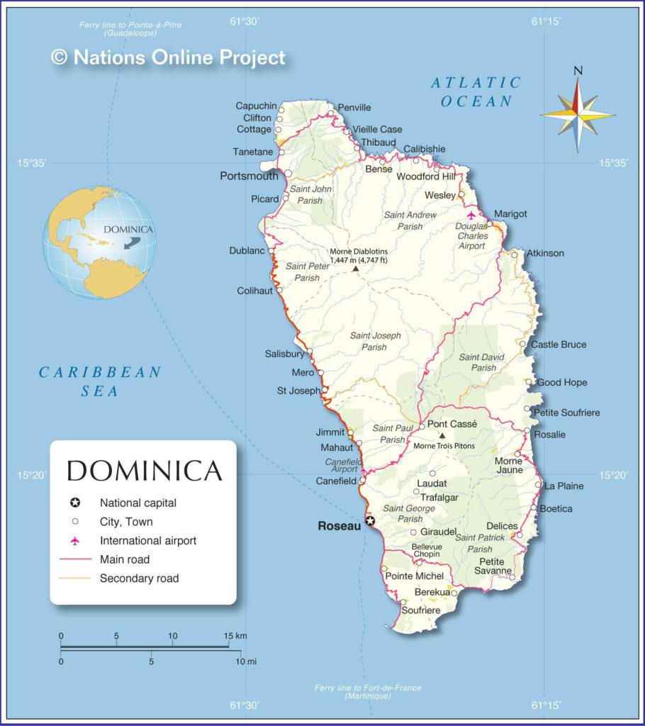
Dominica map – Credit: Nation Online
Morne Diablotin, which rises to 1,447 meters above sea level (see the map of Dominica) in the north of the country, is the island’s highest peak. This vast mountain range is interrupted by a central plain drained by the Layou, Pagua, and Castle Bruce rivers. These rivers, like most other Dominican waterways, are not navigable.
Dominica is home to several volcanoes, now extinct. However, volcanic activity remains evident through the many hot springs and the presence of a boiling lake in the south of the country. The soils are generally very fertile, and the vegetation is lush, especially in the tropical rainforest that covers the island. You can also consult the map of Dominica to better understand its geography.
The island is characterized by a tropical climate, with temperatures generally ranging between 26°C and 32°C. Rainfall is very abundant, reaching nearly 635 centimeters in the mountainous regions but only 178 centimeters along the coast. Wildlife is particularly diverse: there are more than 135 different bird species. The most common animals include iguanas, opossums, boa constrictors, and numerous species of bats.
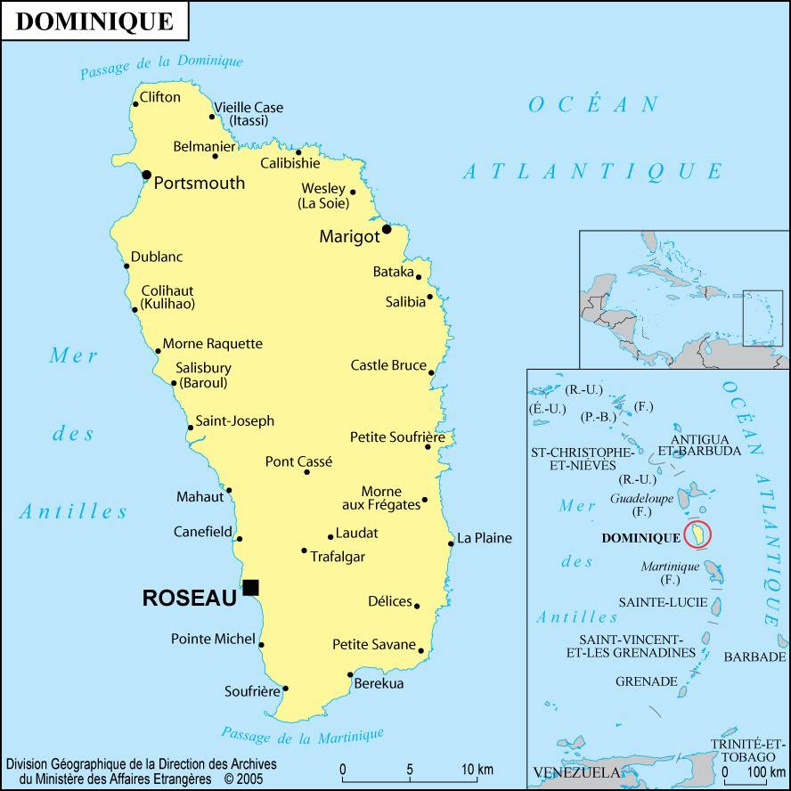
Map of Dominica
Learn more
Dominica is one of the poorest islands in the Caribbean. Bananas are not only the main crop but also the leading export. Farmers also grow, in smaller quantities, grapefruits, coconuts, lemons, oranges, and vegetables.
Coconuts are used to produce copra, oil, soap, and various detergents. Pumice stone is the island’s only known mineral resource. Livestock farming is almost insignificant, and the fishing industry is not highly developed. Dominica mainly exports bananas, coconut oil, and fruit juices.
It imports manufactured goods, machinery, transport equipment, food products, and chemicals. Handicrafts play a significant economic role, and several local factories specialize in producing cigarettes from imported tobacco.

The beauty of its landscapes and tropical flora, along with its mild climate, is one of Dominica’s main tourist assets. The island has therefore developed excellent infrastructure, including swimming facilities, port sites, and deep-sea fishing opportunities.
The road network includes more than 644 kilometers of paved roads. The capital, Roseau (which can be seen on the map of Dominica), financed the construction of a very active port in 1976 that welcomes many cruise ships. The main airport is located at Melville Hall, about 64 kilometers from the capital.
History
When Christopher Columbus discovered Dominica in 1493, the island was inhabited by warlike indigenous tribes known as the Caribs. Protected by often steep coastal cliffs, Dominica was one of the last islands to be explored by Europeans.
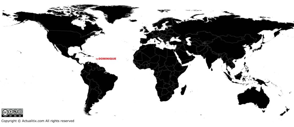
Dominica on a world map
In the years following its discovery, the Caribs, the French, and the British fiercely contested control of the island, which was eventually ceded to the British in 1783. Dominica became an independent state and a member of the Commonwealth in 1978. In 2016, its population was estimated at 73,000 inhabitants.
