Discover a map of Guadeloupe. It is part of the Lesser Antilles archipelago. This French overseas department covers an area of 1,780 square kilometers and includes the islands of Basse-Terre to the west and Grande-Terre to the east, as well as several small islets.
There are also several nearby territories, including Marie-Galante, La Désirade, the Îles des Saintes (Terre-de-Haut and Terre-de-Bas), and the Petite-Terre islands. These are administratively attached to the territory.
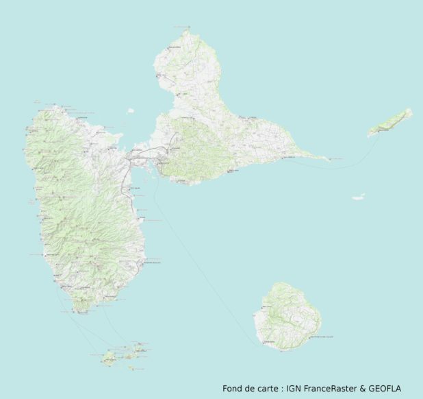
Map of Guadeloupe – Base map: IGN
Guadeloupe is both a French overseas region and department. As such, it is also a European region, even though it is located in the Caribbean. Its departmental code is “971”.
Details about the map of Guadeloupe
As mentioned at the beginning of the article and as shown on the map of Guadeloupe, it is located in the Caribbean. This French overseas department is bordered on one side by the Caribbean Sea and on the other by the Atlantic Ocean.
Guadeloupe is far from mainland France, with a distance of about 6,200 km between them. It is therefore closer to countries in South and Central America, for example 600 km from Venezuela, 700 km from the Dominican Republic to the east, and about 2,200 km from the United States.
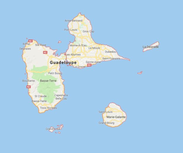
Guadeloupe map – Image extracted from Google Maps
Climate in Guadeloupe
Guadeloupe lies in a temperate tropical climate zone. It is influenced by maritime conditions and the trade winds. There are two main seasons in Guadeloupe and its neighboring islands:
- A dry season known as “Carême,” which lasts from January to June;
- A wet season known as “Hivernage,” which extends from July to December.
As for temperatures, they are far from mainland France averages, with an annual average of 27°C. The weather remains fairly stable throughout the year, with little variation between the hottest months (25°C to 32°C) and the coolest months (23°C to 29°C).
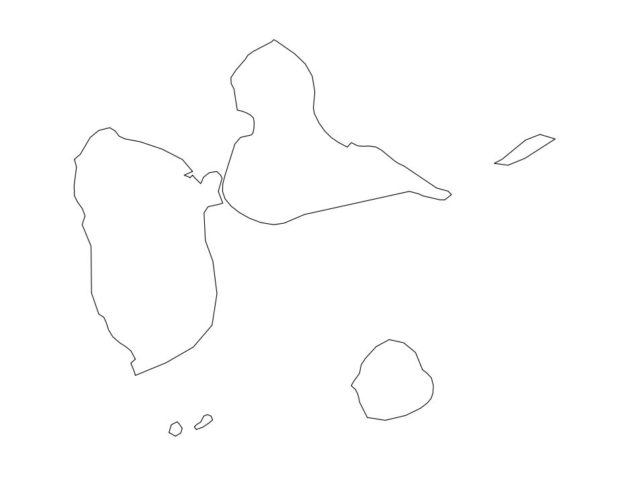
Blank map of Guadeloupe
The specific geography of the archipelago (see the map of Guadeloupe), with differences between Basse-Terre and Grande-Terre, also results in distinct climatic conditions for each island.
Grande-Terre consists of limestone plateaus that often experience significant droughts. Meanwhile, the mountainous relief of Basse-Terre (perpendicular to the trade winds) regulates rainfall. An interesting detail is the average sea temperature, which is around 28°C if you travel there.
Another important point is that the island can be affected by hurricanes, generally between May and November (although such events are relatively rare). Hurricanes either form directly in the Caribbean or off Cape Verde in Africa before drifting westward with the easterly trade winds.
Learn more about Guadeloupe
Guadeloupe’s economy largely depends on tourism, which is by far its main source of income.
Music and dance are the best-known aspects of Guadeloupean folklore. Guadeloupe is also famous for its Creole cuisine and the traditional costumes worn by women during major ceremonies.
Although French is the official language, Creole is widely spoken.
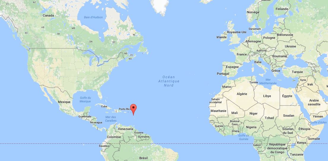
Where is Guadeloupe located in the world?
Christopher Columbus discovered Guadeloupe in 1493. It later became a French colony in 1635. The island experienced brief periods of British and Swedish rule. In 1946, Guadeloupe ceased to be a colony and became a French overseas department.
In 2016, its population was estimated at just over 400,000 inhabitants. You can find the main cities on the map of Guadeloupe.
