Discover one (or several) maps of New York. The city has the largest population in the United States, with more than eight million inhabitants. Moreover, New York is an economic and cultural center with an international dimension
, and it remains a leading tourist destination, ranking among the most visited cities in the world.
Given its size, the city has several airports—exactly three. This allows New York to welcome nearly forty million visitors every year.
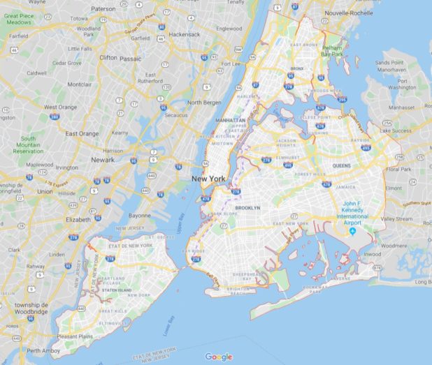
Map of New York – Image extracted from Google Maps
Map of New York: Tourist attractions to discover
The city is known for being cosmopolitan, partly built around neighborhoods linked to the diverse origins of its residents. New York is, of course, famous for its many impressive skyscrapers, which are one of the city’s main characteristics. Below you will find the map of New York (tourist attractions). The most well-known include the Empire State Building, the Chrysler Building, the Flatiron Building, and Trump World Tower—internationally recognized landmarks.
Other must-see attractions when visiting New York include: Times Square, the Statue of Liberty, Central Park, the Brooklyn Bridge, Fifth Avenue, Ground Zero, Carnegie Hall, Madison Square Garden, Broadway theaters, The Blue Note, the Bronx Zoo, and the Coney Island amusement park.
We can also add the city’s museums, such as the Metropolitan Museum of Art and the Museum of Modern Art (see the map of New York).
You will find different maps in this section, including a map of New York monuments, a map of the city’s sightseeing buses, and a tourist boat map. New York is the most visited city in the United States, with nearly 12 million tourists annually.
It is also one of the most visited cities in the world. The city’s charm comes from its many iconic buildings, museums, and tourist sites. The city of New York has been listed as a UNESCO World Heritage site.
Transportation in New York
Getting around the city can be done using various means of transportation. The most iconic—often seen in movies—are the yellow taxis, as well as the subway. The subway system alone includes nearly 500 stations.
As for accommodations, it is very easy to find a place to stay in the city—the main question will be the price you are willing to pay. As you might expect, New York is an expensive city, but you will undoubtedly be captivated by this megacity, its incredible diversity, fast pace, and larger-than-life atmosphere.

The city’s urban and suburban rail network is made up of several train systems (see the map of New York below—more precisely, the maps).
This extensive network includes the following four systems (you will find a map for each):
* New Jersey Transit (NJ Transit)
* Port Authority Trans-Hudson (PATH)
* Long Island Rail Road (LIRR)
* Metro-North Railroad (MNR)
New York neighborhoods
On the map of New York below, you can find the neighborhoods that make up the city. You will see a map of the city’s districts, showing the different boroughs.
After discovering the previous map of neighborhoods, let’s look at each of them in detail. You will find maps of Manhattan neighborhoods, Queens neighborhoods, Staten Island neighborhoods, Brooklyn neighborhoods, and Bronx neighborhoods. The city’s districts are called boroughs.
ALL NEW YORK MAPS ON ONTHEWORLDMAP
These are administrative divisions that split the city of New York into five municipal boroughs. Each borough offers many attractions that contribute to the fame of this incredible city.
New York airports
In this section of the article, you will find another map of New York—this time showing transportation to the airports, as well as maps of John F. Kennedy Airport, New York LaGuardia Airport, and Newark Liberty Airport.
As you can see, you will have access routes to the airports and their layouts to help you find your way quickly. New York has three international airports. More than 100 million passengers travel through New York each year. John F. Kennedy (JFK), New York LaGuardia (LGA), and Newark Liberty (EWR) airports are operated by the Port Authority of NY & NJ.
New York Buses
How can we talk about getting around New York without mentioning the city’s buses? It is difficult to fit everything onto a single map of New York (for buses), so the map is divided into five sections. You will find maps of Manhattan buses, Brooklyn buses, Queens buses, Staten Island buses, and Bronx buses—in short, a bus map for each New York borough.
The city’s bus system remains one of the public transportation systems that allows you to explore New York (United States). As mentioned above, other transportation systems also exist, such as the subway, commuter rail, and ferry. The bus network is a vast web composed of 336 routes (273 local buses and 63 express buses).
