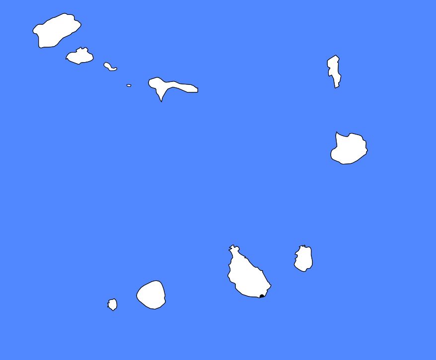
In this article you will find a map of Cape Verde. The Republic of Cape Verde is located in the Atlantic Ocean. It is an archipelago situated about 620 kilometers off the western coast of Africa. It consists of ten islands and five rocky islets
forming the Barlavento (windward) and Sotavento (leeward) island groups.
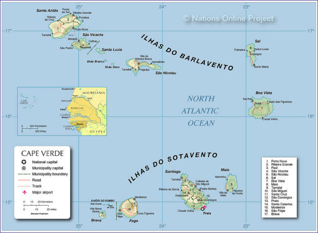
Map of Cape Verde – Credit: Nations Online
Geography on the map of Cape Verde
The total area of the country is 4,030 square kilometers. Praia (visible on the map of Cape Verde) is the capital. The country became an independent nation on July 5, 1975, after five centuries of Portuguese rule.
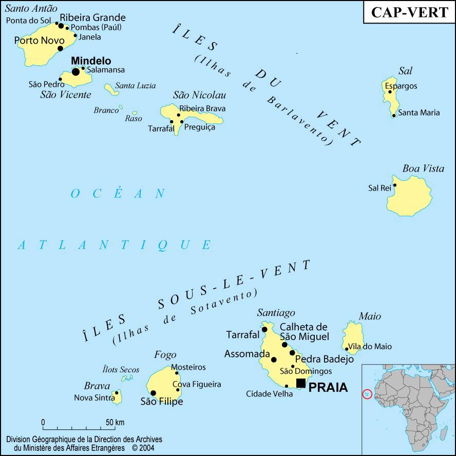
Cape Verde map – Credit: Ministry of Foreign Affairs
These volcanic islands are very mountainous, as can be seen on the map of Cape Verde. The peaks are particularly high: Fogo, an active volcano located on the island of the same name, rises to 2,829 meters above sea level. These islands experience intense wind erosion and their coastline is therefore highly rugged. The mountains are broken up by small valleys that extend down to the shore.
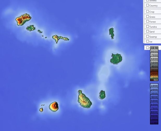
Relief map of Cape Verde – Image extracted from maps-for-free
The climate is not only hot but also very dry, as rainfall is almost nonexistent. The sun is sometimes hidden by a vast cloud made of fine sand particles from the Sahara, carried there by the trade winds.
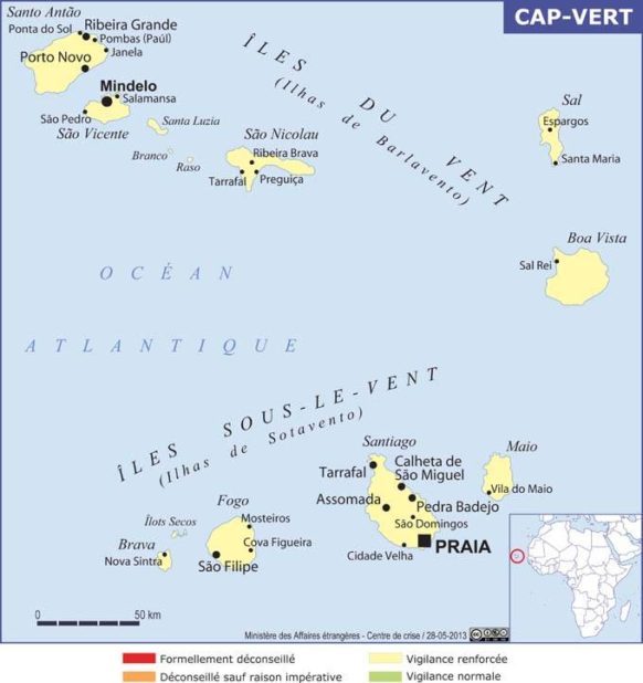
Map of the islands of Cape Verde – Credit: Ministry of Foreign Affairs
Santo Antão, São Vicente, Mindelo, Santa Luzia, Branco, Raso, São Nicolau, Sal, Boa Vista, Branco and Raso belong to the Barlavento islands. Maio, Santiago, Fogo, São Filipe, Brava, Luís Carneiro, Sapado, Grande and Cima form the Sotavento islands (visible on the map of Cape Verde). The main port of the archipelago is located in Mindelo, or Porto Grande, on the island of São Vicente. Very deep, it accommodates ships of all sizes, which often come to refuel there.
Blank map of Cape Verde – Credit Actualitix
Some islands are almost desert-like. Agriculture is practiced only in high-altitude regions that are relatively humid thanks to the presence of a type of sea mist. Vegetation is dominated by aloes, and the main agricultural areas are concentrated on the peaks of São Vicente. Wildlife mainly includes monkeys, sea turtles, lizards, butterflies, and more than 105 different bird species.
Learn more about the country
Volcanic rocks are exported for use in cement factories. Salt is the main production of the islands of Sal, Maio, and Boa Vista. Agriculture employs the majority of the working population. Coconuts, corn, bananas, and sweet potatoes dominate agricultural production in the archipelago. Exports mainly include bananas, sugar, peanuts, and coffee.
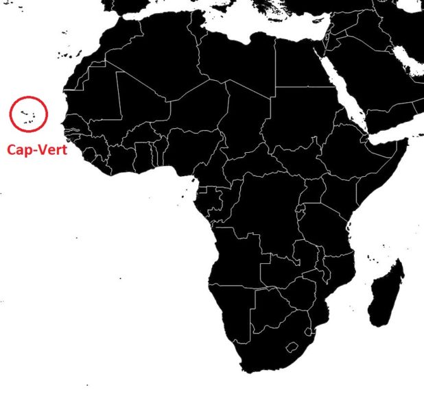
Cape Verde on a map of Africa – Credit Actualitix
However, the archipelago must import more than four-fifths of the food consumed by its inhabitants. Since 1968, Cape Verde has been hit several times by drought and has experienced several famines, though it has benefited from international aid. Nearly two-thirds of the population are Creole, while Europeans and Africans make up the rest of the population.
The Portuguese were the first to land on the coasts of Santiago in 1462. The Cape Verde archipelago became particularly prosperous thanks to the rise of the slave trade in the years that followed. However, at the beginning of the 19th century, the economic and political situation was disastrous: the administration was inefficient, the government corrupt, and the population decimated by famine. In 1951, Cape Verde became an overseas Portuguese province, and later an independent republic on July 5, 1975.
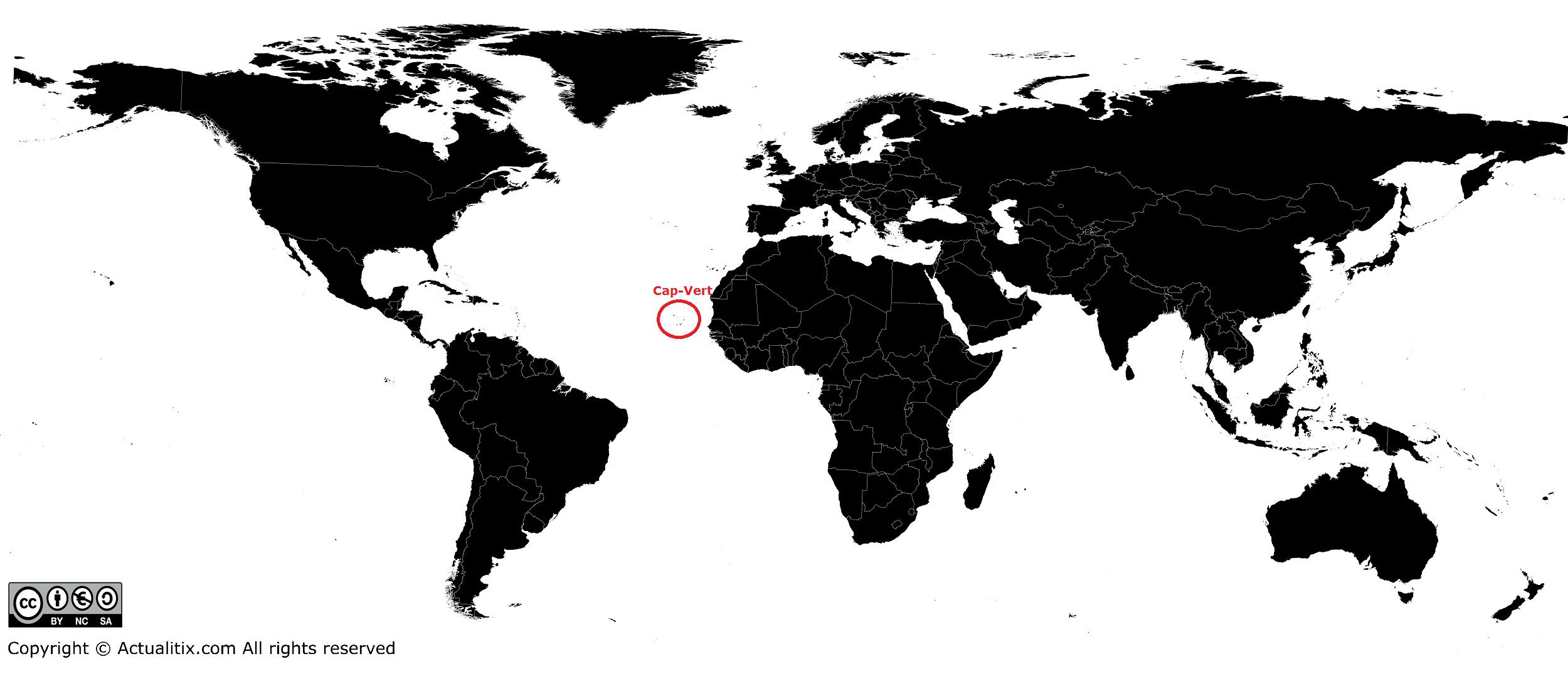
Cape Verde on a world map – Credit Actualitix
You can discover all available maps for different countries of the world on this page.
