In this article you will find a map of Myanmar. The Republic of the Union of Myanmar, known until 1989 as Burma, is home to the vast Irrawaddy River. Most of the population lives in the fertile river plains.
Yangon, the former capital that can be seen on the map of Myanmar, concentrates much of the country’s trade and passenger traffic. Myanmar is bordered by China, Laos, Thailand, the Andaman Sea, the Bay of Bengal, Bangladesh, and India.
Geography with the map of Myanmar
The country is very mountainous. Parallel mountain ranges are separated by the valleys of the Irrawaddy, Salween, and Sittang rivers. These valleys run north to south. The first two extend to the foothills of the Tibetan mountains in China. The Irrawaddy Valley can be divided into three parts. The upper valley is the highest and least populated.
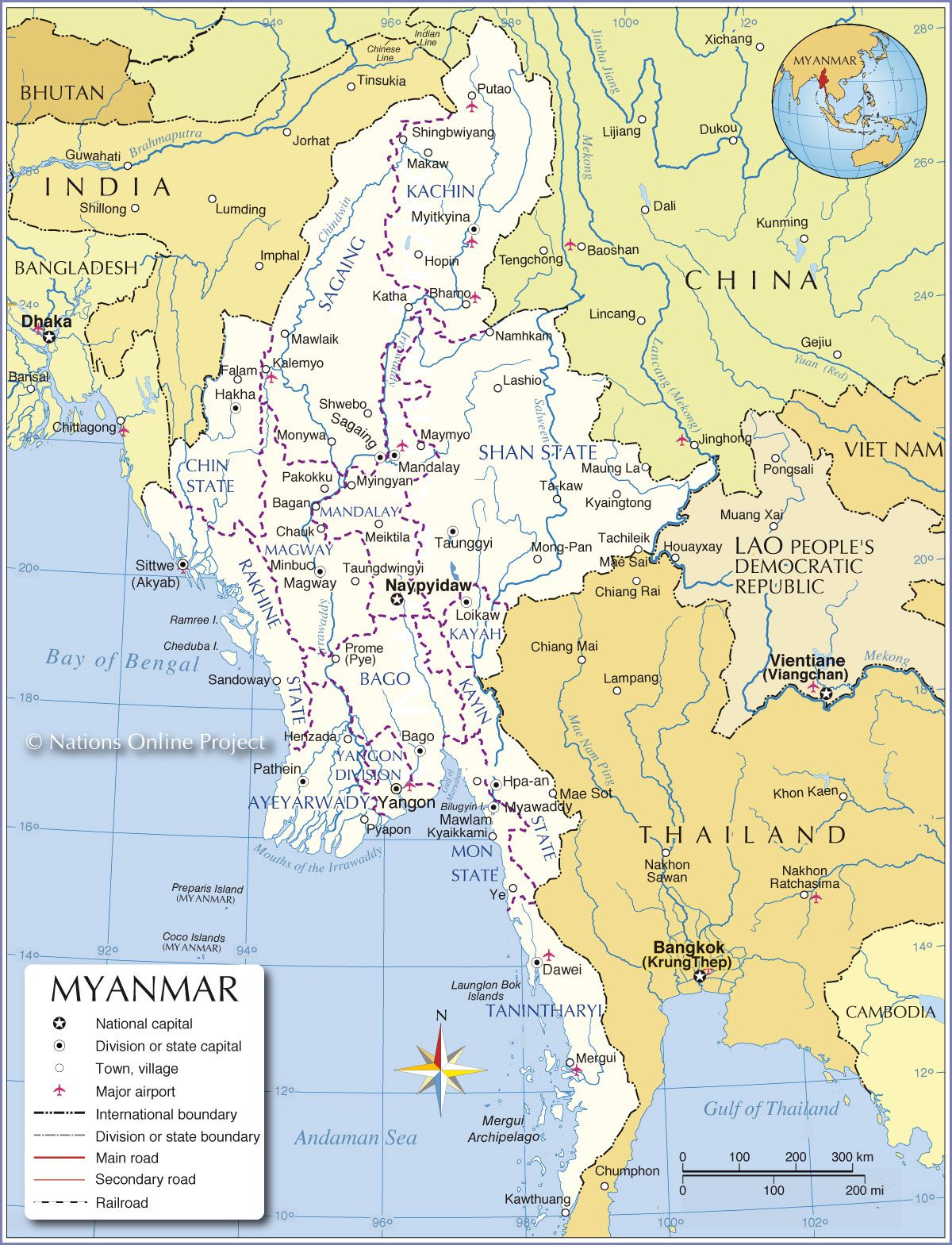
Myanmar map – Credit Nations Online
It lies about 80 kilometers north of Mandalay (see the map of Myanmar) and includes several fast-flowing mountain streams. It is followed by a middle valley where rainfall is scarce and the soil is dry. The third valley lies at a lower altitude and is characterized by the Irrawaddy Delta, which stretches into the Andaman Sea for about 290 kilometers. To the east of the river rises a chain of low mountains.
The extreme south of the Irrawaddy Valley is marked by the Arakan Yoma mountain range. Its highest peaks reach 4,000 meters in altitude (visible on the map of Myanmar). West of the Arakan Yoma lies Rakhine State, which borders the Bay of Bengal.
The eastern and northeastern highlands of Myanmar include the Shan Plateau, which rises to about 900 meters. The Salween River flows through a narrow and deeply cut valley. The Tanintharyi region is located in the narrow strip of land forming the southernmost part of Myanmar. It spans the Kra Isthmus, which connects Malaysia to mainland Asia.
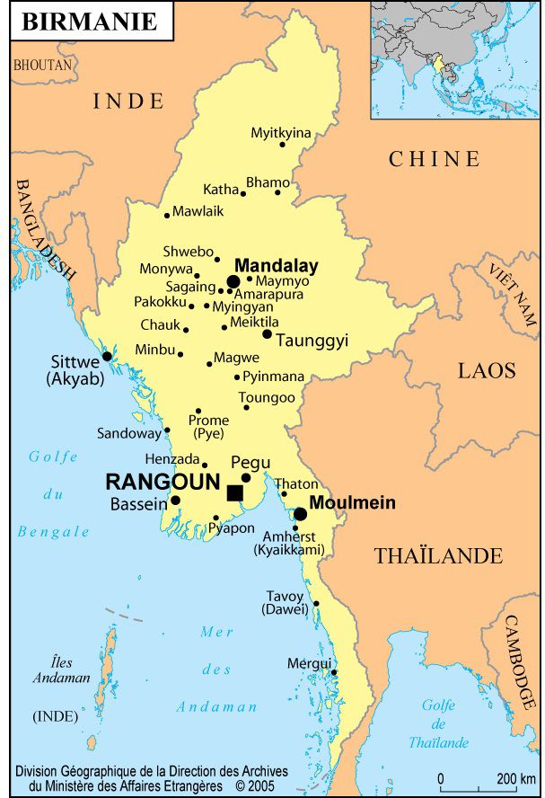
Map of Myanmar cities
Climate of Myanmar
Rainfall is abundant throughout the year and is especially concentrated in summer. The regions of Rakhine and Tanintharyi receive up to 500 centimeters of rain annually. Rainfall ranges between 150 and 250 centimeters in the Irrawaddy Delta and between 100 and 200 centimeters in the mountainous areas of the east and north. However, in parts of the dry zone within the Irrawaddy Basin, annual rainfall is less than 40 centimeters.
Forests cover about half of the country’s total area. In regions with heavy rainfall, evergreen forests dominate. In areas with less rainfall, forests consist mainly of deciduous trees that lose their leaves during the dry season. Teak is the most common tree species. In prehistoric times, the dry zone was covered by savanna, where various grasses and trees grew.
Most of the delta was once covered by swamps and forests. These areas have since been cleared to allow agricultural development. Mangroves extend along the delta and parts of the coastline.
Population of Myanmar
In 2016, Myanmar had approximately 53 million inhabitants. Most of their ancestors migrated from northwestern China about 2,000 years ago. Each ethnic group had its own language and customs, though most were of Mongolian origin.
The country was renamed Myanmar in 1989 to emphasize the ethnic diversity of its population, which is not composed solely of Burmans, although they form the majority. They represent about three-quarters of the population and are concentrated in the central plains and the Irrawaddy Delta.
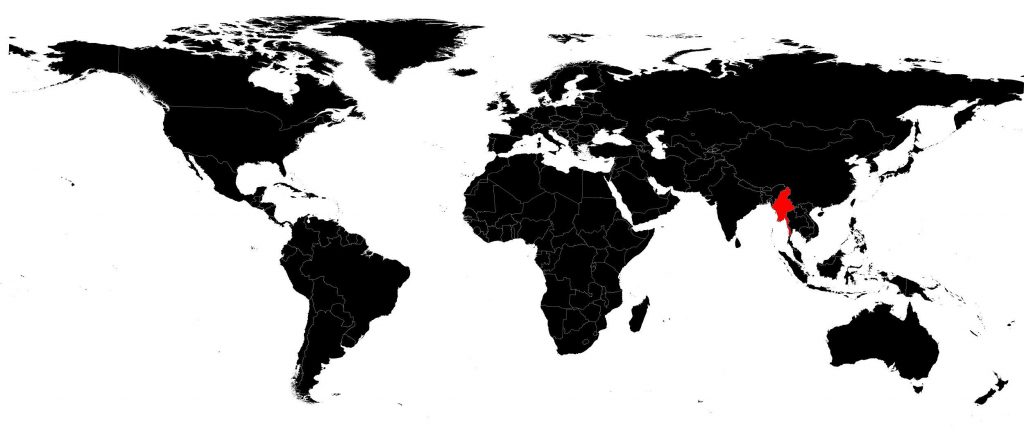
Myanmar on a world map
The Shan people live in the Shan Plateau region. The Karen settled in the eastern part of the country and east of the delta. The Rakhine account for about one-fifth of the total population. In addition, many communities live in the hills and each speaks a different language. The second half of the 19th century saw significant Indian immigration. People of Chinese origin mainly live in the large cities (see the map of Myanmar showing major cities).
