Discover a map of Charente-Maritime. The department of Charente-Maritime is located in mainland France in the Nouvelle-Aquitaine region.
The INSEE code of the department is 17. In this article you will find several maps covering various themes related to the department.
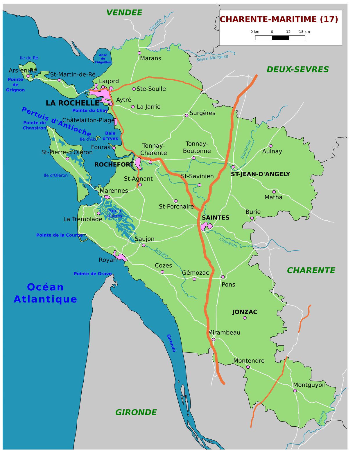
Map of Charente-Maritime – © Floki Fotos – stock.adobe.com
Below you will find a map of Charente-Maritime. It allows you to discover the department and its main characteristics.
In this article you will also find maps on various themes such as relief, major cities, municipalities, a blank map, political maps, and more.
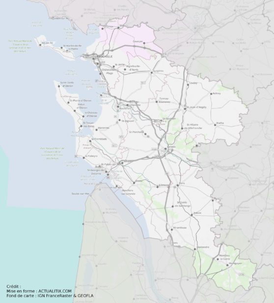
Charente-Maritime map – Credit: Actualitix – Base map: IGN
Map of Charente-Maritime: Geography
As can be seen on the map of Charente-Maritime, the department is mainly drained by the Charente River and its tributaries (the Boutonne and the Seugne) in the center. The Seudre River is also located in the south of Charente-Maritime.
The department is known for its mostly flat terrain, which can be marshy, especially in the lower sections of the rivers. The coastline is quite indented, forming numerous inlets sheltered by the two large islands (which are famous for their tourist attractions): Île de Ré and Île d’Oléron.
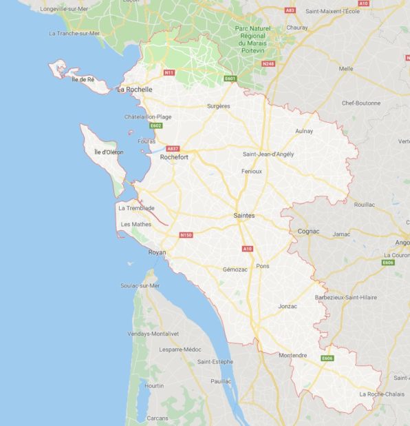
Map of cities in Charente-Maritime – Image extracted from Google Maps
Other small islands are located off the Charente coast, such as Île d’Aix and Île Madame.

Regarding climate, the department of Charente-Maritime has a temperate oceanic climate, mainly due to its wide opening onto the Atlantic Ocean and the Gironde estuary. It is generally characterized along the coast by mild winters and temperate summers.
Learn more about Charente-Maritime
The area of the Charente-Maritime department is 6,864 km², ranking it 21st among French departments in terms of size.
People living in Charente-Maritime are called Charentais-Maritime. The department has a population of 637,000 inhabitants, ranking 39th in population. The population density is 93 inhabitants per km².
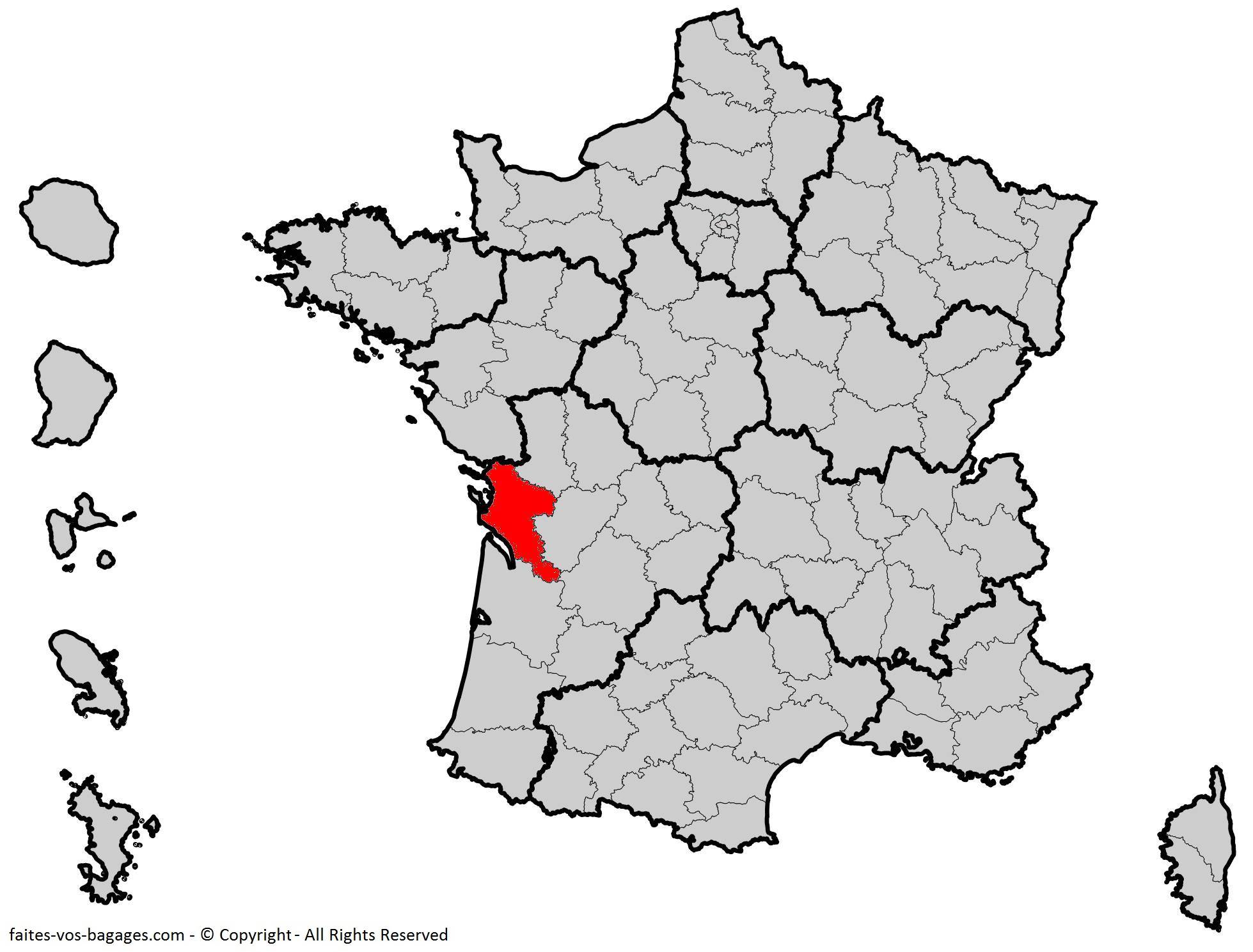
Where is Charente-Maritime located? Department 17
The prefecture of the department is La Rochelle. The sub-prefectures are the towns of Jonzac, Rochefort, Saintes, and Saint-Jean-d’Angély. The main cities of the department are:
La Rochelle, Saintes, Rochefort, Royan, Aytré, Saint-Jean-d’Angély, Tonnay-Charente, Lagord, Périgny, Saujon, Saint-Pierre-d’Oléron, Surgères, Châtelaillon-Plage, Nieul-sur-Mer, Marennes, Dompierre-sur-Mer, Puilboreau, Saint-Georges-de-Didonne.
Main tourist sites in the department:
- The Old Port of La Rochelle
- The citadels of Brouage
- Saint-Martin-de-Ré and Château-d’Oléron
- Former coastal military fortifications such as Fort Boyard, Fort Louvois, and the 17th-century naval arsenal of Rochefort
- The seaside resorts of Royan, Fouras, and Châtelaillon
- The “Most Beautiful Villages of France”: Talmont-sur-Gironde, Mornac-sur-Seudre, La Flotte, and Ars-en-Ré
- Towns and cities of art and history (Saintes, Rochefort, and Royan)
UNESCO World Heritage Sites:
- The Citadel of Saint-Martin-de-Ré
- The Basilica of Saint-Eutrope in Saintes
- The Pilgrims’ Hospital of Pons
- The Church of Saint-Pierre-de-la-Tour in Aulnay
