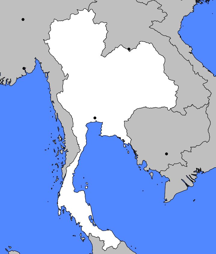
Discover a map of Thailand. The proud and independent kingdom of Thailand, which is one of the most popular tourist destinations in Asia, was never colonized. Thailand was long known as Siam.
However, the Siamese of the Central Plains represent only one of the many peoples living in Thailand. In 1939, the country was renamed in a more nationalist way Muang Thai, meaning Land of the Thai, the word “thai” meaning “free”.
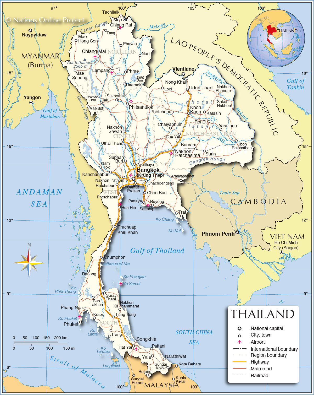
Table of contents
- Map of Thailand: Relief
- The Central Plains
- The Northern Highlands
- Northeast Thailand
- Southern Thailand
- Climate in Thailand
- Population and Cities
Map of Thailand: Relief
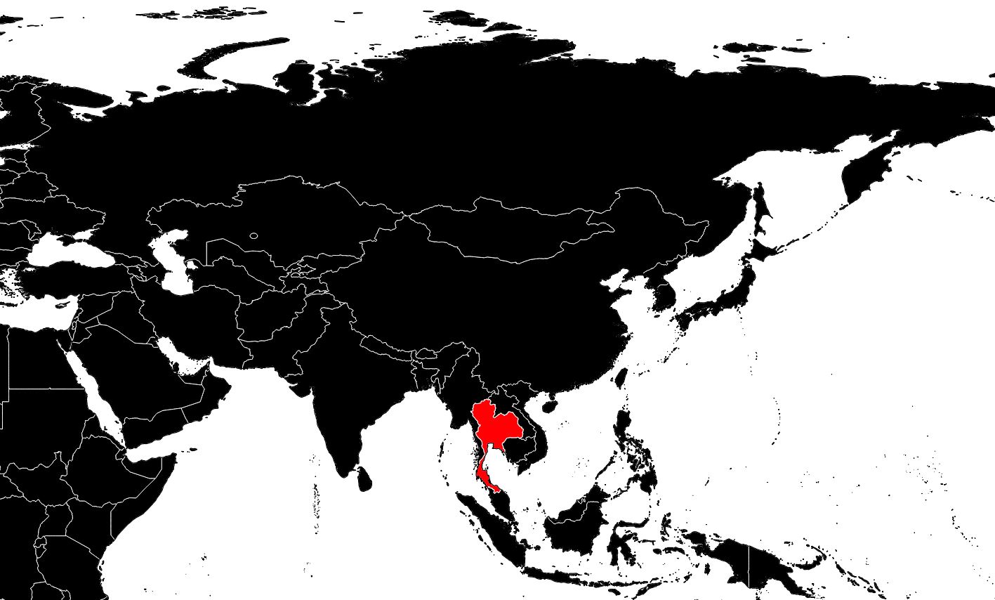
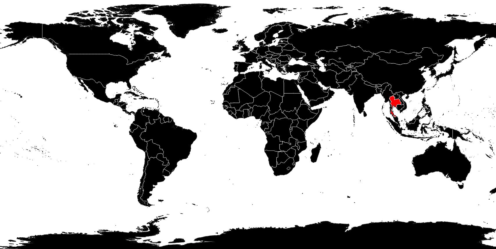
Located in the center of Southeast Asia (see the map of Thailand), the country stretches about 1,585 kilometers from north to south and approximately 821 kilometers from east to west. Its area is estimated at nearly 514,000 square kilometers. Thailand is bordered: to the north and west by Myanmar (Burma) crossed by the Salween River; to the north and east by Laos crossed by the Mekong; to the southeast by Cambodia and finally, to the south, by Malaysia on both sides of the Isthmus of Kra. Thailand’s coastline, about 1,900 kilometers long, borders the Gulf of Thailand which forms a small arm of the South China Sea. The western part of the Malay Peninsula faces the Andaman Sea.
Thais often say their country is shaped like an elephant’s head. The trunk is represented by the south of the country, the ear by the northeast, the bristling top by the mountainous northern regions and the mouth by the delta and port site of the Chao Phraya River. The eyes and brain of the animal are located in the Central Plains of the Phraya basin. The vegetation covering the territory is compared to the trembling skin of an elephant. It mainly consists of rice, more than 250 varieties of bamboo, coconut and banana trees, not to mention numerous orchards of mangoes, rambutans, lychees, mangosteens and other exotic fruits.
The Central Plains
The soil of the Central Plains consists of sedimentary deposits laid down by the Chao Phraya River. This region, located in the heart of Thailand, records the highest population densities in the country and is home to the great metropolis of Bangkok. The river crossing it provides fertile silt and the water necessary for irrigating land dedicated to intensive rice cultivation.
Vegetable and fruit cultivation also thrives here. In the southeast, tapioca is mainly grown, while corn cultivation is concentrated on the hills bordering the plains. The plains contain no mineral deposits, whereas nearby mountains produce significant quantities of sapphires, tungsten and fluorite.
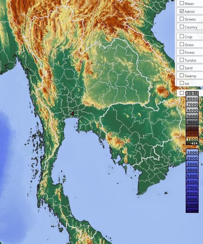
The Northern Highlands
This region is characterized by several north–south mountain ranges visible on the relief map of Thailand. They rise above 2,400 meters and are crossed by deep, narrow valleys carved by tributaries of the Chao Phraya River. These valleys have been widely cleared to allow the cultivation of rice, fruit and tobacco. People living in this mountainous area alternate between corn and a type of rice adapted to high altitudes.
The natural environment has been weakened by deforestation accompanying agricultural expansion and forest exploitation: soil erosion continues to worsen and irrigation systems are increasingly clogged.
Northern forests are one of the country’s main economic assets. They are composed of teak and many tropical hardwood trees. However, neither forestry nor reforestation programs have offset the damage caused by agricultural development. The government has therefore imposed strict restrictions on timber export and logging.
Today, elephants are still used to transport and stack heavy logs. Most of Thailand’s lignite and low-grade coal deposits are located here, along with some tungsten, barite and zinc deposits.
Northeast Thailand
The northeast of the country is occupied by the Korat Plateau. From the low hills rising between the Central Plains and the plateau, its altitude gradually decreases toward the Mekong River forming its northern and northeastern border. Forested mountains separating this plateau from Cambodia were the scene of guerrilla warfare for more than twenty years.
The soils, made of sandstone, are not very fertile and cannot retain enough water for profitable rice cultivation. Large areas are also covered with a thin layer of salt.
The construction of a series of dams on Mekong tributaries has enabled irrigation of certain areas and provided hydroelectric power to the whole region. Formerly covered with monsoon forests of deciduous trees, large areas were burned to produce charcoal and facilitate the cultivation of kenaf, a plant fiber that is the region’s main agricultural production.
Southern Thailand
Southern Thailand extends along the Malay Peninsula to the Isthmus of Kra. River valleys and narrow coastal plains with high population density, especially in the east, are devoted to rice cultivation. Mangroves formed where river sediment expanded the coastline, providing ideal conditions for fish farming and shrimp breeding.
Where siltation has spared the land, fine sandy beaches lined with coconut and exotic trees stretch along the coast. The eastern coast is dotted with small ports. Thanks to recent modernization, Thailand has one of the world’s largest fishing fleets and is a major exporter of shrimp, squid and cuttlefish.
However, overexploitation of the Gulf of Thailand has intensified in recent years. Much of southern Thailand is occupied by a mainly granitic mountain chain rising in places to 2,070 meters. These slopes are mainly used for rubber tree cultivation, one of the country’s main exports, and the region also contains major tin deposits, the most valuable mineral resource of Thailand.
Climate in Thailand
Thailand’s climate is marked by the monsoon blowing from May to October, bringing seasonal southwest winds. During this period, days are hot and humid and rainfall exceeds 100 centimeters, representing more than 90% of annual precipitation.
In October, the northeast monsoon begins, generating a cooler and drier climate considered ideal for travel. From late March to May, tropical temperatures rise across the country. Alternating warm and cold air currents in the upper atmosphere maintain monsoon winds, making the climate extremely hot and dry. Fields and roads become dusty, and water shortages and pollution worsen urban conditions.
Residents eagerly await the refreshing monsoon rains. Regional differences exist: northern mountains can become nearly freezing, while the southern peninsula remains warm year-round.
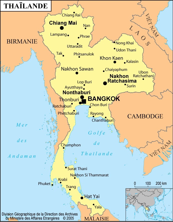
Population and Cities
Thailand’s population was estimated at 67 million in 2013. The decline in mortality is largely due to vaccination campaigns, preventive medicine and improved public health services, followed by strong population growth.
The metropolis of Bangkok dominates Thai life in every field. With more than 8 million inhabitants, it is fifty times larger than the country’s second-largest city and continues to grow rapidly. The Bangkok metropolitan area includes Thonburi across the river, accounting for about 12% of the population and producing half of the national GDP.
Bangkok is not only the capital and main port but also home to top universities and advanced medical services. It is a major religious and economic center hosting many bank headquarters.
The city suffers from heavy traffic congestion and air pollution. Many migrants seeking work live in overcrowded informal settlements. Flooding has become increasingly frequent and the city is gradually sinking. Nevertheless, Bangkok remains a key political and economic hub and often serves as a base for United Nations activities in Asia.
